The air is getting crowded: the problem of friendly fire and the UAV state identification system
Chaos in the air
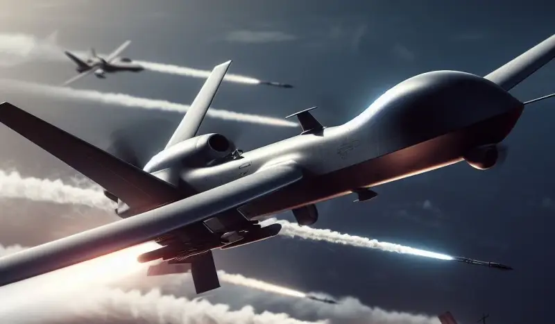
A distinctive feature of the Russian Special Military Operation (SVO) in Ukraine was the widespread use of unmanned aerial vehicles (UAVs). Never before have UAVs been used by the warring sides in such numbers - there are hundreds of UAVs in the air at the same time on both sides. The largest concentration of UAVs is present in the area of the line of combat contact (LCC), but quite a few drones the warring parties are directed towards each other's rear.
The sizes of the UAVs used vary from the smallest that fit in the palm of your hand, such as the American-Norwegian micro-UAV helicopter type Black Hornet, to products comparable in size to manned aircraft. In addition, UAVs can be airplane, helicopter, quadcopter (octacopter, hexacopter, etc.) type, as well as their hybrids, but there are also gliding UAVs.
The situation is aggravated by the presence in the air of manned aircraft - airplanes and helicopters for various purposes, as well as missiles, gliding and free-fall bombs for various purposes, as well as other air objects, which may well include even birds, whose radar signature is quite comparable to the radar signature micro UAV.
In the future, the situation will only worsen due to the expansion of the range of UAVs and the scope of their application, and the use by the opposing sides of swarm tactics of using UAVs. We should not forget about the civilian use of UAVs, both by government agencies and private individuals. As a consequence of the above, for any radar station (radar) that monitors airspace, the sky is teeming with various radar marks, which results in a number of problems.
Firstly, a large number of air targets, exceeding the capabilities of the radar for their simultaneous detection and tracking, leads to the fact that some of the enemy’s air attack assets can pass through the radar control zone undetected.
Secondly, strict time intervals within which it is necessary to determine the nationality of an aircraft can lead (and do) to the occurrence of “friendly fire” when air defense systems shoot down their own aircraft.
The situation is aggravated by the fact that UAVs, guided/unguided munitions and birds do not have government identification systems, making it extremely difficult, if not impossible, to determine whether they belong to one side or another in the conflict. It is unlikely that you will be able to do anything with birds; you can distinguish your own and other people’s ammunition by the direction and trajectory of their flight, but with UAVs actively moving in all ranges of altitudes and directions, everything is much more complicated.
In Russia, several companies are developing developments in this direction.
Same-stranger
The NPP Pulsar company, part of the Ruselectronics holding of the Rostec state corporation, has developed a small-sized radar identification device “friend or foe”, capable of automatically determining the nationality of a UAV at a distance of up to 100 kilometers and at an altitude of up to 5 kilometers. The product works with the Russian state recognition system “Password”. The mass of the radar identification device of the Ruselectronics holding is only 150 grams, power consumption is about 100 mW, which allows it to be placed on most UAVs, including small ones.
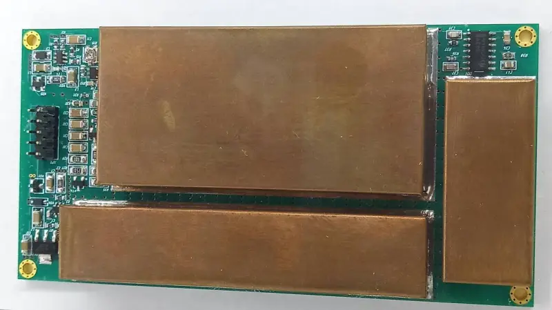
Another similar development was presented in the spring of 2023 by the Obukhov plant, part of the Almaz-Antey concern. The proposed product is a transponder board that is installed on a UAV. The transponder performs two functions - it transmits information about the real location of the drone to friendly air defense systems, as well as false information about the location to enemy electronic reconnaissance (RTR) systems.
The Navigator Institute of Aviation Instrumentation has developed the ADS-Bee product, which is also a transponder that transmits UAV coordinates to ground control. The weight of the product without antenna is 48 grams, it is intended for installation on UAVs weighing from 30 to 750 kilograms. In this case, we are more likely talking about civilian means of monitoring civil and commercial UAVs for organizing safe unmanned air traffic.
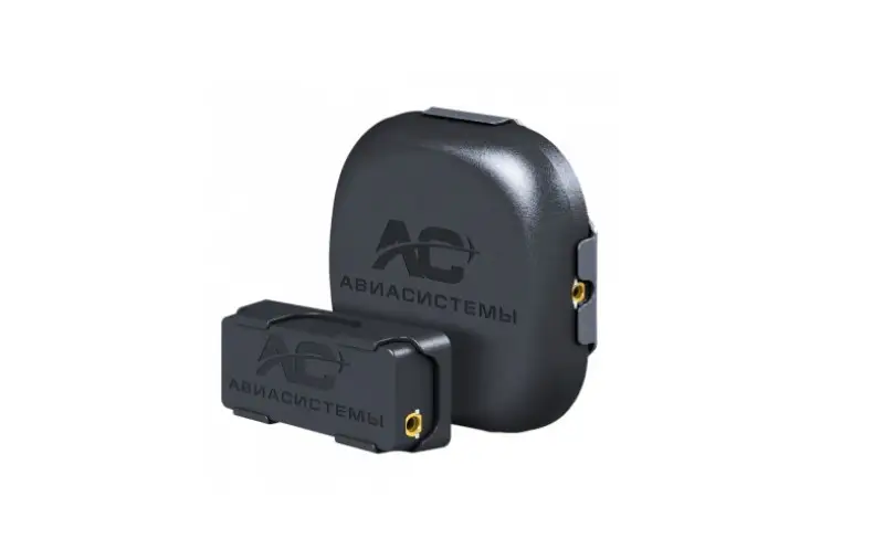
"ADS-Bee"
Work on organizing UAV air traffic is carried out by the Rostec state corporation. In particular, the Azimuth company has developed the Jupiter complex, designed to control not only UAVs, but also other objects, such as air taxis.
As we see, control systems are currently being developed to provide tracking of both civil manned aircraft and UAVs, as well as “friend or foe” systems more suitable for military use. Taking into account the situation in our country and in the world, it can be assumed that deep integration of all of the above systems will be required to build a single information field, within which both civil aircraft will be monitored and violators will be identified, including military UAVs.
Problems and solutions
In fact, the problem of UAV identification is currently far from a final solution.
If we are talking about state identification systems for manned aircraft, then they all have a high degree of secrecy - their exposure to the enemy can have the most negative consequences for the security of the state as a whole. For example, the escape of the traitorous pilot Belenko on a MiG-25 fighter led to the blocks and keys of the “Silicon” state identification system falling into the hands of the enemy, as a result of which it was discredited and it had to be quickly replaced with the “Password” state recognition system.
When it comes to UAVs, things are even more complicated.
Considering the large number of this type of aircraft, it can be considered almost inevitable that one or more UAVs with an identification/control system installed on them will fall to the enemy. As a result, there is a risk that a “wolf in sheep’s clothing” will appear in the herd, that is, an enemy; not only will the enemy move freely throughout the territory of our country, but he will also do so legally. Moreover, it can be assumed that, first of all, not even NATO countries will be interested in hacking the UAV identification system, but ordinary criminal structures, for which UAVs are very convenient couriers.
All these problems can arise in peacetime, let alone in wartime. It would seem that now the state has simply banned the flights of UAVs, and that’s all, there are no problems with their identification, but the question is that so far UAVs have not penetrated our lives that much, but what will happen in 20–30 years?
Now in the Northern Military District zone, hidden Ukrainian agents via the Internet, including using cellular networks, report to the Ukrainian Armed Forces (AFU) the coordinates of targets for long-range precision-guided munitions, which leads to unjustified losses of equipment and manpower of the Russian Armed Forces.
Although to a lesser extent, this problem also concerns the Armed Forces of Ukraine; it can be assumed that there are also enough sympathizers with Russia on the territory of Ukraine. However, for some reason, neither cellular communications nor the Internet are switched off both in the North-West region and in Ukraine. At a certain point, the same thing may happen with civilian UAVs - they simply cannot be turned off.
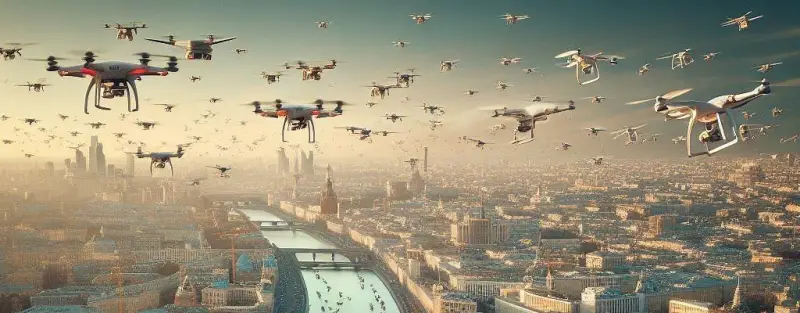
It is possible that in the foreseeable future the skies above cities will be crowded
Apparently, there is no ready-made solution capable of separating the wheat from the chaff - civilian UAVs from military ones, friendly UAVs from others - there are only sketches. It is unlikely that any of the complexes that have been developed or are currently being developed are capable of making the sky above us completely safe.
Nevertheless, the problem of identifying UAVs and other aircraft must be solved as soon as possible, since in the foreseeable future we will be faced with the fact that thousands, or even tens or hundreds of thousands of drones will be in the air over our cities at the same time, which even in peacetime will become a serious challenge for any country.
Information