Smartphones vs. drones: CARPE Dronvm detection and tracking system (USA)
The Pentagon, like the military departments of other countries, continues to search for effective means to combat unmanned aerial vehicles. Recently, the promising airborne target detection system CARPE Dronvm was presented and tested. It is distinguished from other similar developments by its architecture and operating principle: the key element of such a system is an ordinary smartphone with special software.
Designed and tested
Over the past years, the Pentagon and its contractors have been actively working on the topic of combating UAVs. Particular attention is paid to the development of specialized detection tools capable of detecting even the most complex targets. In such projects, both well-known and mastered technologies and new developments are used.
In 2019, the Pentagon awarded MITER an order to develop an advanced UAV detection and tracking system based on unusual components and ideas. The project was called CARPE Dronvm (“Catch a Drone” - a play on words based on the Latin expression Carpe Diem), which generally reflects its essence.
Until recently, the existence of "Carpe dronum" was not reported. The first reports about this system appeared only in July 2023, when it had already entered testing. In the future, the customer and the development company spoke several times about the system as a whole, noted its strengths and gave assessments.
It is expected that in the near future the new detection system will undergo the necessary modifications and after that may enter service. Thanks to its distinctive architecture, deployment and commissioning of the CARPE Dronvm system is quite simple and does not require much effort.
Distributed system
The “Catch the Drone” project proposed and implemented an interesting detection system architecture. Instead of a few radars or optical-electronic stations monitoring a certain space, it is proposed to use a large number of smartphones with special software. In addition, the system has a central control center responsible for processing information and issuing target designations to other means.
The "user" part of the CARPE Dronvm system is represented by an application for smartphones with iOS and Android operating systems. It has the minimum required set of functions to ensure the detection, identification and tracking of air targets. The command post, in turn, is a full-fledged server with advanced features. In particular, it uses elements of artificial intelligence to solve some problems.
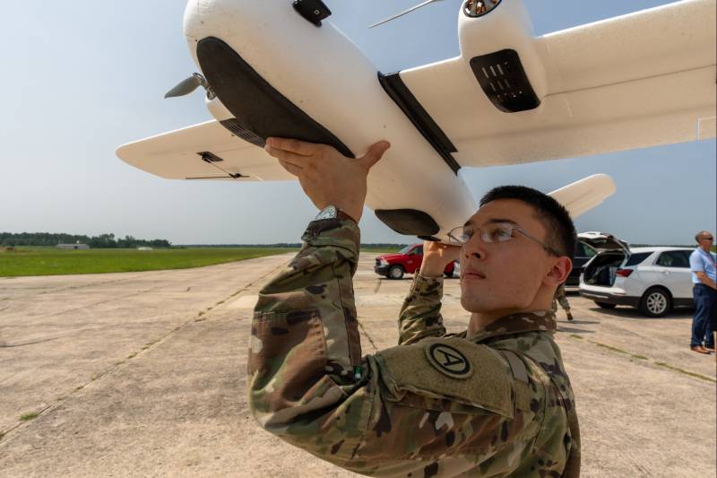
The principle of operation of the system is quite simple. The software is distributed among the personnel and is waiting in the wings. When an unmanned aerial vehicle is detected, a military or intelligence officer must take a photo of it using the CARPE Dronvm application.
Through existing communication channels, the picture, along with coordinates and other information, is sent to the command post. Then the central server, using artificial intelligence, determines whether the target is the UAV, what danger it can pose, etc. Having received such information from a large number of "operators" from the field, the command post can clarify the data on the target, tie up the route and issue target designation to means of suppression or destruction. Provides work on multiple targets in the same area - the central server is able to distinguish between them.
During the test
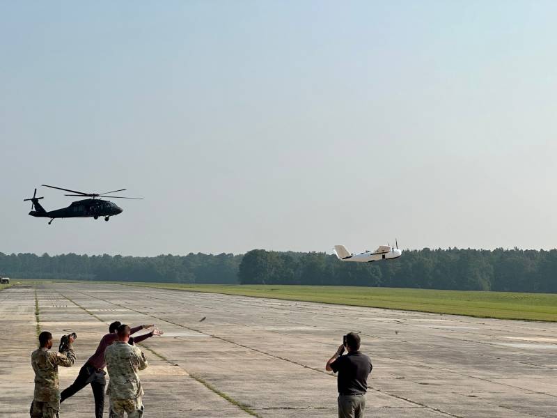
In mid-July 2023, the Pentagon announced the successful testing of the Catch a Drone system at the test site. The events were held by the 39th task force of the Central Command of the Army, which is engaged in the development of promising technologies. The system was tested at the National Guard Joint Base MacIntyre (South Carolina) and the nearest Poinsett training ground.
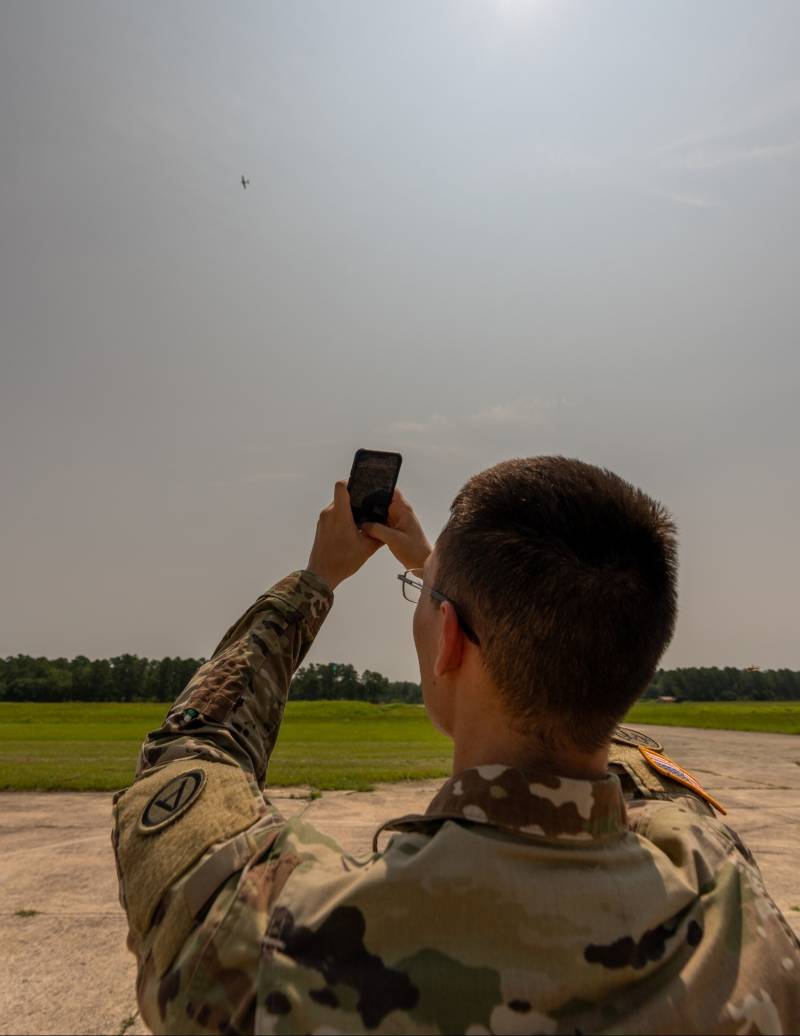
A test participant takes a photo of the UAV
The conditional target during the test was a light aircraft-type UAV. He had to fly from the McIntyre base to the Poinsett training ground with a range of several tens of kilometers. At this time, there were military personnel on the ground along the flight route with smartphones and the Carpe Dronum application.
Test participants were able to see and hear a flying drone without the use of special equipment. They then took photos and sent them to a central server. All details of the event are not disclosed, but it is reported that the assigned tasks were solved. The “operators” on the ground did their job, and the server part of the system correctly identified the air target and provided data for further suppression/destruction.
Test participants noted the ease of use of the CARPE Dronvm application and the ease of solving assigned tasks. The central command post also coped with its work and confirmed the calculated characteristics and capabilities. However, the most interesting details of the tests and the project as a whole were not disclosed due to the sensitivity of the topic.
New approach
The development of the CARPE Dronvm detection system took several years, and only now it has entered the test. It is likely that testing and testing of its various components will take some more time, but the overall potential has already been shown, and you can also understand the prospects for such development. In general, it has a number of strengths and advantages, copes with the tasks set and can be put into service. At the same time, operators will have to face some limitations and disadvantages.
The main advantage of the Catch a Drone system is its relative cheapness and ease of deployment. A key component of the system is the "grouping" of smartphones distributed over the area. User-operators can use their own gadgets, and the army does not have to spend money on bulk purchases. However, a command post with all the required capabilities turns out to be difficult and expensive.
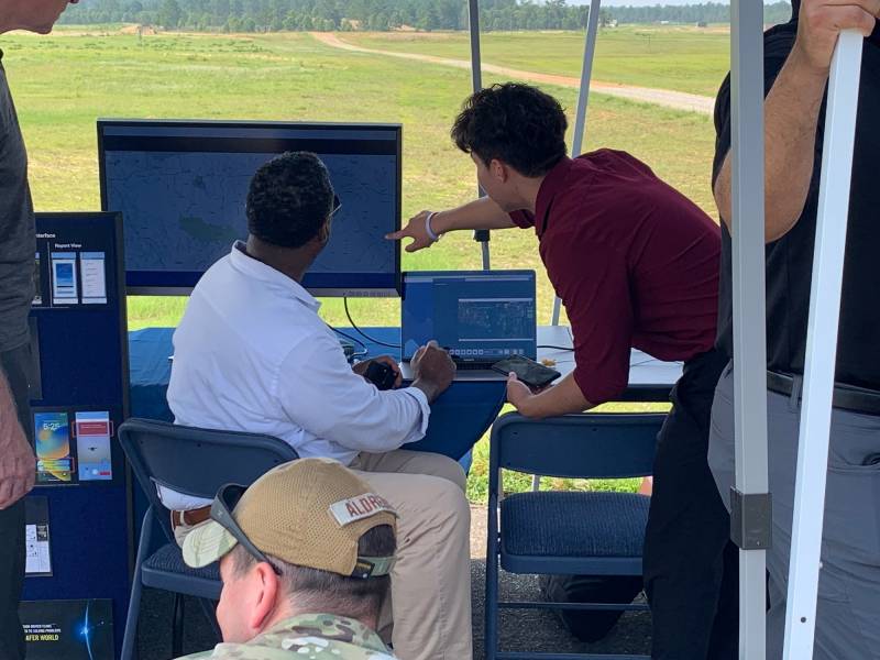
At the command post
The functions of a smartphone as part of such a system are reduced to taking a photo and then transferring it, along with other data, to the command post, which reduces the requirements for user equipment. All data is processed by a single server with the necessary characteristics. At the same time, his work can be extremely difficult due to the difference in the quality of the photos sent, associated with the features of gadgets or with external conditions.
In theory, CARPE Dronvm can receive data from hundreds or even thousands of smartphones located in the same area. This flow of information will make it possible to more accurately determine the class, type and location of the UAV. However, processing the entire volume of data will be a difficult task, which can negatively affect the performance and other parameters of the system.
The CARPE Dronvm architecture allows you to create systems of different scales. Thus, both military personnel and civilians can have the corresponding application on their smartphone. Thanks to this approach, it will be possible to increase the controlled territories, increase the probability of detecting a UAV, the accuracy of determining its coordinates, etc. However, at the same time, the requirements for the computing power of the command post are growing.
New approaches
Thus, the US Army continues to search for answers to pressing questions. In order to more effectively combat the threat of UAVs, systems and complexes of traditional types are being improved, as well as new ideas and approaches are being developed and tested. The most successful promising developments will be developed and used in practice.
The recently tested CARPE Dronvm system from MITER has some chances for further development and adoption in the future. It has strengths and may be of interest to potential customers. In addition, the main capabilities of the system have already been confirmed in the test site. Whether the system will cope with further tests and whether it will be able to realize its full potential, time will tell.
Information