Critical systems enabling strikes with long-range precision-guided munitions
The use of unmanned aerial vehicles (UAVs) - kamikaze and high-precision long-range munitions is one of the most promising areas for the development of the armed forces. The key advantage of this form of warfare is that we do not come into direct combat contact with the enemy, which means that the loss of personnel and military equipment is greatly reduced.
However, everything is not so simple. There are a number of complex systems, without which the use of UAVs and long-range precision-guided munitions is either ineffective or impossible at all - let's consider them in more detail.
GLONASS
The Global Navigation Satellite Communication System (GLONASS) or its analogues - the American GPS (Global Positioning System), the Chinese "Beidou", the European "Galileo" are designed to accurately determine the location of mobile and stationary objects. It is a critical system required for long range precision munitions to function.
Is it possible to do without it? Theoretically, it is possible using the TERKOM type trajectory correction system, originally developed in the USA, or its analogues introduced in other countries. However, the targeting accuracy of TERKOM-type systems is not sufficient for the use of conventional warheads (warheads), an acceptable result will be obtained only with the use of nuclear warheads (nuclear warheads), and this is a completely different story.

Models of GLONASS satellites
What are the problems if there are so many global positioning systems - GPS, GLONASS, Beidou, Galileo?
The problem is that in the event of a serious conflict, the enemy in one way or another can limit the use of a number of global positioning systems by civilian consumers, or, even worse, distort the signals of the exact location. At the same time, no one will sell military receivers of satellite navigation signals to potential adversaries.
As a result, you can accumulate mountains of high-precision weapons long-range, but in the event of a serious conflict and the enemy limits the ability to use the global satellite communications navigation system, all of them will turn into mountains of high-tech garbage.
The way out is either to build such a system ourselves, as Russia and China did, or to rely on allies, as Iran does for example.
There are projects of promising navigation systems that are absolutely independent of external sources of navigation signals, for example, inertial navigation systems (INS) using quantum effects, or navigation systems that orient themselves by the Earth's gravitational field. The complexes equipped with such navigation systems will be able to navigate without "outside" support, not only in the air and on the surface, but also under water, underground. However, while these developments are not yet completed, at least as far as it is known from open data. In addition, it is far from a fact that they can be miniaturized and made cheap enough for use in "disposable" ammunition.
As for the global navigation satellite communication systems, it is necessary to maximize their noise immunity and the accuracy of the coordinates that they allow to determine. This is achieved not only by improving navigation satellites, but also by building ground correction stations all over the planet. Potentially, the accuracy of determining coordinates using global navigation satellite communication systems can reach several centimeters.
Reconnaissance satellites
It's great to be able to strike deep into the enemy's territory, but what objects to hit? It's fine when it's infrastructure that can't change its location, but what if we're trying to destroy objects that can move, like an enemy's mobile radar?
Use reconnaissance Aviation may be difficult due to the enemy's air defense (air defense) assets. Undercover intelligence is also not ubiquitous.
The best means of detecting potential targets for kamikaze UAVs and long-range high-precision munitions are space-based reconnaissance equipment, including optical, radar and electronic reconnaissance satellites. And here the effectiveness of the Russian satellite constellation raises serious questions.
As for the United States and NATO countries, everything is in order with their reconnaissance satellites, which was fully appreciated by our armed forces in Ukraine. In addition to military reconnaissance satellites, there are actively developing commercial solutions that provide commercial images with a resolution of about fifty centimeters in the optical range (visible and thermal), as well as in the radar wavelength range.
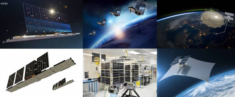
Commercial Earth Remote Sensing Satellites
It is urgent to develop this direction, since numerous constellations of modern reconnaissance satellites for various purposes are one of the cornerstones in achieving victory in the wars of the present and future.
3D surface maps
Simply pointing out a target for a kamikaze UAV or a long-range precision munition is not enough. In order to bypass the enemy's air defense centers, to minimize the risk of detection and destruction of ammunition, it is necessary to lay out the optimal trajectory of its flight, taking into account the terrain. This requires high-precision, constantly updated 3D surface maps that take into account the construction of buildings and other high-rise structures, the location of enemy air defense facilities, and terrain movements.
The less accurate the 3D maps of the surface are, the higher the flight path of the attacking kamikaze UAV or long-range precision-guided munition will have to be laid, respectively, it can be shot down by enemy air defenses with a much greater probability.
Cartographic information is one of the most secret topics, and therefore it is difficult to say what state this issue is in Russia, we can only assume that since the construction and operational updating of 3D maps of the area requires developed constellations of specialized orbital satellites, the quality of Russian cartographic systems largely correlates with the state of the Russian reconnaissance satellite constellation as a whole.
Thus, Google maps cannot be dispensed with - it is necessary to pay increased attention to the development of the Russian orbital constellation of mapping satellites.
Low orbit communication systems
Communication is an extremely painful topic for the Russian armed forces. Many people remember how during the war on August 08.08.08, XNUMX, unit commanders had to communicate by cell phones. Since then, if the situation has improved, then not globally, especially at the tactical level - volunteers buy for military personnel and send them to the zone of the special military operation of the Northern Military District) in Ukraine a huge number of civilian radio stations, while a significant part of them are primitive analog models that do not have noise immunity and the ability to encrypt communication channels - all this inevitably leads to absolutely unjustified and senseless losses.
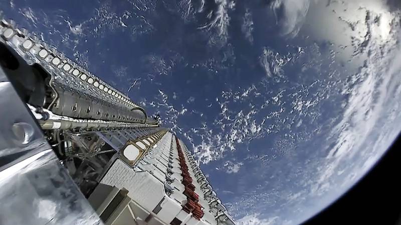
A package of Starlink low-orbit satellites before deployment
But, wait, what does communication have to do with kamikaze UAVs and long-range high-precision munitions: put the coordinates in them - and forward to the target?
The thing is that satellite communication systems make it possible to retarget kamikaze UAVs and long-range precision-guided munitions in flight, and this greatly increases their effectiveness.
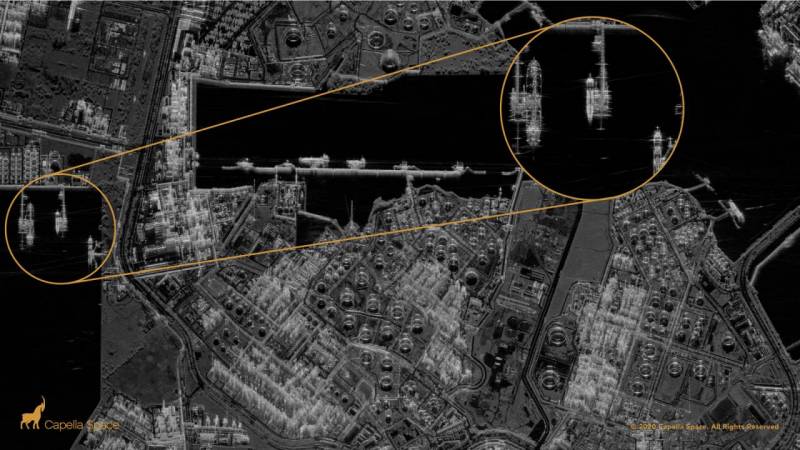
For example, in the context of conducting a military defense in Ukraine, Russian satellite reconnaissance facilities discovered a deployed anti-aircraft missile system (SAM) of an enemy of the Patriot type in the Lviv region. To destroy it, six long-range kamikaze UAVs were fired. NATO reconnaissance satellites discovered the launch of a kamikaze UAV, then a few hours later, US airborne early warning aircraft (AWACS) patrolling in the skies of Poland detected the UAV trajectory and compared it with the intended strike site, after which the Patriot-type enemy air defense system hastily changed position, located a kilometer from the previous base.
Ordinary kamikaze UAVs or any other long-range precision-guided munitions would then simply hit an empty place - “into milk”, and talking heads on TV would report on another “successfully destroyed enemy object”.
However, in the presence of developed constellations of reconnaissance satellites capable of observing objects in time close to real time, a change in the coordinates of targets would be detected. After that, through the satellite communications system, the updated target coordinates would be transmitted to the kamikaze UAV guidance system. It is far from a fact that the enemy would have managed to get out of the blow for the second time. But even if the Patriot air defense system could not be re-detected, or it would be on the move, then the kamikaze UAV could be redirected to destroy other military facilities of the military or civilian infrastructure.
When attacking stationary targets, the combination of reconnaissance satellites and communications satellites allows you to assess the damage to the attacked object and redirect additional ammunition to it, if necessary. Or vice versa, for example, if two of the four cruise missiles fired have already caused sufficient damage to the attacked object, then the remaining two can be redirected to other targets.
Thus, space communication systems make it possible to multiply the efficiency of using kamikaze UAVs and long-range high-precision munitions by providing the possibility of their retargeting in flight.
Automated systems for analysis and strike planning
Previously, 30-40 years ago, planning a strike with long-range precision weapons took about a day - it was necessary to choose the optimal flight route for a cruise missile to the target, taking into account the specifics of the TERKOM-type guidance system. However, at that time there were hundreds of cruise missiles in service, and they were intended to destroy especially important strategic targets of nuclear warheads.
Now, taking into account the use of global navigation satellite communication systems, as well as modern electronic computing systems, preparation for a strike most likely takes no more than a few hours, however, the number of long-range high-precision munitions used at once has increased significantly - up to hundreds in just one hit.
What will happen when it will be necessary to strike several thousand kamikaze UAVs and long-range precision-guided munitions per day?
In addition, the vast amount of information coming from reconnaissance satellites and other sources in near real time is extremely difficult to process using only personnel of the armed forces and other intelligence structures. Automation tools are needed that allow for preliminary analysis of intelligence information, for example, recognition of patterns and directions of movement of potential targets, and so on.
Conceptually, an example of such a system - EAKRUS (single automated intelligence, control and communications complex) was considered in the material Taming Country "A". In fact, there is little data on such complexes, although information that the US and other NATO countries are improving the automation of combat operations management periodically appears in the media.
If there are significant problems with hardware in Russia, then in the field of software we have a huge potential.
Thus, in the presence of advanced space reconnaissance and communications systems, it is quite realistic to provide primary computer analysis of information and automated target designation for kamikaze UAVs and long-range high-precision munitions.
Conclusions
As can be seen from the above, most of the systems that provide the very possibility, as well as the effectiveness of the use of long-range precision-guided munitions, are deployed in outer space.
There is no doubt that the importance of outer space will only increase over time, and the statement of US President Lyndon Johnson -
"who owns space, he owns the world",
will become more and more relevant.
Unfortunately, our country has largely lost the leading positions it has held since the middle of the XNUMXth century. Sadly, but now even a commercial company - SpaceX has competencies that in many ways exceed the capabilities of Roskosmos.
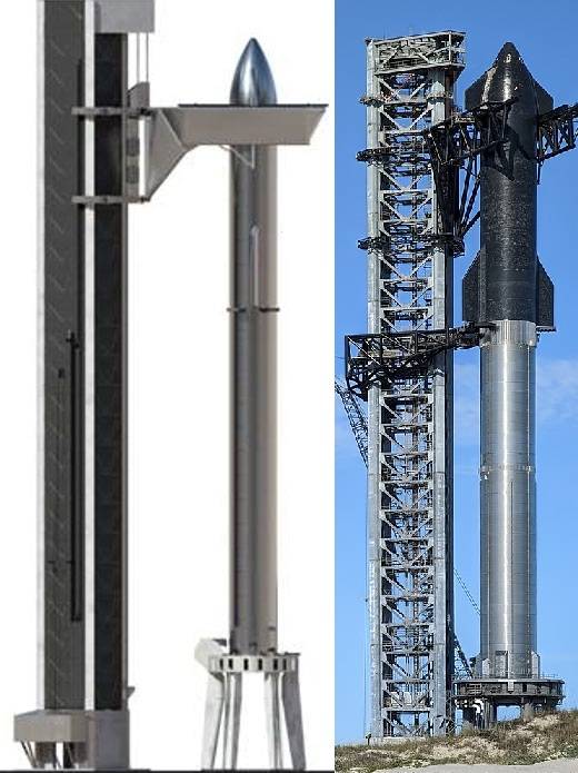
If this thing takes off, and most importantly, successfully lands, then we will have problems ...
Structural changes are needed in the development of outer space by our country, large-scale industrial production of satellites for various purposes, electronic element base for them, as well as fully reusable launch vehicles of various classes.
Otherwise, no modern weapons systems, no matter how many we produce, will not allow us to achieve victory on the battlefield.
Information