Henry the Navigator
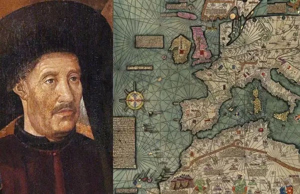
Henry the Navigator (1394–1460)
A small introduction
On March 4, 1394, one of the main historical figures in the collective memory of the Portuguese people Infante Dom Henrique (1394–1460), Grand Master of the Order of Christ and Duke of Viseu, better known to us today as Prince Henry the Navigator, fourth son of the royal couple of the founder of the Aviz dynasty, King John I (1357–1433) and Philippa of Lancaster (1360–1415).
His name is associated with the discovery of a route to the south along the western coast of Africa, overcoming a natural barrier in the form of Cape Bojador (modern Morocco), which was previously considered one of the geographical limits of medieval European man, which provided the basis for future Portuguese discoveries.
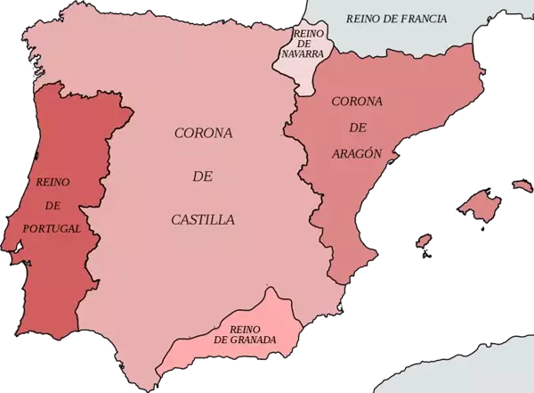
Kingdoms of the Iberian Peninsula by 1400
Prince Henry devoted a lot of time to the study of mathematics and especially cosmography, when these sciences were just becoming known in Europe, and it was these that he began to actively cultivate in Portugal.
And it was precisely thanks to this information, the thoughtful research that he received from his brother Pedro, who traveled through Europe and Asia, and reading ancient writers, that the confidence formed in his head that in the north of the Senegal River, then considered by geographers to be one of the branches of the Nile, lived heretical peoples to whom the Portuguese were supposed to bring Christian light and then reap the fruits of their craft.
But first, let's try to look at that era...
Age of Discovery
The XNUMXth century marked the beginning of the era of grandiose geographical discoveries - the period from the beginning of the XNUMXth century to the beginning of the XNUMXth century, when the ships of European pioneers sailed around the world in search of new trade routes. This era was famous for its outstanding discoverers and travelers.

Age of Discovery
Note. Geographical discoveries have always been made under the influence of economic factors, in pursuit of unexplored and rich lands, and new markets. During these centuries, powerful sea powers began to emerge, enriching themselves by seizing open lands, enslaving and plundering the indigenous population. In the economic sense, the Age of Great Geographical Discovery can be called the era of primitive accumulation of capital.
The actual course of geographical discoveries at its main stages developed in the following sequence. In the Old World (Europe, Africa, Asia), many discoveries were made in ancient times by the Egyptians, Phoenicians, and Greeks (for example, during the military campaigns of Alexander the Great in Central Asia and India). Based on the information accumulated then, the ancient Greek scientist Claudius Ptolemy in the XNUMXnd century. compiled a map of the world that covered the entire old world, but it was far from accurate.
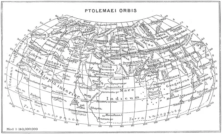
Ptolemy's Map
When the Ottoman Turks took full control of Constantinople in 1453, they blocked European access to the East, severely restricting European trade. In addition, they also blocked access to North Africa and the Red Sea, two very important trade routes to the Far East. Starting from this period, Europeans were forced to look for an alternative route to the East and began to seriously open up new maritime trade routes.
Long before the era of the Great Geographical Discoveries, the stories of the Venetian Marco Polo (1254–1324) about his visit to the legendary China caused great excitement among Europeans about the fabulous riches of the countries of the East, and besides, we must not forget about the upcoming Renaissance, which was also responsible for subsequent geographical discoveries. But there were other motives, such as the spirit of adventure, the desire for new lands, and competition for exploration among European states, which encouraged pioneers to venture into unknown lands.
And one of the first sea voyages associated with the Age of Great Geographical Discovery rightfully belongs to the Portuguese, who launched the first large wave of expeditions planned by Henry the Navigator...
Note. During Antiquity and the Middle Ages, only a small part of the world was known - European geographers in the Middle Ages were familiar with the countries of their continent, North Africa and parts of Asia. True, then there was an opinion that some sailors reached North America long before Columbus’s voyage - these were Irish monks led by Saint Brendan of Clonfert* in the XNUMXth century and the Icelanders led by Erik the Red and his son Leif Erikson at the beginning of the eleventh century.
But their stay there did not last long, and their experience was soon forgotten. Let us remember that Europeans knew almost nothing about the lands south of the Sahara. And although they knew about Russia, India and China, information about them was sparse and confusing...
Until the 711th century, the small states of the Iberian Peninsula were mainly occupied with fighting the already weakened and slowly receding tide of Muslim conquest, which, from 1492, spread over almost the entire Pyrenees. But the last gasp of the Umayyad Moor in Spain occurred with the capture of the last Arab fortress of Granada by the Spaniards in XNUMX - an epochal year, both in European history and in geography.
But Portugal, the most prominent in the Atlantic and the westernmost side of the peninsula, got rid of its Moors much earlier - more than 200 years earlier, when in 1249 the southernmost part of modern Portugal - the Algarve - was recaptured from the Moors, and in 1255 the capital of the kingdom becomes Lisbon.
Home
Although Mediterranean peoples such as the Portuguese, Spaniards, Genoese or Venetians had plied the Mediterranean Sea for many generations, most ships remained within sight of land or followed well-known and long-established routes between seaports. But Prince (Infant) Henry (1394–1460), who later received the nickname “The Navigator,” broke the sailors’ ideas about coastal navigation and began to encourage sailors to go beyond the mapped routes and open new trade routes to West Africa...
The history of that period tells us about many famous sailors, but for some reason Prince Henry is remembered very rarely. And this is too unfair an oblivion, because thanks to his efforts, Portugal began sea voyages to the shores of Africa, but what is surprising is that the main organizer of these sea campaigns went to sea only three times during his life, and his campaigns were no further than two hundred miles. But even despite this, Henry went down in history as “Henry the Navigator.”
Note. In the year of Prince Henry's birth, the Iberian peninsula was divided between three large Christian kingdoms: Portugal, Castile and Aragon, and the last remaining Muslim foothold in Western Europe, the Emirate of Granada in the south. All of these Christian kingdoms participated in the Reconquista, a protracted series of wars aimed at driving Muslim states out of the Iberian Peninsula.
But gradually displacing the Moors from the peninsula, by the XNUMXth century Portugal could no longer expand by land, since Castile was already beginning next. And having abandoned expansion on land, Portugal turned to the ocean, thereby ushering in the Age of Discovery, when European sailors traveled around the world in search of new lands.
And although the main project of Henry the Navigator was the exploration of the western coast of Africa, as a result of his efforts, pioneer sailors discovered the islands of Cape Verde (1460), Madeira (1419) and the Azores (1427). Continuing to move further south, the Portuguese reached Sierra Leone (Lion Mountains), but were unable to advance further south than this point during Henry’s lifetime.
In 1460, Henry died, but his unbridled zeal for the unexplored sea expanses prompted the Portuguese to further exploration - after his death, the Portuguese reached the Cape of Good Hope by 1490, and in 1498 another Portuguese navigator Vasco da Gama would follow this route all the way to India!
As mentioned above, Portugal was the first European country to begin the systematic development of hitherto unknown territories in the XNUMXth century. And it was the efforts of one man that truly moved Portuguese research forward. And this man was the Infante of Portugal Henry from the Avis dynasty, who later received the nickname in history - “The Navigator”!
Henry the Navigator
He was only twenty-one years old when his father, King João I of Portugal (1357–1433), decided to knight him and his two brothers, Duarte (1391–1438) and Pedro (1392–1449), with public celebrations and great solemnity. , according to the custom of those times.
But Prince Henry wanted to get weapon in a real war, to which his natural inclination and courage attracted him. He was highly regarded by the monarch when he and his two brothers captured the seaport of Ceuta on the northern Moroccan coast, the largest and most fortified city in all of north-west Africa, which had long served as a base for Barbary pirates who carried out devastating raids on the Portuguese coast.
At the Battle of Ceuta (1415) he first showed his courage and planted the Portuguese banner on the captured Moorish coast.
After the capture of Ceuta, King João I declared that he wanted to reward his sons for their great services. To Prince Duarte, as heir to the crown, he could offer nothing more valuable than the title of king after his death, he granted Pedro the title of Duke of Coimbra (a city located 182 km north of Lisbon), and Henry became Duke of Viseu - a specially created duchy for the youngest son. It should be noted here that the title of duke was then unknown in Portugal.
Portuguese "Skolkovo"
It was the conquest of Ceuta that further strengthened Prince Henry's desire to unravel the secrets of the ocean, for Portugal as a state was actually formed in the west, on the very edge of the then known world, and the sea to the west and south for Europeans was a region of mysterious depths, peopled with horrors and fantastic visions.
In the south of Portugal, on the small Sagres peninsula, he founded a village called Vila do Infante (“Prince’s Estate”), where a navigation school was founded - a real center of maritime research, which predetermined the further successes of the Portuguese in the discovery and colonization of new lands .
Sagres Peninsula, southern point of Portugal, where the center of marine research was located
He began to gather at his court the greatest cartographers, mathematicians, shipbuilders and explorers, whose wisdom undoubtedly guided Prince Henry's efforts to finance the expansion of the Portuguese dominions and the exploration of distant shores.
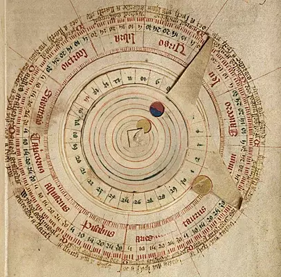
Volvelle – computational astronomical instrument
Prince Henry was also motivated by profits from maritime ventures. Trade with Africa later brought wealth to Portugal. And he was especially interested in discovering the African gold mines that made the "kings" of West Africa rich.
In the village of Vila do Infante, he founded shipyards and shipbuilding workshops, and also built the first astronomical observatory to exist in Portugal. Inside the village there was a chapel dedicated to Our Lady of the Immaculate Conception, and outside it, near the port where sailors who came from distant expeditions usually disembarked from ships, there was a cemetery.
A new type of ship called a caravel was developed in Vila do Infante. It was fast and more maneuverable than previous types of ships. In addition, all Portuguese ships were equipped with a compass, which completely determined their direction. The astrolabe (an instrument used to determine the latitude and longitude of celestial bodies) was also improved there.
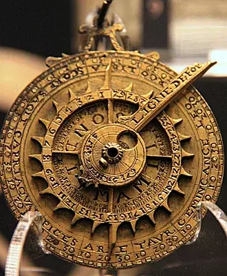
The astrolabe is an astronomical observation instrument. History of Science Museum, Oxford
Note. Caravel is a light sailing ship of the XNUMXth–XNUMXth centuries. was the first ship on which Europeans traveled along the coast of West Africa, and then crossed the Atlantic in the XNUMXth century. The caravel's hull was built so that the planks touched each other at their edges, giving the hull a relatively smooth surface.
The caravels had two or three masts, equipped with a square sail on the foremast and lateen sails on the remaining masts. This rig allowed the caravels to easily maneuver close to the shore, which made them ideal for reconnaissance, and the main advantage of the caravels was its ability to sail against the wind. The weak point of the caravel was its fragile hull, which tended to be damaged.
It was a cult ship, which in the XV-XVII centuries. largely dominated the entire maritime industry of Southwestern Europe. Although the exact origins of the caravel are still debated, the peoples of the Iberian Peninsula used it as a sea fishing vessel since at least the 1200s and was used for sea fishing and the transport of some coastal cargo. The Portuguese, and then their neighbors the Spanish, soon realized the ship's potential and transformed it from a simple fishing vessel into the basis of the European era of maritime exploration.
It is clear that the caravel revolutionized European shipping, and this new shipbuilding technology itself allowed European explorers, fishermen and traders to expand their horizons, giving them the ability to travel further and faster. We can safely say that she played an important role in the rapid colonization of the New World.
However, it can be said that the opposite is also true. Much of the caravel's success was due to the new navigational techniques brought to the Iberian Peninsula by the Moors, combined with the European desire for political, economic and religious expansion.
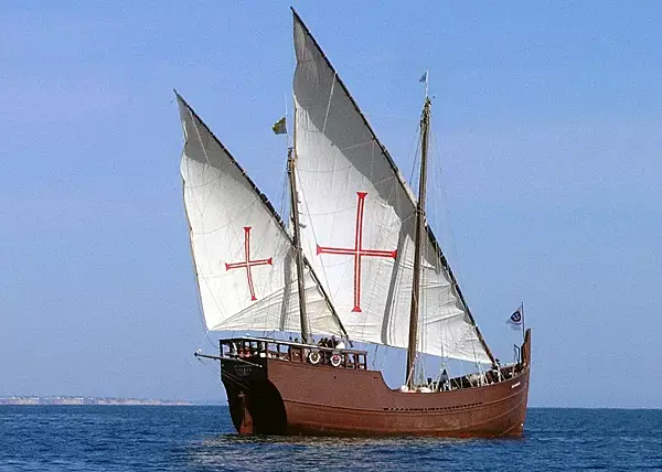
Caravel - a ship from the time of the Great Geographical Discoveries
Although the above achievements were not the work of Henry the Navigator, the design of this type of ship was one of the achievements for which Henry was personally responsible.
Thus, in this Portuguese “Skolkovo” everything necessary for the implementation of the enterprise started by Heinrich was collected.
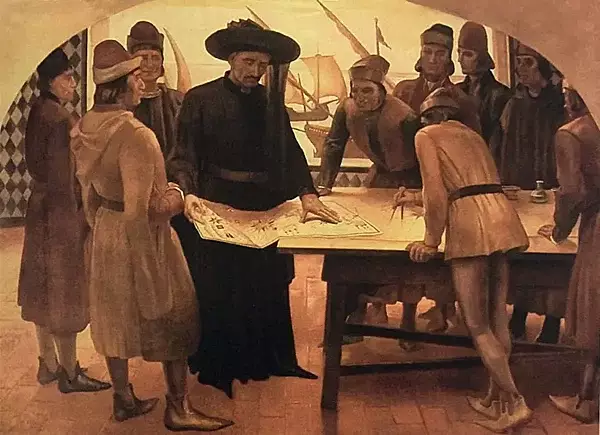
Prince Henry the Navigator - one of the first explorers who looked for sea routes to sail to India
But, of course, there were not enough resources for such fantastic plans, and Prince Henry received his initial capital from the Order of Christ (a fragment of the Order of the Templars), of which he became master. As Grand Master of the Order of Christ, he was able to use the enormous income of this religious organization for expeditions that were so beneficial to the spread of the Christian faith. Later, the prince's brother, Duarte, becoming king of Portugal, granted him a royal fifth of the profits from trade in all newly discovered lands for further exploration.
Prince Henry, who would later be called “The Navigator” and “the discoverer of the seas and lands that he charted,” was, without any doubt, the great driving force behind the Great Geographical Discoveries. In his village of Vila do Infante on the Sagres Peninsula, surrounded by an elite group of mathematicians, cosmographers and cartographers, he persistently and persistently prepared voyages into the unknown.
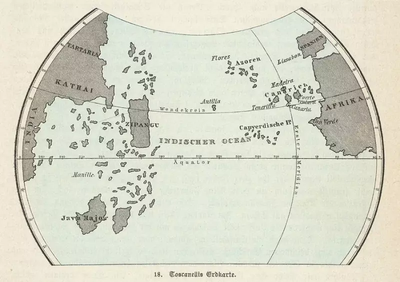
Map of the then known world
And, armed with information about Arab trade with the inhabitants of South-West Africa, which he received back in Ceuta, Henry decided to send several ships every year to conduct research in the south.
Well, then began a series of greatest discoveries that were destined to carry the Portuguese banner to the farthest corners of the earth and perpetuate the memory of the organizer of these discoveries - Prince Henry the Navigator.
Discovery of Madeira
The date that is considered official for the discovery of the island of Madeira is 1419, when Bartolomeu Perestrelo and Gomes Ianiz de Zurara decided to explore what was hidden behind the bank of clouds that they could see from the island of Porto Santo (an island 43 kilometers northeast of the island Madeira).
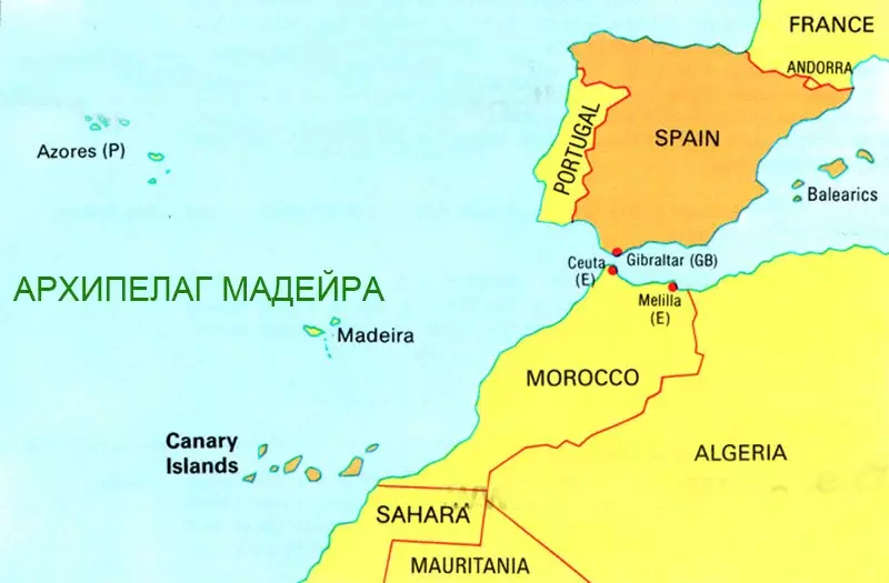
Madeira Archipelago in the Atlantic
Note. Madeira, originally uninhabited, was captured by Portuguese sailors in 1419 and settled after 1420. This archipelago is considered the first territorial discovery of the exploration period of the Age of Discovery. But despite the fact that the Portuguese were the first to lay claim to Madeira, there is information to suggest that the island was actually discovered before the Portuguese first stumbled upon it.
For example, some ancient Roman texts (Pliny the Elder) mention islands off the coast of Africa that were known as the Purple Islands, and based on these texts, some researchers believe that this is the island of Madeira. Additionally, besides the vague mention of the island in some Roman texts, there is also a book called Libro Del Conocimiento*, dated between 1348–1349, which gives the exact location of the island.
There is another interesting version of the discovery of this island - this is the Viking expedition that visited Madeira between 900 and 1030 AD. The discovery came after experts dated old mouse bones found in Ponta de São Lourenço in the easternmost part of the island. This is the earliest evidence of the presence of mice on the island, which in turn hints that the mice were not local residents and did not sail on the ships of the Portuguese sailors who took possession of the island in 1419.
Researchers believe that the first mice, arriving on the island via Viking ships, started the extinction of the island's endemic bird species, and that their predation destroyed the eggs of at least two-thirds of the endemic birds and caused two non-endemic species to become extinct, leading to environmental disaster due to the extinction of these bird species and changes in the ecology of the island*.
However, despite any pre-existing knowledge, it was Portuguese explorers who brought Madeira into official records.
The arrival of the first Portuguese ships in 1419 was an accident. While exploring the coast of Guinea, the Portuguese ship was carried to the west by a strong storm and landed on an island; the Portuguese named it Porto Santo (“Holy Port”), from the shores of which another island was visible. A year later, with the prince's approval, a fleet sent to explore the island, which the Portuguese had seen in the distance, discovered a new island. And this island was Madeira.
The first Portuguese settlement appeared soon after its discovery, and the first groups of colonizers, rich and influential people, began to arrive there between 1420 and 1425. It wasn't just the rich and powerful who were the first to settle in Madeira - prisoners were brought in to work the land, and these prisoners played a major role in creating the island's infrastructure, cultivating the land, establishing agriculture, and clearing forests to make room, as well as building roads and digging channels.
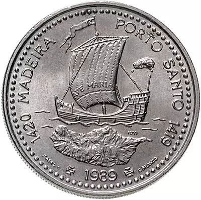
Portuguese 100 escudo coin depicting the island of Madeira
After this initial colonization, Madeira began a period of prosperity and growth. Wheat began to be grown on the island, which became the main product of the land, and although at first it was only enough for the settlers of Madeira, it was soon grown in sufficient quantities to be exported to mainland Portugal. And this ensured the steady growth of Madeira's economy and population.
Grapevines brought from Burgundy were planted in Madeira and form the main industry of the island to this day.
Azores
After the discovery of Madeira and the beginning of its settlement by Portuguese colonists, Henry decided to send his captains on a new maritime expedition. He had heard about nine islands in the North Atlantic Ocean, also discovered by the Portuguese at the beginning of 1375 and included in the Catalan Atlas*, but not populated and soon forgotten. And in 1427, Captain Diogo de Silves, sent to search for these islands, rediscovered the islands of Santa Maria (the southernmost of the islands) and San Miguel (the largest island).
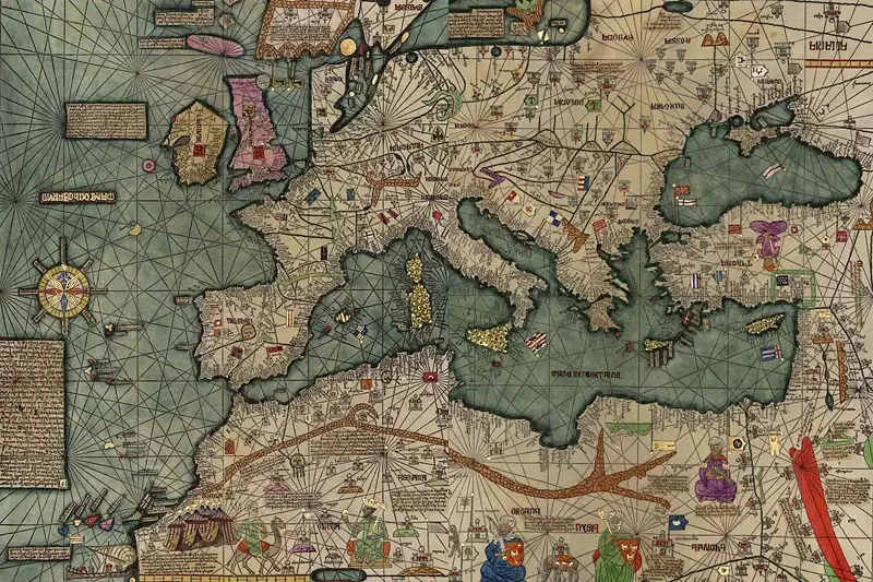
Catalan atlas. Medieval map of the world, created in 1375 and surviving to this day
Note. History books say that the Azores were discovered by Portuguese explorers in 1427. But a study of mouse mitochondrial DNA and lake sediments suggest that this Atlantic archipelago was actually discovered by the Vikings 700 years before the Portuguese. Well, if you go even further back into the depths of centuries, then these islands were known to the Carthaginians. At the level of legends, some people associate the Azores with the once extinct Atlantis, a mythical island kingdom mentioned by Plato.
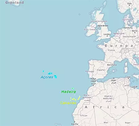
Azores, Madeira and Canaries
The first island discovered by explorers was Santa Maria Island, followed by San Miguel. A little later, the island of Terceira was discovered, as well as the islands of Faial, Pico and Sao Jorge, located at a close distance from it. And finally, the islands of Graciosa, Corvo and Flores were discovered, which marked the end of the era of discoveries of these islands.
And five years later, on August 15, 1432, captain Gonçalo Velho Cabral again moored his ships to the island of Santa Maria.
Unlike the previously discovered Madeira, the Azores were not settled immediately after their discovery. This may have been due to their location, being approximately 1 kilometers from mainland Portugal. Or perhaps because of their volcanic activity, which may have prevented people from settling on these islands. However, the Azores were finally settled almost a century after their first official discovery.
Colonization of Santa Maria. The first island inhabited by the Portuguese was Santa Maria (1439), and the first village, Anjos (now Villa do Porto), was founded there. There were no large animals on the islands, so settlers brought with them cattle, sheep, goats, pigs and chickens. As for the cultivation of crops, they were mainly focused on grain, grapes and sugar cane, which were in great demand at that time.
Colonization of San Miguel. The first Portuguese settlement on the island was established in 1432, but São Miguel was officially settled in 1449, with its main town being Villa Franca do Campo, located in the center of the island's southern coast.
Looking ahead, it must be said that in 1522 the city was badly damaged by an earthquake, which led to a landslide and destroyed it. Thus, the capital was moved to Ponta Delgada, which today is the capital of the Azores archipelago.
Over the next decade, the largest island of São Miguel attracted Portuguese and French settlers who recognized the Atlantic island's fertility, and the production of wheat, sugar cane and oranges led to positive economic growth in the Azores.
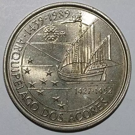
100 escudos 1989 Discovery of the Azores archipelago 1427–1452
Cape Bojador
For many years, the prince sent one caravel after another to the coast of West Africa in the hope of finding a sea route to the fabulous and distant East for Europeans, and each time the ships sent for new discoveries returned ingloriously. And the main obstacle on their way was Cape Bojador, located far into the sea, located on the coast of West Africa (modern Morocco).
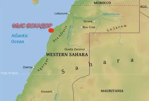
Cape Bojador on the map of West Africa
Moving along the western coast of Africa, the Portuguese caravels from 1421 began to get closer and closer to Cape Bojador, upon seeing which, all sailors immediately turned back. Situated on a dangerous section of the African coast, surrounded by reefs, this cape was considered impassable due to strong north-east winds. Its Arabic name Abu Hatar means “father of danger,” and sea tales passed down from mouth to mouth warned of sea monsters, the scorching sun that would destroy any ship that dared to sail beyond this cape, and that there all sailors immediately turned into blacks...
Early European navigators called this cape "the point of no return" until it was first successfully navigated by the Portuguese navigator Capt. Gilles Eanes in 1434. Fifteen failed attempts to round this cape had been made before Eanesh, so this would be one of the most important achievements in maritime history, and one that would be known throughout Europe!
Subsequently, the Portuguese actively used this region, in particular for the trade of enslaved Africans. This success of Captain Eanesh removed the fear factor of Cape Bojador and became an important turning point in the advance along the African route.
After this breakthrough, Henry had no difficulty in persuading his captains to pass this cape further, and by 1436 they reached Rio de Oro...
Tangier Crusade
But such rapid progress in the discovery of new lands did not last long - from 1436 to 1441, sea expeditions had to be suspended. This period refers to the unsuccessful attempt of Henry the Navigator to capture the Moroccan fortress of Tangier (a port city in northern Morocco), taking advantage of a power dispute between the regent and the crown sultan.
But in 1437, Henry suffered a serious defeat there from the troops of Abd al-Haqq II of the Berber Marinid dynasty.
To save his troops from complete destruction, Henry concluded a humiliating treaty with the Sultan and promised to return the fortress of Ceuta, which he had captured in 1415, to Morocco in exchange for allowing the evacuation of his army, but the terms of this treaty were never fulfilled.
Along the coast of West Africa
Rumors of large gold deposits in Africa came to impoverished Europe after the African king of Mali, Mansa Musa*, sometimes called the richest man who ever lived, visited Cairo during his pilgrimage to Mecca.
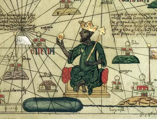
King of Mali Mansa Musa with a gold bar in his hand (Catalan Atlas)
Portuguese expansion into Africa began with the desire of King John I to gain access to the gold-mining areas of West Africa. Trans-Saharan trade routes* between Songhai (part of modern Mali, Niger and Nigeria) and North African Arab traders supplied Europe with gold, which was then used to trade spices, silks and other luxury goods from India.
At that time, there was not enough gold in Europe, and there were persistent rumors that there were states in southern Africa that had a lot of gold. This news prompted King John I's son, Prince Henry, to send an expedition to explore these possibilities. And although knowledge of West Africa was passed along trans-Saharan trade routes to North Africa and from there to Europe for hundreds of years, West Africa was not explored by sea until the XNUMXth century...
Note. But in XII, Arab sources recorded several attempts to navigate the sea along the coastline of West Africa. In 1154, the Moroccan geographer al-Idrisi told of some Muslim adventurers who set out from Lisbon and apparently reached the Canary Islands, which lie off the Atlantic coast in southwestern Morocco. In the XNUMXth century, the Arab historian Ibn Said said that Muslims explored the coast of West Africa as early as the twelfth century in search of an area where tuna, which was the main food of the Moroccans, was found.
But the Arab sailors of North Africa did not invest much money or effort in such maritime expeditions because the trans-Saharan trade route was a well-established and efficient means of satisfying their needs for most West African goods and materials. Much of the naval exploration along the west coast of Africa was therefore financed by Portugal and the Italian trading cities, who were particularly attracted by West African gold and territory suitable for growing crops such as sugar cane.
So, having safely passed the dangerous Cape Bojador, the Portuguese expeditions then moved further south, and in 1441 Nuno Tristan и Antan Gonçalves reached Cape Blanco (between modern Mauritania and Western Sahara), and by 1448 they opened a trading post on the island of Arguin and a small fortress to protect it.
It should be noted here that Portuguese explorers landed on the shores of West Africa after they began building ships that could navigate not only the ocean, but also the shallow waters and strong currents around the legendary Cape Bojador. These Portuguese caravels were much lighter and more maneuverable than the Venetian cargo ships, and therefore could sail both along the Atlantic wind and up rivers.
Portuguese expansion to the south of West Africa grew more and more, and by this period, sailors had already passed the southern border of the Sahara, from that time on, the Portuguese bypassed the Arab land trade routes through the western Sahara desert by sea, and African gold began to arrive in Portugal.
These maritime discoveries seriously changed the direction of trade, which led to the impoverishment and decline of Algeria and Tunisia, but, conversely, began to enrich Portugal. The flow of gold coming from Africa allowed the king to mint the first gold coins in Portugal - the cruzado.
Note. The sub-Saharan African "kingdoms" of Ghana, Mali, Benin, Songhai and Congo were relatively well-organized societies with long histories but largely unknown to Europeans. Before the Muslim invasions in the XNUMXth century, the kingdom of Ghana had extensive trade links with the states of North Africa and the Middle East, and Mali (an Islamic state whose capital Timbuktu was a major economic and cultural center) controlled the gold trade.
But the arrival of the Portuguese dramatically changed the flow of African gold. Instead of being caravanned overland to North Africa and then to the coffers of the financially powerful Italian city-states, the precious metal was transported by sea directly to Lisbon and then throughout Western Europe.
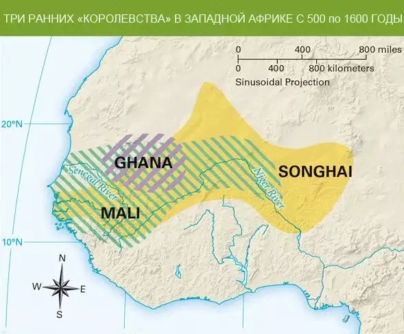
Kingdoms in West Africa from the XNUMXth to the XNUMXth centuries
The arrival of maritime traders on the coast of Guinea in the XNUMXth century marks a new era in their history, and indeed in the history of all West Africa. And the founders were the Portuguese, who had the necessary knowledge and experience to begin the development of ocean trade routes with Africa, and subsequently with Asia.
The Portuguese first established temporary trading bases along the entire western coast of Africa, and to protect their trading posts, they built forts at Cabo Blanco (1441), Sierra Leone (1462) and Elmina (1481–1482) to protect them from rivals - European traders.
Thus, as stated above, the Portuguese diverted the gold and slave trade away from the trans-Saharan routes, which led to their decline, and increased Portugal's own status as a powerful trading nation.
Between 1444 and 1447 the Portuguese explored the coasts of Senegal, Gambia and Guinea, and in 1456 a Venetian captain Alvise Cadamosto, while in the service of Prince Henry the Navigator, explored the Cape Verde Islands (Cape Verde), after which the Cape Verde Islands were transferred for settlement on behalf of the Portuguese crown to the Order of the Knights of Christ (former Templars), the Grand Master of which was Henry the Navigator himself.
Having a good foothold in Africa in the form of the Azores and Madeira Islands, the Portuguese were able to mine gold and enslave people from the African continent, later using them to mine gold and work on island plantations, where their job was to cultivate the land and water sugar cane.
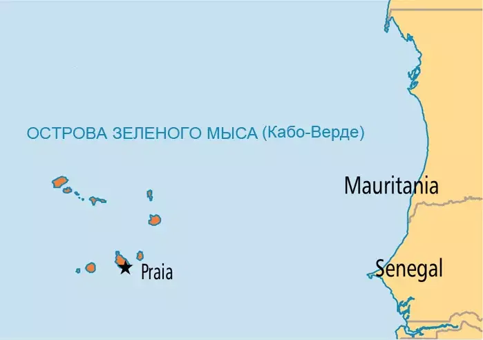
Cape Verde Islands (Cape Verde)
During these same years, the Venetian explorer Alvise Cadamosto, in the service of Prince Henry, and a Portuguese Diogo Gomes explored the Gambia River (1 km) on separate expeditions sent by Henry to Portugal in 120 and 1455, and wrote accounts of their travels. After this, Portugal continued to send small fleets on annual expeditions to West Africa. It was here that European sailors first lost sight of the North Star and saw the bright constellation of the Southern Cross...
In 1452, Pope Nicholas V issued the bull "Romanus Pontifex", praising the Catholic King Afonso V of Portugal (r. coast of Western Sahara. This papal bull sanctioned and legally granted Portugal, as a Christian state, the full right to enslave non-Christian peoples and fully approved their further colonization.
But most importantly, it prohibited other Christian powers from encroaching on the rights of the Portuguese in North-West Africa. This bull is an important example of the papacy's claim to spiritual dominion over the entire world and its role in regulating relations between Christian rulers and between Christians and "unbelievers" ("pagans" and "infidels").
The last discovery made during Prince Henry's lifetime was the Cape Verde Islands, made by one of his captains, Diogo Gomez. As successive discoveries were made under Henry's leadership, his cartographers recorded them in portulanos (publications containing plans of various ports), and shortly before his death, Prince Henry sent them to a Venetian monk Fra Mauro* details of all the discoveries made, a copy of which still exists...
By the time of his death, Portuguese explorers and traders had advanced into what is now Sierra Leone.
Death and legacy
Prince Henry of Portugal, nicknamed the Navigator, died on November 13, 1460, aged 66, in his hometown on the barren Cape of Sagres.
Another 28 years would pass before another brave navigator, Vasco de Gama, under the Portuguese flag, would circumnavigate Africa and complete the expedition to India. After Henry's death, the pace of progress in Portuguese maritime exploration accelerated noticeably - the Cape of Good Hope was passed and a sea route to India was opened, and the colonization of newly discovered Brazil began in the West.
It was Henry, later nicknamed "the Navigator" by two German historians of the 1500th century, Heinrich Schäfer and Gustav de Veer, who was the first to organize sea expeditions that, by XNUMX, after his death, made Portugal the dominant maritime power in the world.
The impetus given by Prince Henry's patient exploration of the African coast continued long after his death. In Sagres, in the navigation school created by Henry, sea expeditions continued under the leadership of his nephew, King João II of Portugal.
In 1472, the Portuguese crossed the equator line, and soon began the exploration of Guinea, Congo and Angola. Everywhere the Portuguese established their colony-fortresses with a small number of armed forces, trading posts for the needs of trade and Catholic missions for the baptism of pagan natives.
What did Prince Henry the Navigator discover?
He himself did not discover anything, he had never even crossed the waves of the ocean, except for three voyages across the Mediterranean Sea. However, he was known for his apparent experience as a good organizer in sending sea expeditions to search for unknown lands. And thanks to their role as good organizers and financiers of expeditions, its captains made several key discoveries:
1. Madeira (1419). Henry built a relatively large colony on this archipelago, and the settlement was quite prosperous. The island became one of the main centers of the slave trade that Henry pioneered, and it was also the first sugarcane colony established by Portugal. This first colony used a specialized sugarcane plantation system, which became the model for future agricultural colonies.
2. Azores (1427). The purpose of this expedition was almost the same as that of the expedition to Madeira. As this colony grew, both it and Madeira specialized in certain agricultural products and goods and served as a starting point for further exploration.
3. Coast of West Africa (beginning 1434). The ships sent by Henry explored more than one and a half thousand miles of West African coast. They used all their knowledge and skills to expand the trade they established with the native Africans. After the Portuguese advanced south of Cape Bojador, slaves and gold began to arrive in Portugal.
Although Henry was no longer around, his three main achievements in life are associated with him:
1. Around the Cape of Good Hope (southern tip of Africa). This was accomplished in 1488 by Bartolomeu Diaz, years after the death of Prince Henry. However, Diaz achieved this using the methods that Prince Henry laid down in his time.
2. Trade with India. The direction set by Prince Henry ultimately helped the Portuguese establish trade relations with India and other countries of the East, including the most important goods of the Age of Discovery - spices, slaves and gold.
3. Discovery of America. Brazil was colonized in 1500, forty years after the death of Prince Henry. This discovery was part of a plan created by the prince and his researchers at Skolkovo in Portugal. The trade in slaves, who began to be imported to the Portuguese colonies in America, was also initiated by Prince Henry.
Infante Dom Henrique, aka Henry the Navigator, left behind him a glorious name in history, and a sublime legacy to Portugal. He was the most brilliant figure in the history of the Middle Ages, a man who should symbolize the glory of historical discoveries.
Along with Columbus, Henry is considered one of the founders of modernity - a brilliant man who dared to challenge the scientific beliefs of his time and thereby contributed to liberation from the geographical shackles and ideas that had shackled Europe since the fall of the Roman Empire, and his image as a sailor, mathematician and pioneer navigator will always be very noticeable...
In the center of the chapel of the Dominican monastery of Santa Maria da Vitoria in the city of Batalha is the tomb of the founder of the Aviz dynasty, King John I and his wife Queen Philippa of Lancaster. The burials of their sons are also located there, one of whom was Prince Henry the Navigator, whose grave is a large marble structure and is marked with beautiful stone tiles.
Its stone relief is surmounted by a royal wreath woven from oak leaves and a rose in the middle, and the lower part of the sarcophagus is decorated with three shields: one with the coat of arms of the Kingdom of Portugal, and on the other two - the coats of arms of the orders to which he belonged - the Order of Christ and the Order of the Garter, and On the tomb you can see the epitaph of his motto, written in French: Talent de bien faire...
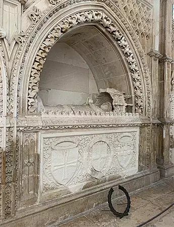
Burial site of Prince Henry the Navigator (aka Infante Dom Henrique, 1394–1460) in the Batalha Monastery
Prince Henry was known as a devout Christian. He was celibate, had no children, and always wore a hair shirt (a coarse shirt made of hair). Henry lived his life following the code of chivalry, devoting himself entirely to maritime exploration, the fight against the Moors and the expansion of the Portuguese Empire...
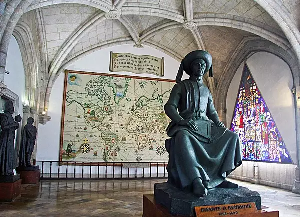
Monument to Henry the Navigator in the Museu de Marinha, a museum located in the Portuguese parish of Santa Maria de Belem in the municipality of Lisbon
Information:
*Libro Del Conocimiento. The Book of All Kingdoms is an anonymous Castilian gazetteer dating from about 1385, written in the form of an imaginary autobiographical account of the journey of a Castilian mendicant monk traveling around the world - from the westernmost islands of the Atlantic, through all of Europe, Asia, Africa and the Arctic, describing all the lands and all the rulers as he passes by them.
*Catalan atlas. A medieval map of the world that has survived to this day, created in 1375. Created in Mallorca by Jewish cartographers, cosmographers and manufacturers of navigational instruments who lived in Mallorca in the XNUMXth–XNUMXth centuries until the expulsion of the Jews from Spain. The Catalan atlas is still kept in the National Library of France.
*Brendan of Clonfert (484–578) - the first Irish saint to receive the nickname "The Mariner" and is revered by the church as a prophet. Known for his travels across the ocean to the west in search of the “Promised Land”, there is even a belief that Brendan was the first European to reach the shores of North America.
*Island ecology changes. Article in a British newspaper Daily Mail dated May 6, 2014, where, after studying the DNA of mouse bones, it is believed that the first Europeans (Vikings) and rodents with them arrived on the island in the XNUMXth century.
*Mansa Musa (reigned 1312–1337) - ruler of the “kingdom” of Mali, under which the state had the greatest size in its entire history and reached the zenith of its power and cultural development. He became well known throughout North Africa and the Middle East thanks to his pilgrimage to Mecca, where, on the way to the Holy Places, he distributed gold to the poor people he met along the way.
*Trans-Saharan trade routes. The oldest trade route through the Sahara Desert, covering most of Western and Northern Africa. The main items of trade were gold, salt and slaves, and the caravans were led by the Berbers, who were well versed in the desert and ensured safe passage through the territory of their fellow nomads.
References:
1. N.V. Ovchinnikov “Prince Henry the Navigator.”
2. Gomes Eanesh de Zurara, Chronicle of the Discovery and Conquest of Guinea.
3. C. R. Beasley "Henry the Navigator 1394–1460."
4. Malyn Newitt "The Portuguese in West Africa, 1415–1670: A Documentary History."
5. Ernst Bradford "Wind from the North: The Life of Henry the Navigator".
Information