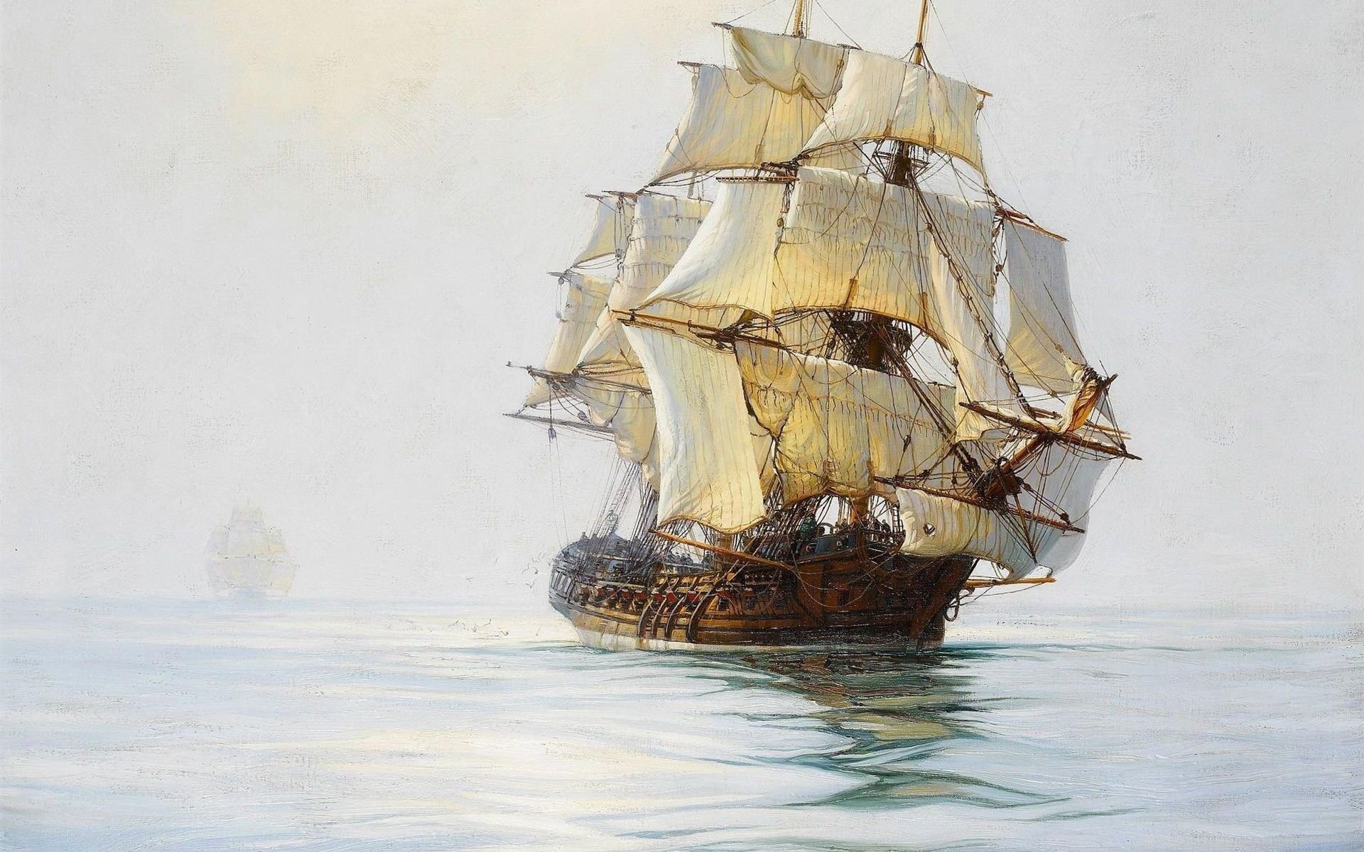
Not only the captain of the Flying Dutchman

In the eventful and naming stories England of the second half of the 16th century, the name of John Davis, an eminent English navigator and explorer, was in the shadow for many years compared to D. Hawkins, F. Drake, W. Raleigh, and polar explorers G. Hudson, U. Baffin and others. But he is not inferior to them either in the scale of the voyages, or in the results achieved. In recent times, it has become more often to remember him, but only about his piracy activities. As a result, in the United States, John Davis has become one of the characters in the Hollywood film Pirates of the Caribbean, in which, under the name of Davy Jones, the 4 is plowing the seas on the cursed Flying Dutchman. At the same time, they somehow do not remember at all that he is privileged to be a re-discoverer (after the Vikings) of Greenland in the 1585 year. That in the second voyage in 1586, he discovered the Cumberland Bay of Baffin Land, explored the North American coast in detail, and determined the exact location of the Hudson Strait. In the third voyage in 1587, he again explored Greenland, moving north to 72 ° 12 's. sh. The exact maps he created paved the way for subsequent researchers such as the Hudson and Baffin. His observations contributed to the development of English whaling. In addition, Davis is the inventor of several navigation tools, including Davis’s double quadrant. He was the author of a number of books on maritime affairs.
The story of the birth of John Davis is for sure unknown. According to some sources, he was the only son and heir to the English lord, but after graduating from the Liverpool nautical classes, being twenty-one years old, he preferred the fate of a pirate to royal service and went to sea in search of adventure on one of his father’s ships. According to another version, which was more common in Soviet historiography, John Davis came from a non-fertile, poor family and began his life journey from a shipboard cabin boy.
Be that as it may, good primary education, along with natural abilities, the desire for knowledge and acquired experience in navigation, enabled him to become a famous captain by the age of thirty. Brothers Andrian and Humphrey Gilberta, who were looking for the northern routes to India and China, presented Davis to some top statesmen, to whom he outlined his proposals for opening the northwestern route in January 1583. Finding them worthy of attention, they, in turn, introduced him to a group of rich and influential London merchants. Thanks to their material support, Davis got two ships to his command two years later - the “Sunshine” with a displacement of 50 and a crew of 23 people and the Munshine with a displacement of 35 and crew of 19.
7 June 1585, both ships sailed from Dartmouth, and on July 20 approached the southeast coast of Greenland, surrounded by solid ice. Impressed by the lifelessness of the unknown land, Davis called it the “Land of Despair”. Proceeding to the south-west, the ships rounded the southern tip of Greenland - Cape Farvell, headed north-west and at latitude 64 ° 15 're-entered a vast bay called Gilbert Bay (now Gothob Bay). Here the first acquaintance of the English sailors with the Greenland Eskimos took place. In the first days of August, the vessels again went to sea free from ice, paving the course to the north-west.
Despite frequent storms, interspersed with snow blizzards, ships passed more than 320 miles. At the latitude of 66 ° 40 ', the earth was discovered, which he named Cumberland, which turned out to be a peninsula on a large island (now Baffin Land). So was opened the strait between Greenland and the Canadian Arctic Archipelago, which received the name of Davis. Believing that he had gone too far north, Davis turned south. Stepping out to the wide entrance between the two, as he thought, islands, he decided that there might be a welcome passage, and turned into it. But soon the ships entered the dense fog, which prevented further pursuit. Believing that the beginning of the Northwest Passage had been found, Davis hurried back to Dartmouth.
Satisfied with a bold voyage, tales of results and possible prospects, the London merchants released funds for a new expedition in the next year, 1586. To the previous ships "Sunshine" and "Munshain" were added the "Mermaid", a displacement of 250 and a ten-tonne pinnacle "Nore Star". The ships left Dartmouth on May 7, and on June 15, at latitude 60 °, approached the land covered with ice and snow (the southern tip of Greenland). It was impossible to land on it. The violent storm that began on June 29 carried the ships far to the north - to the 64 parallel, from where they quickly reached Gilbert Bay. Despite the bad weather, Davis began his search for an aisle, but on July 17, at a latitude of 63 ° 08, the ships met a solid ice field. Up until July 30, they followed its edge in a dank, cold fog. Tackles and sails froze, colds began among the crews. Difficult sailing conditions, ill health, deteriorating nutrition caused discontent among sailors, and Davis decided to send to England unsuitable for swimming in ice “Mermaid” and “Munshine” with the sick and dissatisfied, and with volunteers at Sunshine and pinnas 6 August went through the ice and fog to the north.
18 August at a latitude 65 ° opened a high rocky cape, to the south of which land was not observed. Both ships turned west. However, 19-th in the evening began a heavy snowfall, the wind intensified, which passed by morning into a snowstorm. A few hours later, we managed to take shelter in a sheltered bay, but, having landed, the mariners discovered that they were on the island. Turning south, Davis, when following, did not notice the entrance to Hudson’s Bay and went to the shores of Labrador Peninsula. At the latitude of 54 ° 15 ', the vessels approached the strait, which was taken for the desired Northwest Passage. Two strong storms prevented him from examining. 6 September Davis lost an 5 man killed while fishing by locals. In the evening of the same day, a new storm hit the ships, in which they lost each other, and the Munshine received severe damage in the spars and rigging. The weather calmed down on 10 on September, replaced by passing north-westerly winds.
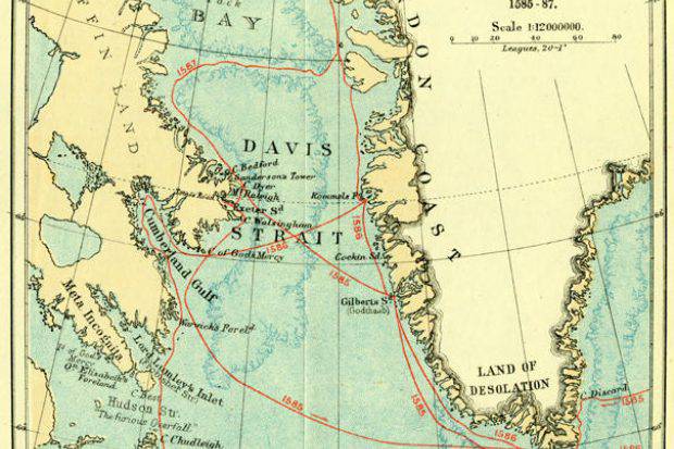
Munshine arrived in Dartmouth on October 4, but the Nora Star pinas went missing. Davis has kept a brief account of this voyage, in which he indicates the brought prey - 500 full and 140 half of the seal skins and many small tanned pieces. Although the desired route to China and India was not found, the merchants outfitted a new expedition on three vessels, placing the requirement to combine the search for the Northwest Passage with the hunting industry. In the spring of 1587, Davis sailed back to the Arctic on three ships, immediately heading for Gilbert Bay. Here he left two large vessels for fishing, and resumed his search for passage on a small one. It passed along the coast of Greenland to 72 ° 12 ', and then the open sea to 73 ° c. sh. Stopped by impassable ice, Davis turned to the south-west and in mid-July approached Baffin Earth, and then, following south, went out to the strait opened in the first voyage. After a two-day voyage to the northwest, he nevertheless concluded that it was the bay, which he called Cumberland. Coming out of it, Davis began to explore the southeastern protrusion of Baffin Earth. Then he passed the entrance to Hudson Bay and proceeded along the Labrador Peninsula to the 52 parallel, after which, lacking provisions and fresh water, he returned to England.
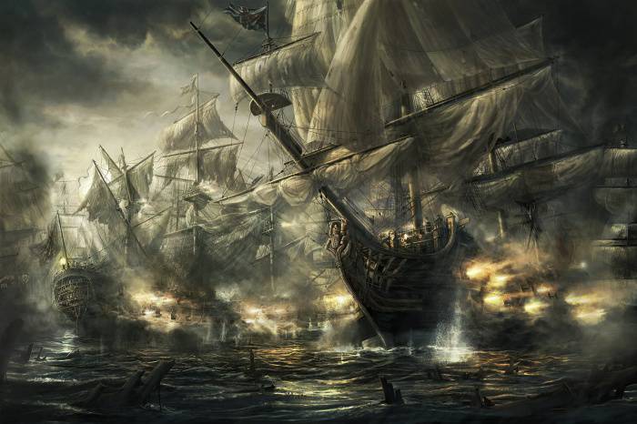
Despite the successful fishing of two other vessels, the merchants refused to subsidize another expedition. In July, 1588, the Spanish fleet, called the Invincible Armada, appeared off the coast of England, threatening to invade the island. Davis joined the English fleet and received command of the ship "Black Dog", which participated in the defeat of the "Armada". The following year, 1589, he took part in the seizure of cargo of American gold and silver from the Spanish galleons near the Azores under the command of George Clifford. The raid brought the desired prey and compensated for the material loss of the captain's place with the London merchants.
Davis has acquired a good seagoing vessel. Two years later, Davis and Thomas Cavendish set about organizing a caper expedition to the Pacific Ocean. The share of Davis, First Deputy Cavendish, was the value of his own ship and 1100 pounds. The main thing in the "gentlemen's agreement" was the condition that on the way back from the coast of California, Davis would leave the "Designer" of Cavendish and separate on his ship with pinas and proceed north to search for the Northwest Passage from the western side of the still unknown American continent.
An expedition consisting of three ships and two small ships left the Plymouth August 26 1591. 29 November ships reached the shores of Brazil. The December 15s approached the then small town of Santos, and the 24s set out on course towards the Strait of Magellan. The February 7 storm hurricane force scattered ships across the ocean. When the weather improved, Davis decided to go to Port Designer Bay (currently Puerto Deseado in Argentina) and arrived there in March with three ships joining the route. Cavendish came only 18 March. From his stories to Davis it became clear that he had lost the desire and energy to continue the raid. And yet 8 April detachment again headed for the Strait of Magellan and anchored in a small bay. On the ships began hunger and disease. Cavendish finally lost faith in the success of the passage of the Strait of Magellan and insisted on returning to Brazil to continue the raid around the Cape of Good Hope from there. After much controversy, which lasted until May 15, he insisted on returning. After leaving the 18 strait in May, the ships soon lost each other.
The Designer went to an unknown land, but since the mast was lost in the storm, and the people on board from 75, besides Davis and his assistant, there were only 14 healthy sailors, it was not possible to investigate the discovery. These were the Falkland Islands. In Port Design, Davis decided to leave the ship for repair pending the arrival of Cavendish, and with healthy sailors proceed to Pinas along the American continent to the Northwest Passage. The sailors began to repair the ships and replenish their provisions. The bay abounded in seals and penguins, fish and mussels. On August 6, having decided that Cavendish had already proceeded to the Strait of Magellan and, possibly, is waiting for them there, they left Port-Designer.
The exhausting storms, the everyday probability of near death, the dampness, the monotonous meager food created among the crew part discontent and desire to return to Port Designer. Davis assembled the crew and indicated that waiting for Cavendish put them on the verge of death. It is better to go further than to go back. Davis aide Randolph Koten approved the captain's arguments and suggested going to the Pacific Ocean. October 2 ships entered the ocean, but in the evening a storm of hurricane force began. In the coming night with the whole crew pinnas died. October 11 "Designer", having lost most of the sails, was near the rocky shore on the edge of death and only miraculously survived thanks to the art of Davis and Koten.
Having rounded the cape, the vessel entered the calm bay, where it was moored to the coastal trees (all anchors were lost). Rest and putting the ship in order took the crew until October 20. 21-th went into the strait, where they were suddenly overtaken by a hurricane from the north-west. Once again, the art and determination of Davis rescued the "Design" from death in a narrow strait. On 27, he led the ship to the Atlantic Ocean, and on 30, they approached Port Designer.
In 11 miles to the southeast, there was an island named Penguin. October 31 "Designer" moved to the Gulf and 3 November, moored near the high bank at the mouth of the river. Three days later, a group of sailors went out on a boat to the Penguin Island to collect poultry meat and eggs. The 9 man went ashore, and the boat and the others proceeded along the coast. None of the disembarked were ever seen again. A few days later, the Indians appeared, set the bushes on fire, and under the cover of fire moved toward the ship. There was no doubt about the unfriendly intentions, and the remaining sailors opened fire with cannons. The attackers fled and left the gulf. Apparently, the 9 people who landed on Penguin Island were killed by them.
Coming out of Port-Designer, the ship headed for Brazil and reached its shores near the island of Plasenshiya 20 January 1593. After a skirmish with the Portuguese and Indians, which resulted in the death of a 13 man, Davis hurriedly sailed from Plasencia. However, new disasters followed. With the passage of the equatorial band, withered penguins began to deteriorate, worms appeared in large numbers, which multiplied literally not by days, but by hours. After passing the equator, scurvy appeared on the ship, 11 people died from poisoning with poor quality meat.
The disease struck everyone except Davis and Jung. In addition to them, 3 patients could somehow work with the sails. Davis and sick Koten alternately kept the watch on the steering wheel. When 11 June "Designer" approached the coast of Ireland at Birhaven, the population hostile to the British refused to help. Only after 5 days, Davis persuaded a team of an English fishing vessel that had come in to transport the dying sailors to England. Leaving the assistant and several sailors on Design, he himself accompanied the patients at Padstow (Cornwall). Here he learned about the death of Cavendish.
After that, a break came in Davis's distant wanderings. Apparently, it was at this time that he completed the creation of his instrument for measuring the heights of the stars and determining the latitude of the place. In this device, for the first time, the idea of bringing the image of two objects (the star and the horizon) between which the angle was measured in the same direction was practically realized. The principle of bringing two objects to the same image is still the basis of the design idea of modern navigation and surveying sequstans. Called Davisov, or the "English quadrant", this tool required certain skills in use, especially with excitement. The blinding sun forced him to measure his height, becoming his back to him. And, nevertheless, the device is widely used. The quadrant was also used in Russian navy and was finally supplanted by the sextant of Hadley and Godfrey only by the middle of the XIX century.
In 1594, Davis published The Secrets of Seafarers, in which he gathered and outlined the main issues of navigation and maritime practice. In 1595, his new work is published - "Hydrographic description of the world." In it, Davis summarized the knowledge of Earth, expressed some interesting considerations on the basis of his voyages: about the presence of northern passages from Europe to China and India, about reaching them across the North Pole directly, about the presence of a large number of islands now called Canadian North America. Arctic Archipelago.
In 1596, Davis took part in the Anglo-Dutch military expedition to the main base of the Spanish military fleet, Cadiz as navigator of the Walter Raleigh detachment and, possibly, part-time commander of its flagship Worspite. This expedition finally buried the hopes of the Spanish king Philip II for a rematch for the defeat of the Invincible Armada and new plans for landing in England. After hiring a Dutch service, Davis took over the expedition to the shores of India and Indonesia as a navigator in 1598. In 1600, Davis joined the established East East India Company and became the chief navigator of the expedition under the command of John Lancaster.
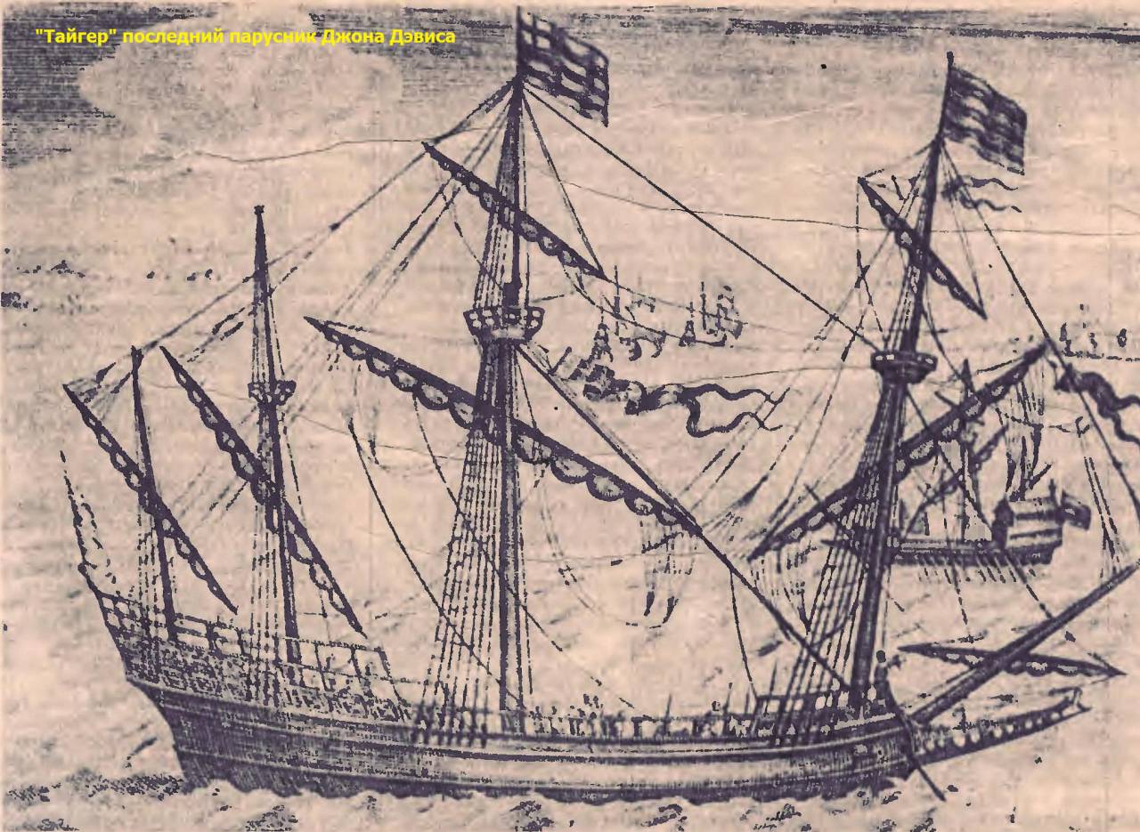
But thoughts of the Northwest Passage did not leave him all his life. Returning to England in 1603, he agreed to go on a new expedition under the command of Edward Mihelborn, and in the position of chief navigator sailed from England on the ship "Tiger". In December 1604, he successfully conducted expedition vessels to the Malacca Peninsula. At the end of December 1605, the Tiger, following along the shores of Bintan Island (east of Singapore), discovered a junk dying on the reef with people. The English sailors took them off and took them on board. For two days the crew of the "Tiger" and the rescued Japanese sailors spent time in rest and amusements. 29 or 30 December, the Japanese, who turned out to be pirates, who after a predatory raid on the northern coast of Kalimantan Island (Borneo) were caught in a storm and crashed, attacked the crew of the Tiger. Thanks to surprise, they captured a part of the ship, but the ship's gunner was able to quickly deploy small cannons on the poop and to turn the pirates into a stampede with accurate fire. Most of the Tiger team died in a fight, and John Davies was among the first to be killed. Events on the "Tiger", the death of the chief navigator forced the expedition leader Michelborn to stop swimming and return to England.
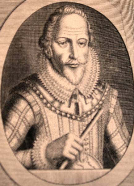
The story has not preserved neither the lifetime portrait of Davis, nor the exact place of his burial. The best epitaph to this outstanding sailor and researcher is the statement of the American historian of the last century, D. Winsor: "Navigation owes its development to Davis more than to any of the English ..."
Sources:
Magidovich I., Magidovich V. Three Davis Expeditions // Essays on the History of Geographical Discoveries. Volume II. M .: Enlightenment, 1983. C. 163-188.
Miroshnikova V. Miroshnikov V., Sklyarenko V. Famous travelers. Kharkiv: Folio, 2014. C.61-64.
Krasnitsky O. Navigator and explorer // Marine Fleet. 1983. No.1. C.16-17.
Gorkin A. Geography. Modern illustrated encyclopedia. M .: Rosmen-Press, 2006. C. 124-12.
Faynes Ranulf. Around the world on the meridian. M .: Progress, 1992. C.284.
Information