How Google destroys spy satellites KH-12

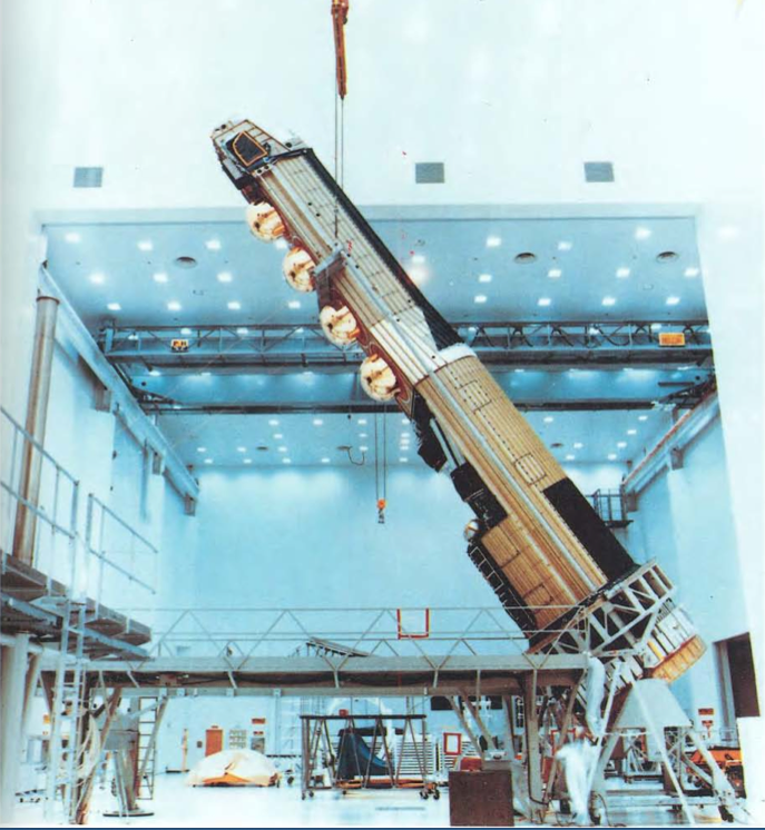
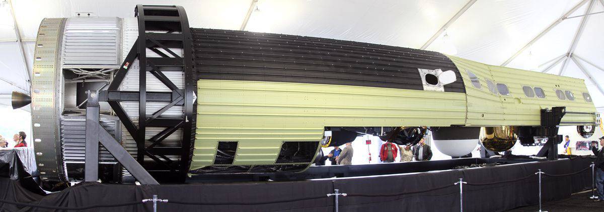
The main elements of the reconnaissance satellite HEXAGON KH-9, including the aerial camera for cartographic surveying. (Photo by the National Directorate of Military Space Intelligence of the USA)
The National Earth Intelligence Agency, the NGA (National Geospatial Intelligence Agency, NGA) recently confessed to what everyone has long suspected, namely that it receives most of its satellite photos from commercial satellites. For the military, this was not a secret before. This is due to the fact that when the first commercial photo satellites appeared at the end of 1990, the US military became one of the first buyers and users of their declassified images. Photo commercial-class satellites gradually caught up with their military colleagues (who appeared in orbit in 1960's) and even received orders from the military itself. The greatest impetus to this process was the appearance in 2005 of the program year Google Earth. This easy-to-use web application revolutionized military intelligence. At first, the military did not like to admit this fact. Nevertheless, Google Earth presented a huge number of satellite photographs for viewing to everyone, and in a very convenient form to use, while making more information available to military professionals (as well as to terrorists, criminals and scientists). Military users instantly appreciate how great this new tool is.
For the US Department of Defense, the main problem with Google Earth was not the ease of use offered by the application, but the manner in which this application demonstrated the shortcomings of the NGA responsible for producing satellite photos, editing them, and supplying them to troops. The trouble was that the material coming to the troops was either not what was required, or it did not come when it was required. With the advent of Google Earth, it became clear how to provide satellite images of everyone and how it can be done with minimal difficulties.
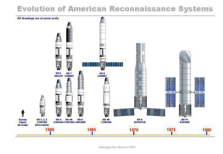
The diagram shows the size of reconnaissance satellites and decades of their deployment. The far right is KH-11, it is slightly larger than KH-9, which was discontinued after a failed launch in 1986. The KH-11 spacecraft costs more than $ 2 billion, and two additional satellites ordered from Lockheed Martin after the failed Boeing program on Future Imaging Arcitecture cost more than $ 4 billion each. The advanced KH-11 is gradually being replaced by top-secret upgraded spacecraft. (Scheme of Giuseppe De Chiara, The Space Review)
NGA and other US government organizations prefer to keep all satellite images (and aerial photographs) in secret archives in case they suddenly contain some secret information that could interest the enemy. Google Earth has changed the rules of the game. Making the military change their decisions is always very difficult. Limited access to satellite photos is a known issue. Beginning in the 1980s (when large numbers of satellite images became available, often very quickly), generals and officers with access to “satellite images” often complained about the difficulties they faced when getting this material on hand or handing it officers and soldiers most in need of these pictures.
Despite the fact that tens of billions of dollars were spent on reconnaissance satellites since 1960's, US troops, as a rule, received "leftovers", and usually the information came in too late to be useful. Until now, "people from outer space" regularly demand from the US Congress more money to build more satellites and special systems for transmitting satellite images "to the troops". The promises were never fulfilled at all, or were never fulfilled on time. After the 1991 war in Kuwait, the generals gave angry testimony to Congress about the current situation in this area. "People from space" admitted their guilt and promised to improve if they receive enough funding. The money was transferred to them, but the troops did not receive anything.
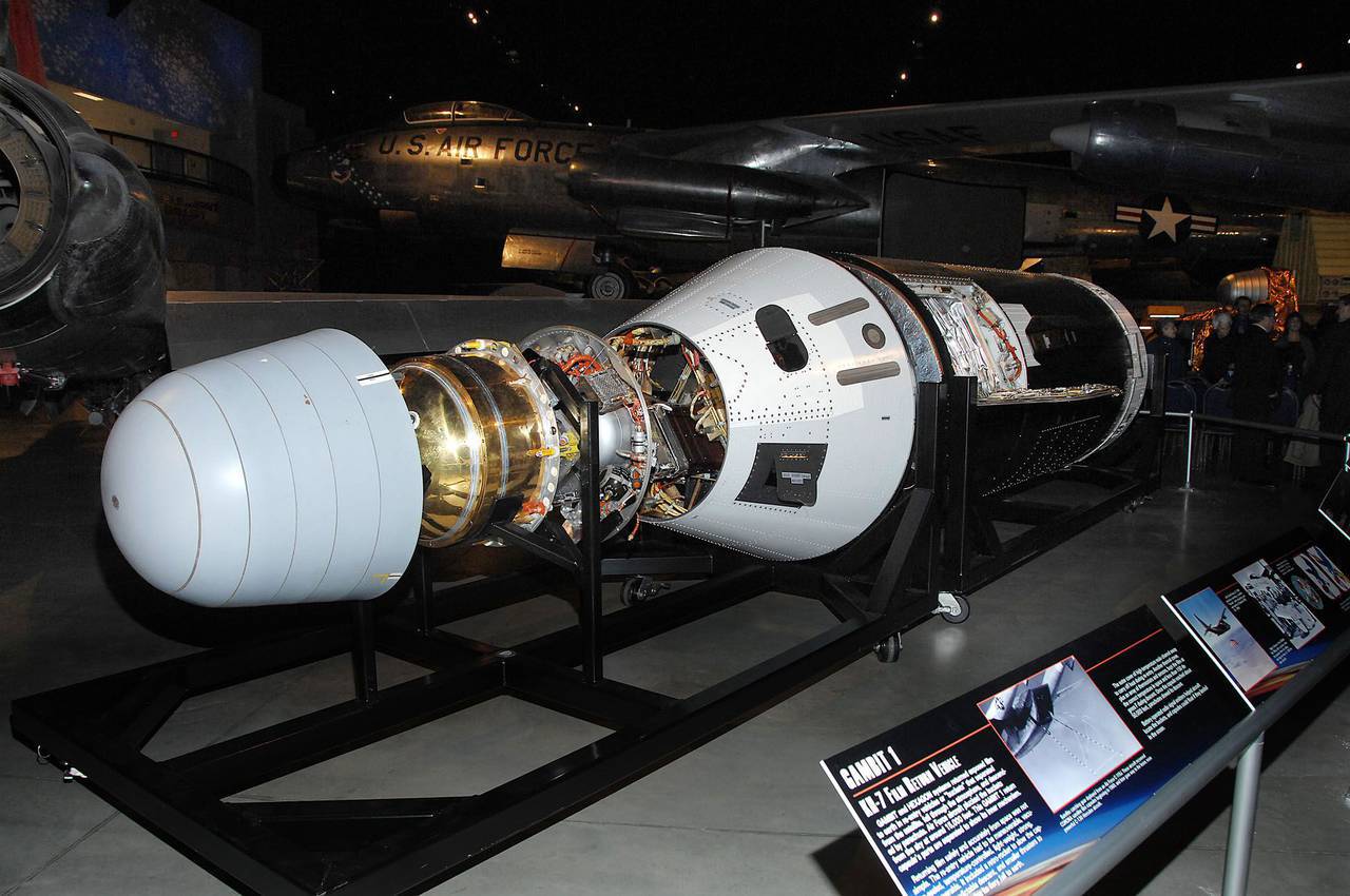
Dayton, Ohio. 1 KH-7 Gambit Intelligence Satellite in the Cold War Gallery at the National Museum of the United States Air Force. (Photo by USAF)
When American troops gained access to Google Earth in 2005, they were able to see for themselves what they had lost before. Even worse, the software used in Google Earth was first developed for the NGA, but before using this useful tool, it was necessary to take care of security considerations and bureaucratic details. This was the main reason why using an interface like Google was impossible on such a large scale. While the troops were fighting, the NGA constantly insisted on how to work with secret documents.
Shortly after 2005, the US military presented the NGA Google Earth application, and Congress had to take note of this. Nevertheless, NGA officials turned out to be more accustomed to decision-making circles than the angry military, and this explains the still slow progress in this matter. At least, at the disposal of the US military was Google Earth, but, unfortunately, it was the enemy. However, over the next decade, the army was able to reorient itself to commercial satellite imaging providers, who, in turn, supplied more and more high-quality satellite imagery every year. Many of these new satellite images had higher resolution and were not available on Google Earth. Nevertheless, the American army could not afford to buy these images (as other commercial consumers can do) and provide the troops with instant access to them for the reason that commercial satellite photographs are not classified.

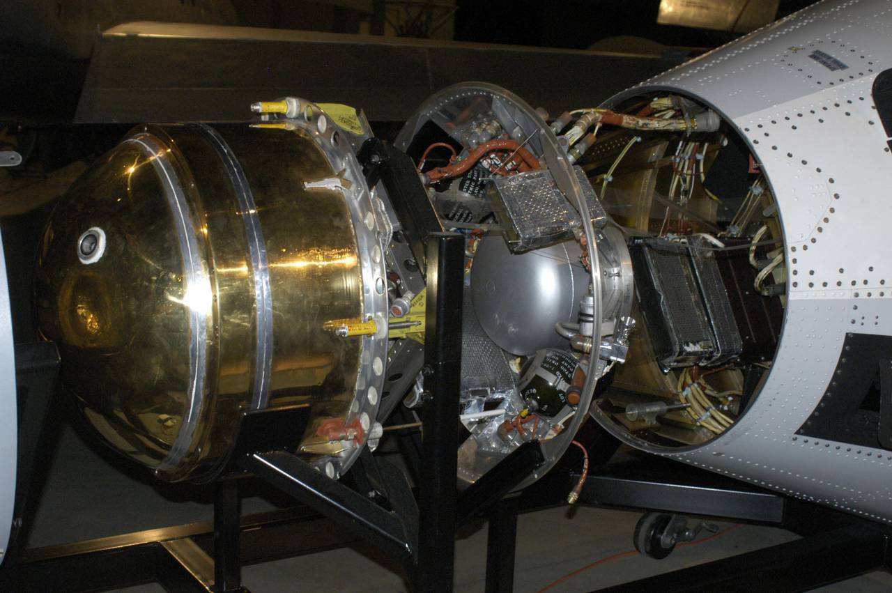
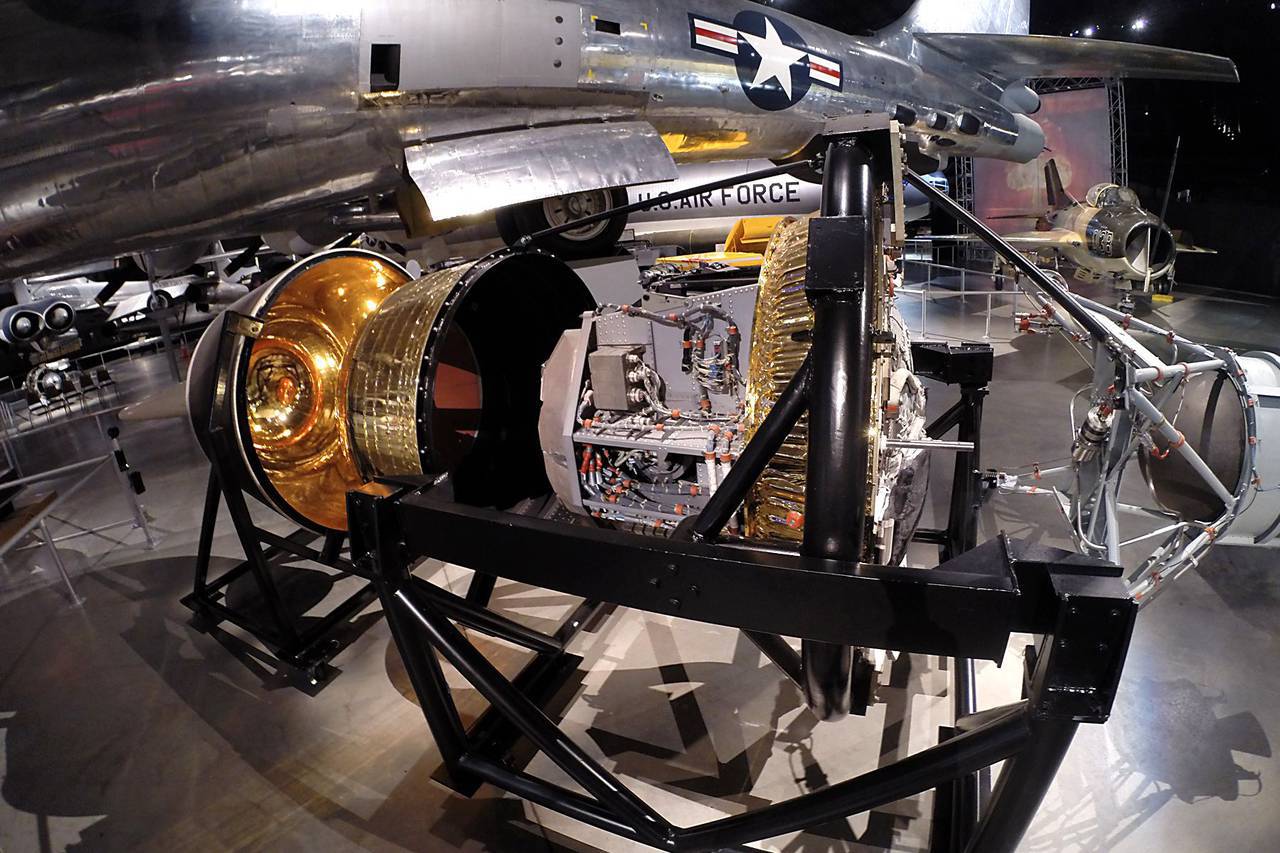
Dayton, Ohio. 3 KH-8 Gambit Intelligence Satellite in the Cold War Gallery at the National Museum of the United States Air Force. (Photo by USAF)
After some time, the NGA ceased to "sulk" and began working with a large number of unclassified satellite photos. It also encouraged NGA to make high-quality (high resolution and other improvements) satellite photographs more accessible to troops, or at least to military intelligence officers and specialists in detailed planning of military operations. It also forced other intelligence agencies to make their data (especially satellite electronic data) quickly accessible (often in real time) to the troops in need.
While Google Earth opened the gateways and provided the troops with instant access to satellite imagery, in the beginning, high-resolution satellite photographs very needed by the troops appeared. It all started in the 1960s with the advent of the first series of KH spy satellites (Key Hole, Keyhole). The first KH-1 satellite with a film camera appeared in 1959, but the first successful satellite appeared only in 1960. Thus, until the 1970s, satellites using photographic film were in service with the warring parties. KH satellites from the 1st to the 9th series sent the captured film for further processing (for high-resolution photographs) back to Earth in special capsules. The KH-9 reconnaissance satellite, which entered orbit in 1971, was not only the last of the satellites using photographic film, but the largest and most capable satellite. Its main design was used in subsequent satellites with digital cameras. KH-9 could cover large areas with a high (for that time) resolution of 0,6 meters. This was more than enough for recognition and counting. tanks, planes and even small ships. The nineteenth and outermost satellite KH-9 was launched into orbit in 1984. KH-9 was a 13-ton satellite with several cameras and 4 or 5 modules for returning captured film for its further processing and analysis. Satellites KN-9 received the name "Big Birds".

Dayton, Ohio. Currently on display at the National Air Force Museum, the Gambit 3 KH-8 is one of the three previously classified reconnaissance satellites. Three satellites were one of the most important intelligence systems in the United States from 1960 to 1980 and played an important role in winning the Cold War and maintaining US national security. (Photo by USAF)
The era of film satellites began to fade with the launch of the first KH-1976 satellite with a digital camera on board in 11. These satellites were large, weighing almost 15 tons, and digital cameras were able to get higher resolution images and broadcast them back to Earth. The resolution allowed identifying objects of 200 mm size from a height of 70 km. Digital cameras were more flexible than film cameras and eventually surpassed film cameras in all respects. The telescopic cameras of the KH-11 satellites operated on the similarity of high-resolution cameras. The image was formed continuously and transmitted to earth stations. To complete the process and produce photographs identical to those obtained using a conventional film camera, computers were used. This made it possible to observe a live picture, as well as the thermal radiation of various objects, and to evaluate the nature of these objects. KH-11 satellites often allow you to determine the type of metal from which an object is made.
All this is not cheap. These satellites cost more than $ 400 million each, and their service life is three or four years, depending on fuel consumption. In addition, it is necessary to use at least two satellites simultaneously to provide the required coverage and eliminate the need to change the satellite orbit too often. The last, fifteenth, KH-11, was put into orbit in 2011. Since the launch of the first of the five KN-11 "1 Block" in 1976, at least four KH-11 models have been created. Since the 1960-s, more than one hundred KH satellites have been launched.
The launch of the next-generation satellite, KH-12, was to be carried out in 1987. However, due to problems with the space shuttle (one of which exploded during launch), only the late KH-1987 was launched in October of 11. The launch of the KH-12 was postponed, despite some of the advantages it had over the KH-11. Along with the improvement of ground-based data processing equipment, the KH-12 was capable of real-time data transfer. This allowed live to follow the events on the big screen with high resolution. It also allowed the military headquarters and other users to obtain satellite information directly, bypassing the processing centers of the CIA or the NRA (National Intelligence Agency). Data from the most sensitive sensors still had to be studied by experts elsewhere. The KH-12 satellites should have generated even more enthusiasts among users of satellite intelligence. In fact, this was due to the deeply modernized KN-11. In fact, these satellites are called KH-12, but so far they are officially known as KH-11.
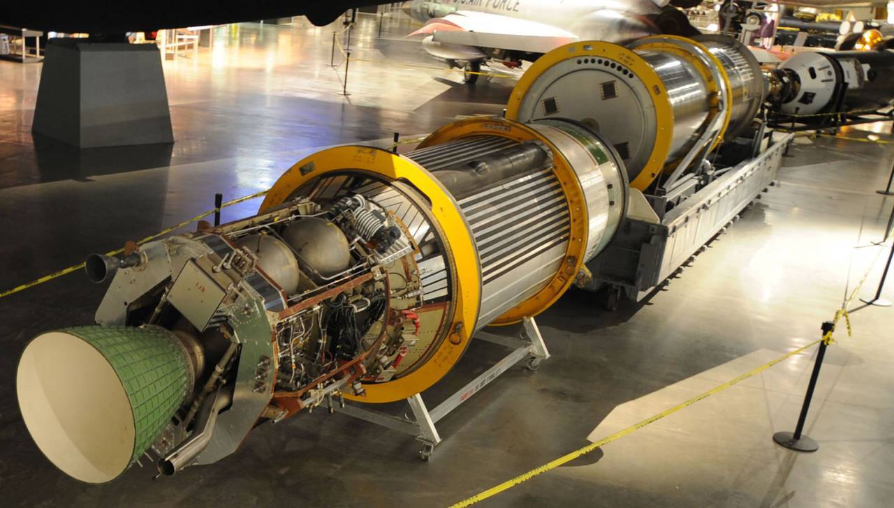
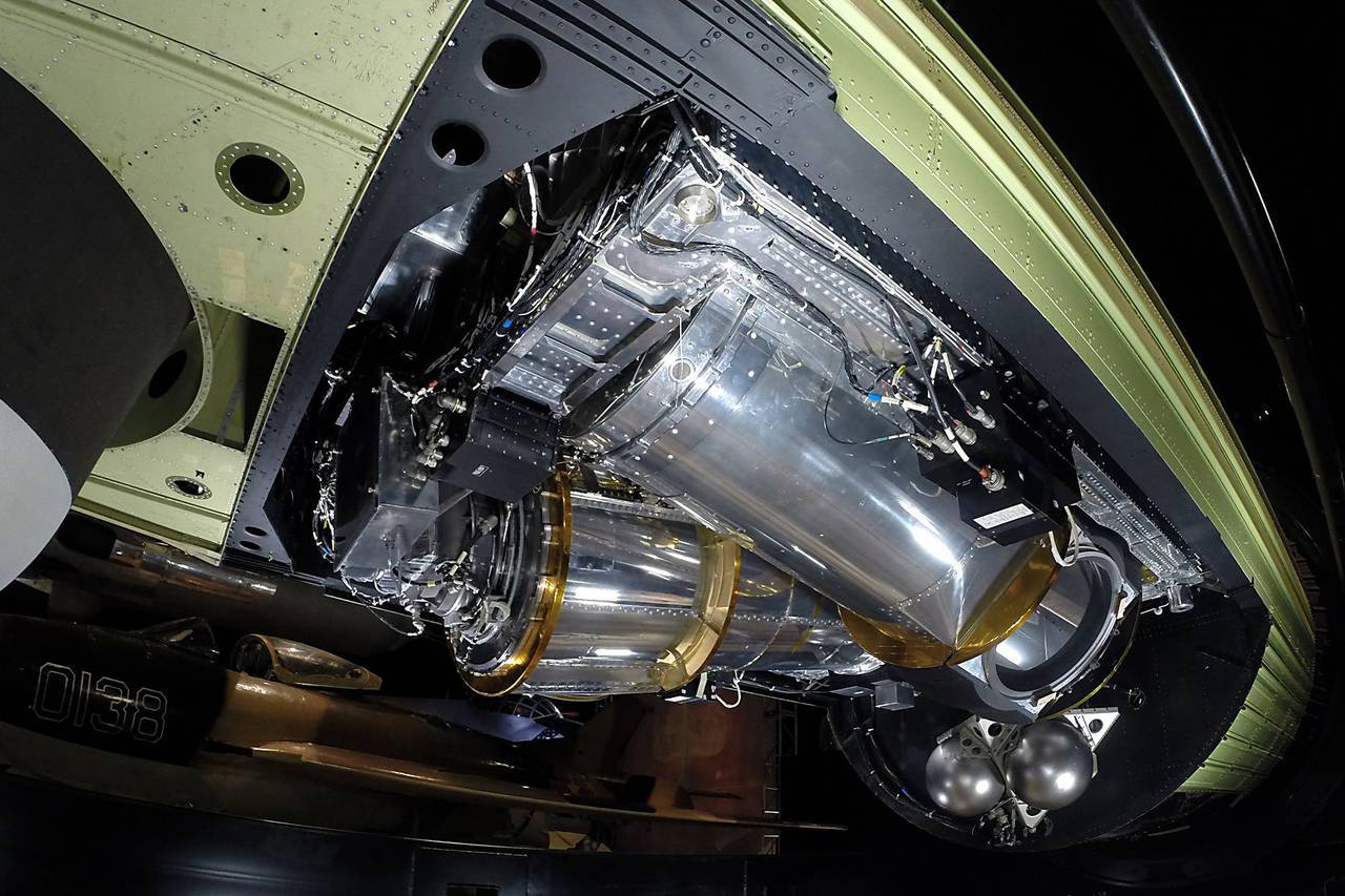
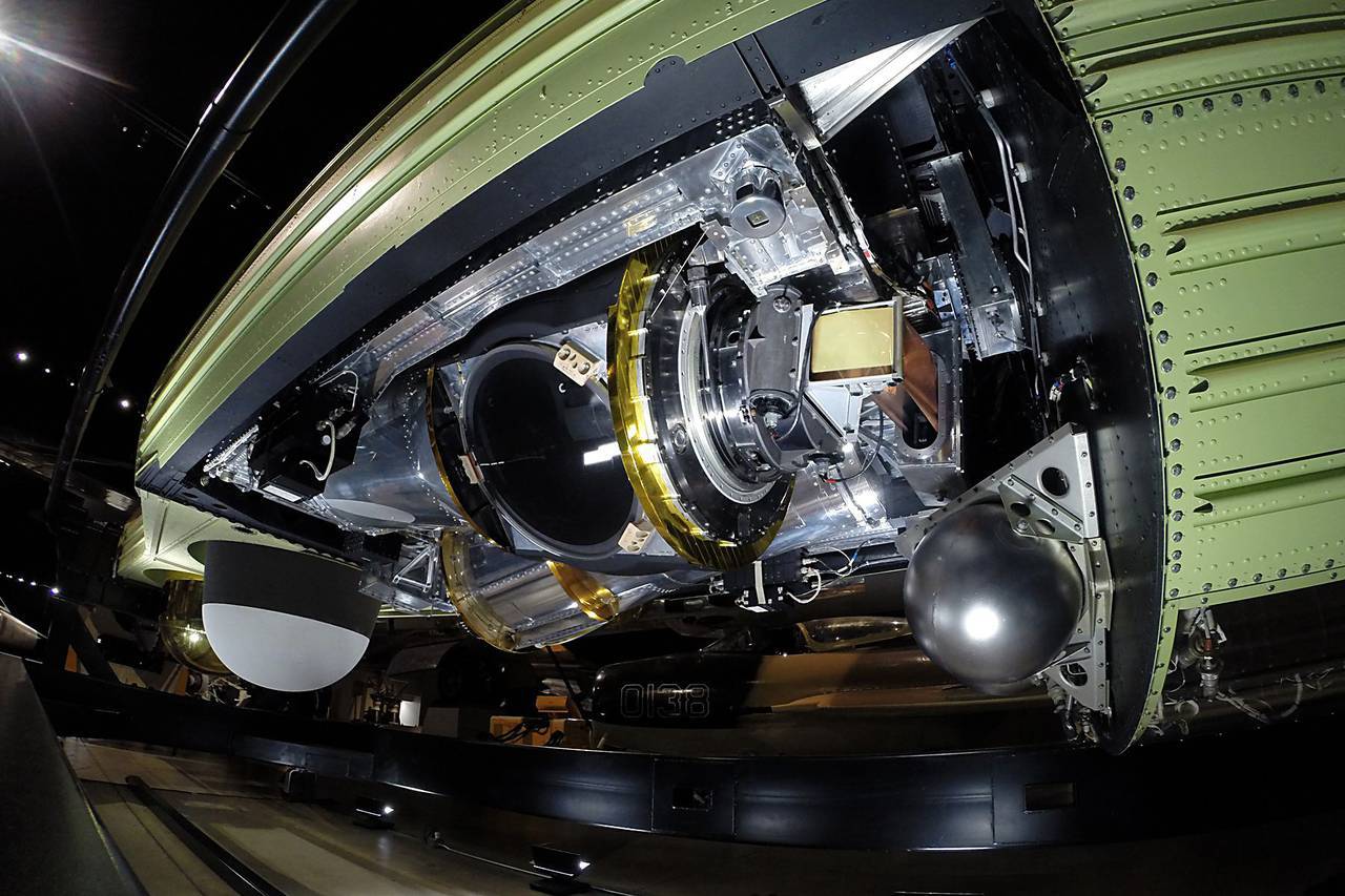
The Lockheed Martin KH-9 reconnaissance satellites with the film being returned to Earth were in service with the new KH-11 for 10 years. Two large PTZ cameras are located in the stern of the vehicle next to the four lowered capsules with the film taken. A low-resolution camera is installed on the nose of the spacecraft where the fifth descent capsule with the film is located. (Photo by the National Directorate of Military Space Intelligence of the USA)
The number of photographic and electronic data has grown significantly faster than the ability of analysts to do something useful with them. In addition to the KH satellites, radar and electronic intelligence satellites also existed. There are also missile defense program satellites that use heat sensors to detect rocket launches.
Until now, there are no real KH-12 satellites (new design), and partly because commercial satellite images have become cheaper and more convenient for use for military purposes. Many of the features of the KH-12 were simply implemented on subsequent KH-11 models. This turned out to be cheaper than building a new KH-12 design, and required less paperwork. Thus, "people from space" are asking for less money to develop new spy satellites and spend more on creating a reserve of GPS satellites and communication satellites that can be quickly launched to replace losses in wartime. The US Department of Defense is already purchasing more commercial-grade satellites.
In 2007, the US Department of Defense agreed to spend 10 billion dollars to build two military spy satellites, similar to those already in orbit, and two more commercial-class satellites. The US DOD was forced to go for this uncharacteristically cautious behavior under the pressure of Congress. Politicians were outraged by the inability of the US Department of Defense to design and build a new generation of military spy satellites. For example, in 2005, the United States canceled the Future Imaging Architecture (FIA) program. This disaster cost the US government more than $ 10 billion when a poorly thought-out and unsuccessfully launched program to create a more powerful new generation of reconnaissance satellites failed. The two existing military spy satellites were simply replaced by similar constructions instead of the ambitious FIA program. In addition, the Pentagon purchased two commercial-class photo satellites for about $ 850 million each to replace what the US Department of Defense is currently spending on acquiring photographs of private companies. Both types of satellites are owned by the US Department of Defense.

Intelligence satellite HEXAGON KH-9 of the cold war era in the national museum of the USAF. (Photo by USAF)
The future information display system (Future Imagery Architecture, FIA) was to be a new generation of smaller and numerous spy satellites that could provide better target coverage and, thanks to a larger number of devices, reduce the possibility of an enemy destroying a group of US spy satellites. The KH satellites were to be decommissioned in the 2005 year, giving way to FIA satellites. Launched in 1998, the project was poorly designed and poorly managed. Looking back, we can safely say that the project was doomed from the very beginning due to the lack of necessary technical skills from the government and the choice of the subcontractor who offered the lowest price for the project (Boeing), but who did not have the relevant experience and ability to lead such a project. . After the cancellation of the FIA in 2005, work was continued on individual new satellites. Thus, at the end of the 2013 of the year, there were two FIA Topaz radar satellites in orbit. KH satellites will last until the end of this decade in the form of KH-12. This is not a satellite of a new design, but a significantly improved and updated KH-11. The KH-12 satellites have always existed as an alias for the extreme version of the KH-11.
It has long been assumed that the US government simply relies on low-resolution images of commercial satellites (able to detect vehicles and buildings) to meet its satellite needs. However, military and intelligence agencies often need more “satellite time” than commercial companies can provide. In addition, the US government is committed to preserving sensitive information by possessing complete control over a pair of commercial-class satellites.
Two new commercial-class satellite owned by the state took on the task of tracking troop movements, finding bases and military operations in general. Two new military-grade high-resolution satellites are spy satellites of an improved version of existing models. They are used to obtain more detailed (able to detect an object smaller than an inch in size) photographs of what a commercial-class satellite has found (with a resolution of 30-45 cm).
US troops and military strategists are also big users of Google Earth, annoying people working on the program of military satellites. However, for many military needs, satellite photos of Google Earth are enough. Two commercial-class military reconnaissance satellites prevent the risk of information leaks (about the image that the military is interested in) and provide much more opportunities to work with low-resolution photographs.
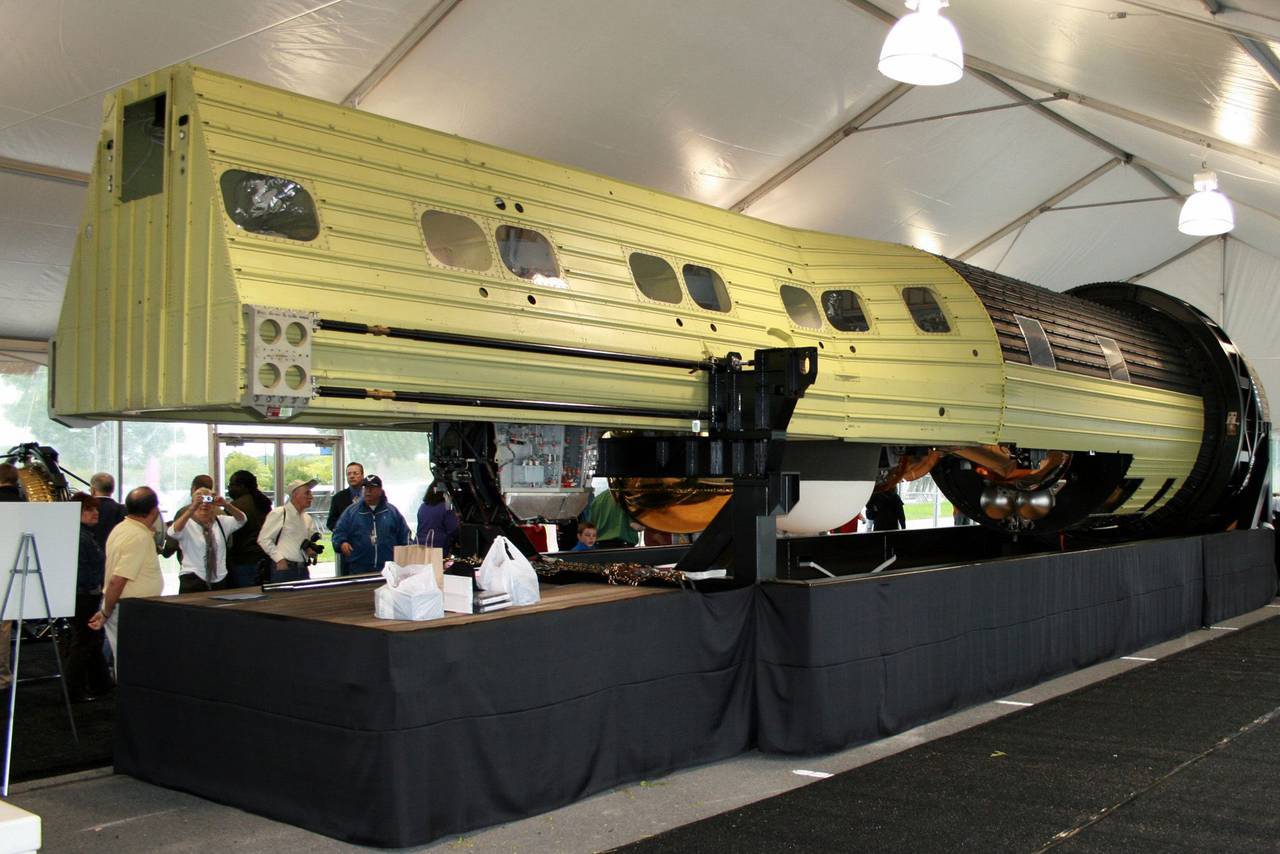
The KH-9 Hexagon heavy reconnaissance satellite is presented at the exhibition of the National Aerospace Museum of the Stephen Udvar-Hazy Center after it was declassified on September 17 of 2011. Larger than the school bus (18 meters in length) and with a starting weight of 13 tons, XHUMX KH-20 Hexagon satellites were launched by the National Intelligence Agency in the period between 9 and 1971. (Photo by Roger Gulmette (Roger Guillemette) SPACE.com)
The leaders of the military satellite system are increasingly concerned about the needs of wartime, and this explains the request for spare GPS satellites and communication satellites. Compared to reconnaissance satellites, they are relatively cheap and most in demand in the event of the transfer of hostilities to near-earth orbit and the destruction of some American satellites. There is also growing concern about space debris in orbit, which are small fragments of old satellites and spent rockets and an increased risk of damage to or destruction of satellites by this debris.
Meanwhile, KH-12 is a thing of the past, since the last upgraded KH-11 was put into orbit in 2013.
Information