Day of the military topographer
 February 8 in Russia celebrates the Day of the military topographer. Officially, this professional holiday has been celebrated since 2004. In February 2003 of the year by order No. 395 of the Minister of Defense was set the date of the holiday - February 8.
It was 8 February (February 27 old style) 1812 of the year in the Russian Empire was approved by the "Regulations for the Military Topographical Depot". The Military Topographical Depot was managed by a director who was appointed by the Emperor himself. At the same time to say that the military topography before World War 1812, did not exist, it is impossible. Topographic maps for military purposes were created earlier. At the dawn of Russian topography, it was difficult to draw a clear line between the military and civilian areas of topographic research directly. Any topographic and cartographic surveys were carried out within the framework of the public service, which automatically equated the creation of maps to a matter of special importance. They were used not only to study the terrain for, for example, construction work, but also to select the best positions for the deployment of troops on the ground.
A special impetus to the development of cartographic services received under Peter the Great. It was during his reign that the Russian army acquired the so-called quartermaster unit, whose officers were obliged to provide military units with "fresh" maps. In addition, during the reign of Peter I, the Navigational School appeared on the territory of Russia. The full name of this school sounded like this: School of Mathematical and Navigational Sciences. At school, among others, trained specialists in the field of topography and geodesy.
In 1743, four dozen topographers and surveyors joined the General Staff of the Russian army. This year is considered the year when the military topographic service began. If we count the activities of military topographers since 1743, then in 2013 service, it is 270 years.
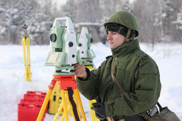
The value of the work of military topographers is difficult to overestimate. After all, often the outcome of not only local battles, but also entire military operations and even wars depended and continues to depend on the timely compilation of a topographic map of the battlefield or on the study of topographic maps obtained from the enemy.
From 1940 to the present day, the military topography is represented by the Military Topographical Directorate of the General Staff. Before the collapse of the Soviet Union, the Military Topographic Service consisted of 106-139 people.
The main tasks currently set by the Military Topographical Directorate are related to the organization of the topographic and geodetic support of the Armed Forces and other security agencies, the conduct of topographic, geodetic and cartographic work, the planning of measures for the topographic and geodetic training and the development of principles for constructing a navigation system for various branches of troops .
We sincerely congratulate military topographers on their professional holiday!
Information