The Russian military explained the reason for the delivery of the Oko-3 ground penetrating radar to the Khmeimim base in Syria

24

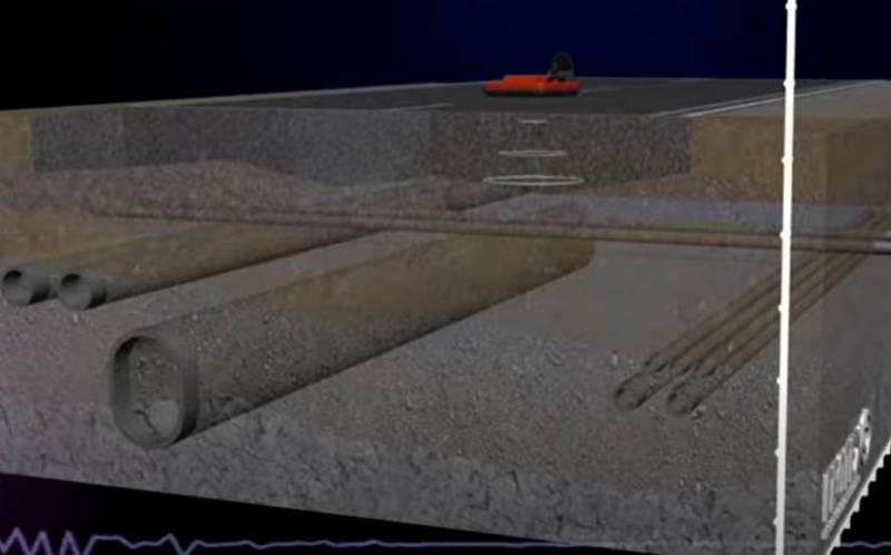
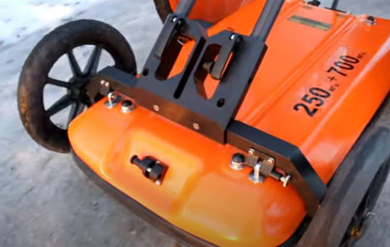
The Russian military explained the reason for the delivery of a georadar to the Khmeimim military base in the Syrian Arab Republic. We are talking about the Oko-3 system, which is designed for soil research.

In particular, the GPR is capable of detecting voids in the ground, which makes it possible to use it to detect possible undermines.


According to the deputy chief of the engineering troops of the Russian contingent in Syria, Lieutenant Colonel Pavel Reutsky, this kind of undermining can be created by militants to carry out sabotage actions. In different parts of Syria, militants of various groups used just such tactics to commit terrorist acts or to transfer weapons closer to one or another object with the aim of its subsequent shelling from a minimum distance. For example, this kind of action was carried out against the posts and bases of the Syrian government army.

The Oko-3 system is capable of detecting voids not only in soil layers, but also in other environments, for example, in concrete. The use of such a georadar is capable of disrupting any plan of the militants to conduct the so-called tunnel war.


Some characteristics of the GPR: it is capable of detecting voids at a depth of 50 m, operates at temperatures up to 55 degrees Celsius, has a screen for displaying GPR profiles, provides for the connection of a navigation unit that allows you to accurately track the coordinates of voids in the ground. Data scanning can be carried out both in planar mode and in 3D. It can work remotely by connecting a radio modem.
24 comments
Information
Dear reader, to leave comments on the publication, you must sign in.
  1. +27
    12 March 2021 05: 58
    A very competent decision, it is strange that it was not there initially.
    1. +28
      12 March 2021 06: 25
      The same question came up on reading, but as the saying goes, better late than never. It has such a good feature for Syria that you can use it from an armored car without leaving it.
    2. +7
      12 March 2021 08: 05
      In principle, it is impossible to foresee everything. Therefore, everything is decided by the possibility of threats. Since it was just now that they brought it in, the threats have intensified. Apparently the intelligence spotted some sort of swarming.
      1. +5
        12 March 2021 08: 07
        So he is in Syria, I suspect, not only at the base would be useful.
        1. +5
          12 March 2021 08: 11
          And where else?) Look for tunnels near each checkpoint?) The point is not in finding it, but in constant monitoring. Although I'm sure there are sensors around the perimeter, like Tabun. Digging will be spotted quickly. Fig knows in short
          1. +1
            12 March 2021 08: 46
            Quote: carstorm 11
            Where else?)

            There below, in the comment, options for its use are described.
            Records with weapons and medicines, for example, to detect.
            1. +4
              12 March 2021 09: 41
              In order to detect something, you need to monitor it constantly. Literally every day. I'm talking about that. One complex is not enough for this. Plus, I repeat that our aircraft have been using seismic sensors for a very long time, even at the level of reconnaissance groups. I am silent about the bases.
              1. +1
                12 March 2021 09: 44
                Quote: carstorm 11
                need to be monitored constantly

                This is definitely
            2. +1
              12 March 2021 10: 19
              Records with weapons and medicines, for example, to detect.

              https://topwar.ru/42857-put-otkryt-sistemy-proverki-i-raschistki-marshrutov.html
              Such a machine is needed in every department dealing with IRD, as well as a nonlinear locator.
              https://lopatov-45.livejournal.com/13744.html
              To provide engineering reconnaissance at a speed of 3 km / h, from mines at a distance of up to 100 meters from the road (anti-aircraft) and fire weapons up to 2 km (SWR or automatic cannon 20-23 mm).
    3. +1
      13 March 2021 07: 00
      Yes, I think I was. Or there was an analogue. And the article looks like an ad. However, the thing is useful if used correctly.
  2. +4
    12 March 2021 05: 59
    We live in fortification
    We eat bread and drink water;
    And how fierce enemies
    They will come to us for pies,
    Let's ask the guests a revel:
    We load the buckshot gun.
    Soldier's song. (AS Pushkin, "The Captain's Daughter")
  3. +2
    12 March 2021 06: 04
    A good thing in general, in principle, in the national economy, and not only in military affairs.
    I put it on a pickup truck and go around exploring the necessary areas ... I wonder if such a ground penetrating radar is capable of detecting IEDs and minefields and minefields, as well as buried metal structures.
    It would be nice for archaeologists to work with such a device.
    1. +4
      12 March 2021 07: 20
      It would be nice for archaeologists to work with such a device.
      This is how they work. True, this is not yet the standard standard equipment for each field team.
    2. -4
      12 March 2021 13: 27
      I wonder if such a GPR is capable of detecting IEDs and minefields and minefields

      Of course it can, but not for long, 100% detection guarantee
  4. +3
    12 March 2021 06: 21
    Description on the manufacturer's website
    https://geodevice.ru/main/gpr/kit/oko2multipurpose/
    It looks like the main purpose is to study the condition of the runways.
  5. +4
    12 March 2021 07: 26
    Quote: Avior
    Description on the manufacturer's website
    https://geodevice.ru/main/gpr/kit/oko2multipurpose/
    It looks like the main purpose is to study the condition of the runways.


    Someone can't read

    Solved problems:

    Refinement of the geological section
    Search and assessment of the state of underground communications: pipelines, cables, tunnels
    Inspection of highways - determination of the thickness of the layers of the pavement, search for the causes of violations and subsidence of the roadway
    Study of railway embankments - inspection and identification of defects in the subgrade
    Runway survey
    Monitoring the condition of bridges - analyzing the condition of reinforced concrete spans, determining the need for their strengthening, etc.
    Inspection of buildings, determination of the position and quality of reinforcement.
    Environmental surveys - search for areas of soil contamination, oil and gas pipelines leaks
    Archaeological research - non-destructive search for ancient and modern natural and anthropogenic structures, objects and burials
    Construction control - layering, volume counting
    Detection of groundwater level, waterlogging and decompaction zones.
    Study of the bottom of water basins, differences in the composition of the ground floor, mapping of bottom sediments and bottom topography
    Determination of ice thickness
    Determination of the thickness of the layer of seasonal freezing or thawing, delineating permafrost areas, taliks, etc.
    Search for unexploded ordnance and sunken equipment
  6. 0
    12 March 2021 08: 13
    Something like this ...
    1. +2
      12 March 2021 09: 31
      Something like this ...
      ... Looks fantastic laughing Can't load the map so that it would monitor the situation using GLANAS in the machine 24/7?
  7. The comment was deleted.
  8. 0
    12 March 2021 21: 47
    And, they, what should they explain to someone? Uncle, are you? Or how?
  9. +1
    13 March 2021 02: 09
    In general, there is such a system in the RF Aerospace Forces, which brings down everything that is at a depth of 300 meters ... Really everything. That's all for now.
    1. -2
      13 March 2021 07: 32
      Quote: migsu
      In general, there is such a system in the RF Aerospace Forces, which brings down everything that is at a depth of 300 meters ... Really everything. That's all for now.

      There is no such system. And even up to 300 meters ..... There is Zheleznogorsk near Krasnoyarsk, there is a lot of things under the mountain, even an electric train runs !!!! Neither from the top nor through the entrance can be taken with bombs ... hi
  10. 0
    13 March 2021 16: 48
    That's right, you need to acquaint the barmaley with the classics.
    About how many wonderful discoveries
    Preparing georadar "Oka" ...
    By the way, archaeologists will be delighted with the possible results of using GPR.
  11. 0
    15 March 2021 21: 31
    Before that, the perimeter of the base underground was not controlled?