Barrier environment
After Berlin and Great China: Russian Planet talks about walls dividing the modern world
As soon as a barrier appears, it is almost impossible to get rid of it. For example, even in the globalized “world without borders”, new walls, fences and barriers dividing nations and societies are constantly appearing.
Israel, Palestine and all-all-all
Perhaps the largest number of separation barriers (the so-called walls created for political purposes) falls on Israel and its neighbors. First in modern stories The border fence appeared here in 1938. The so-called Tegart wall was built by the British colonial administration along the entire northern border of Palestine so that the 1936 – 1939 Arab uprising did not receive support from Syria and Lebanon. A three-meter barbed wire fence proved to be ineffective and lasted only a year, but some of the five “forts” and 20 pillboxes built along its route still stand today.
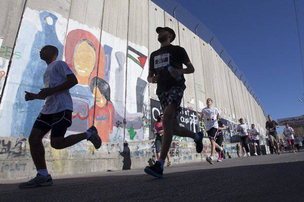
Participants in the second annual Palestinian Marathon run along the Israeli separation barrier, 2014 year. Photo: Majdi Mohammed / AP
Until the Six Day War 1967, the eastern part of Jerusalem was under the control of Jordan. The city was divided into two parts than necessary: somewhere with barbed wire, and somewhere - with full walls. These barriers eventually fell, but in 70, Israel began to build its own at the borders with Lebanon, Jordan and Syria. The Lebanese site was named “Strong Fence” - it stretched 128 kilometers over mountainous terrain and existed until 2000.
Today, barriers remain between Israel, on the one hand, and Egypt and Jordan, on the other. The Palestinian territories are fenced on all sides. Tel Aviv has even erected a fortification of the 11-kilometer-long wall between the Gaza Strip and Egypt, and the West Bank is now separated by an 703-kilometer fence and a height of eight meters.
The Israeli separation barrier, opposed by the UN General Assembly and the International Criminal Court in The Hague, seizes 10% of Palestinian territories: approximately one fifth of its length crosses the demarcation line 1949 of the year.
Walls of the world
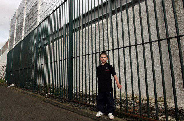
The Berlin Wall did not become the last dividing barrier in Europe. Its closest analogues remain in Belfast and other cities in Northern Ireland. The walls, or lines of the world, as they are called, began to emerge after the 1969 riots of the year. The idea was simple: to divide the areas where mostly Catholics lived (and therefore, following the logic of the authorities, Irish nationalists) and Protestant areas (read - unionists who consider themselves British) to prevent clashes between these groups.
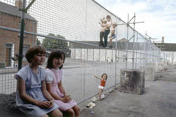
Children at the wall of peace in Belfast, 1984 year. Photo: Peter Kemp / AP
There is nothing more permanent than temporary. The walls were built for six months, but many of them still stand today. The newest “world line” was built quite recently - in 2008. It is believed that these barriers really help to reduce the heat: a survey of residents of divided areas in 2012 showed that more than two-thirds are still not ready to abandon the walls. The government of Northern Ireland nevertheless promises to remove all sectoral boundaries by 2023.
The Belfast Wall is not united. She has sections from 100 meters to five kilometers in length. In some places, the “lines of the world” are made of sheet iron or metal mesh, in others - of brick. Barriers reach the 7,6 meter in height. There are gates in them that are sometimes guarded by the police. At night they close.
Thin "Green Line"
At the opposite edge of Europe, two more walls remain. Both separate the Greeks and the Turks, but they arose at different times and for different reasons.
In the 1964 year, the Green Line, shown on the map by British peacekeepers as a late reaction to the conflict between the Turkish and Greek ethnic groups, divided Cyprus to the north and south. In response to a military coup organized by supporters of unification with Greece in 1974, Turkey invaded the north of the island. The buffer zone, arranged in 60-s, became the southern border of the unrecognized Turkish Republic of Northern Cyprus.
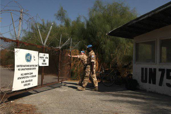
British peacekeepers at the Green Line in Cyprus, 2009 year. Photo: Patrick Baz / AFP / East News
The buffer zone between the two states in some places is only three meters wide, and in others it is more than seven kilometers. Over the past 40 years, nature has conquered this territory from humans - in fact, a reserve has been established there. A barrier system appeared on the Turkish side: barbed wire, concrete walls, minefields, anti-tank ditches and observation towers. Sometimes these barriers are called the “Attila Line” by analogy with the 1974 operation of the year. With 2003, the access control regime is gradually softened.
Greece itself on the mainland fenced off the wall from Turkey, but completely because of another problem. By the 21st century, the border between countries has become one of the key entry points to the European Union for illegal immigrants from Asia, Africa and the Middle East.
Almost the entire 200-kilometer border between the states runs along the Maritsa River. The Greek authorities promised to reinforce it with barriers, but for the time being, on the land, a fence was installed that was 10,5 kilometers long and 4 meters high. He built the entire 2012 year, spending € 3 million.
Besieged fortresses
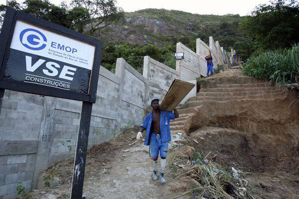
Attempts by Greece to combat illegal emigration are fading against the background of measures taken by Spain. Its Moroccan enclaves of Ceuta and Melilla are regularly stormed by people in sub-Saharan Africa — before 2005, migrants used tactics of massive raids. They gathered in the buffer zone in large groups and tried to “overload” the border guards with waves of hundreds of people so that they physically could not stop everyone.
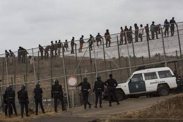
Spanish police guard the border of the Melilla enclave from Morocco, 2014 year. Photo: Santi Palacios / AP
The first barrier around the enclaves appeared in the 1993 year, but migrants easily overcame it. The second version was built in 1995 year, but it did not help. The third wall was to solve the problem of illegal immigration once and for all. It consisted of three parallel three-meter fence with barbed wire and surveillance systems. The project was completed in 2005 year and cost Spain Spain € 33 million. The wall around Melilla stretched for 11 kilometers, around Ceuta - for eight.
The third barrier caused the tragedy. In September 2005, several thousand migrants tried to break through it. They were caught in the crossfire of the Spanish and Moroccan border guards. The first used rubber bullets, the second - fighting. Killed about 20 people. After that, the Spanish authorities have increased the height of the fences to six meters, but residents of poor African countries are not leaving attempts to break into Europe through Ceuta and Melilla.
Echoes of War
The Moroccan authorities opposed the fences around Ceuta and Melilla, but not so long ago they themselves built a separation barrier in the south of the country. In 1981 – 1987, the Moroccan Wall grew during the conflict around Western Sahara on the border with this territory. It is a 2,7 thousand kilometers of mounds, sand, stone and wire barriers in six rows. The height of the obstacles reaches three meters.
View of the "Moroccan wall", 2011 year. Photo: Michele Benericetti / Flickr
Parallel to the Moroccan Wall, the longest single minefield in the world stretches. From time to time various races are organized along it, as well as marches in the name of peace and demilitarization. In 2009, at one of these actions, a teenager blew up a mine and lost a leg.
Great American Dotted
The border between the United States and Mexico stretches for 3145 kilometers. The farther away from the United States, the more wild stories you can hear about what kind of fence guards this border. They talk about three thousand kilometers of continuous ten-meter electrified wall. The real American-Mexican wall is much less impressive. Nevertheless, the problem it creates is very real.
Four US states — California, Arizona, New Mexico, and Texas — go to the border with Mexico — the latter accounts for about half of the entire length of the border. In 2005, the US Congress allowed the construction of the entire 1123 kilometers of the separation barrier. In 2010, the Barack Obama administration froze the project. By this time, the border guards reported on initial readiness of more than 900 kilometers of the fence. True, most of it remained “virtual”: short sections of the wall at key points alternate with an open border, where cameras and motion sensors act as a barrier.
Completely the project was completed only in California - on the stretch from San Diego to Yuma. There, the finished wall reaches 6,4 meters in height and goes into the ground another 1,8 meters. In Arizona and New Mexico, apparently, it was not always possible to install exactly that barrier option that was planned: in some areas the temporary “virtual fence” became permanent, on others instead of walls made of sheet metal in three rows there was a metal grid. In Texas, construction did not have time to finish.
Wall on the border of the United States and Mexico, view from Tijuana, 2013 year. Photo: David Maung / EPA / ITAR-TASS
Officially, the Mexican-American “wall” was erected to discourage drug trafficking, but for some reason its success is measured in intercepted illegal immigrants. In the five years of the wall’s construction, this figure has really decreased by 61%. 96,6% of detentions by the end of the period was recorded precisely in the south-west, where the fence was completed. But there is a downside.
Against the background of the wars in Afghanistan and Iraq, the Minister of Homeland Security of the United States received the right, at its discretion, to lift legislative restrictions on the construction of roads and barriers. As a result, the border wall was built around all environmental standards: on air pollution, water and coastal zones, protection of endangered species, protection of migratory birds, and so on. Among other things, without any approval, the construction site unfolded in the middle of the reserve at the mouth of the Tijuana River. Naturally, many species lost their habitat and access to water, and seasonal migration patterns were disrupted.
Opponents of the construction of the wall point to another problem: for those who are still trying to cross the border illegally, it exposes unnecessary danger. According to the statistics of detention it is difficult to judge whether the real flow of migrants has decreased. But it is already known that many more Mexicans began to risk (and die) trying to get to the United States through the Sonoran Desert - not many people manage to cross 80 kilometers across rough terrain under the hot sun.
African pen
In 1975, South Africa installed an 120-kilometer electrified fence on the border with Zimbabwe and Mozambique in the Kruger National Park. The voltage in 3,3 thousands of volts should have scared off the participants of the civil war in Mozambique. In just three years (1986 – 1989), more people died because of this barrier than during the entire 28 years of the Berlin Wall - mostly women and children who sought refuge in South Africa.
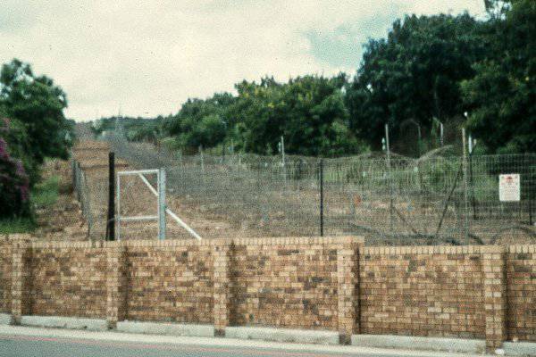
The fence on the border of Zimbabwe and Mozambique, 2001 year. Photo: Wikipedia
In 2002, South Africa, Mozambique and Zimbabwe agreed to demolish the fence and merge the adjacent national parks into one large cross-border. In fact, only a small section was dismantled and the wall between the countries still remains.
In 2003, a two-meter high voltage fence appeared between Botswana and Zimbabwe. Officially, the first country defends itself from diseased livestock wandering on pastures from Zimbabwe, but in practice the barrier also hinders illegal immigration from one of the poorest countries in Africa to one of the richest. Electricity, however, was never supplied to this fence.
Out of sight
Brazil has found particular use for the walls. While some are hiding behind high fences from illegal immigration, while others are fenced off from all sorts of conflicts, in the official capital of the World Cup 2014, they preoccupied themselves with ecology, according to the official version. Authorities enclose favels - urban slums, constantly expanding at the expense of samostroya.
Construction of the “eco-barrier” on the border of the Santa Maria favela in Rio de Janeiro, 2009 year. Photo: Vanderlei Almeida / AFP / East News
Three-meter brick and concrete walls are called "eco-barriers." They are supposed to prevent illegal deforestation and parks in the way of the favel. However, among the 13 selected in 2009 to screen off poor areas, 12 borders with rich neighborhoods and only one is located in the part of the city where the slums are expanding rapidly. For this reason, human rights activists and residents of favel believe that the unsightly parts of Rio de Janeiro are trying to simply isolate into a kind of ghetto, hiding them from sight on the eve of the championship.
Something similar happened already 20 years ago in the Dominican Republic. In the capital Santo Domingo, to the opening of the 33-meter lighthouse, installed in the middle of the city in honor of Christopher Columbus in 1992, the wall was fenced off a nearby poor district so that it would not spoil the view.
The specter of capitalism
The demilitarized zone between North and South Korea goes along the 38 parallel. The strip of land four kilometers wide and 250 kilometers long is probably the most militarized section of the globe. Sentinels, tunnels and fortifications protect this border, which has become a dead zone on both sides for 60 years.
View of the "Korean Wall" through binoculars, 2007 year. Photo: Kilroy-was-here / Wikipedia
The buffer zone between the Koreas is often called the separation barrier. But in this region there is a real wall, according to the DPRK authorities. In the 2002 documentary of the year, North Korean escorts demonstrate to Dutch journalist Peter Tetter what, in their opinion, is a concrete wall crossing the entire country.
According to North Korea, South Korea has built an artificial slope of five to eight meters along almost the entire demilitarized zone. In the event of a new open conflict for North Korea, it will become an unbreakable wall.
It is impossible to confirm or deny the existence of the "Korean Wall" in the available images.
Information