Weather forecast for the fight. Space, meteorology and war in the XXI century
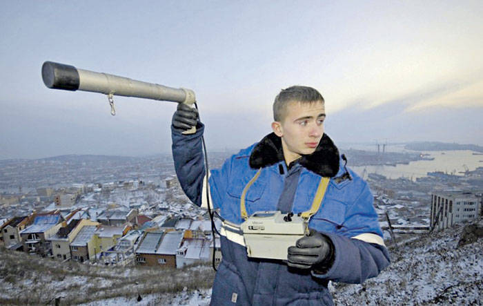
Conduction of radiation background in the area of the location of the object of defense importance. Reuters Photos
According to the views of American experts, the fighting in the XXI century will be conducted in four-dimensional space. Success requires immediate access to critical information. Integration of space information systems with systems weapons, the use of civilian spacecraft (KA) for solving military tasks and vice versa (dual-purpose spacecraft), the orientation towards the creation of spacecraft based on small spacecraft, highly maneuverable (mobile) means of launching spacecraft are increasingly used in organizing and conducting warfare.
Obtaining operational information about weather conditions that affect the fulfillment of the task, especially in a network-centric war, is the key to success. This information must be accurate, publicly available at any time, easy to use with the use of appropriate software.
In this regard, the development and operational use of integrated weather data bases is becoming increasingly important. Access to this information will be provided through interactive ports connected to the information flow through permanent connections (fiber optic cables, coaxial cables, telephone connections), microwave and direct data transmission via satellites or by radio.
Interactive ports will include such devices as universal computers, personal computers, as well as wrist or machine-mounted (in the cockpit, tank, ship, land) microprocessor receivers capable of receiving information directly from the satellite.
ELEMENTS OF STRUCTURE
Integrated meteorological databases should include meteorological observations, forecasts, climatological information, meteorological comments and warning messages. The following are examples of possible databases that may be available to the consumer in the information flow: 1) weather data from existing single stations and distributed databases from ground and air weather stations; 2) images of global cloudiness, cloud clusters, including information on the highest and lowest points of cloud cover; 3) information on lightning discharges and Doppler radar in specific areas; 4) global frequency propagation predictions of different frequencies; 5) environmental conditions in a particular area on the surface of the land or sea; 6) individual weather forecasts and weather warnings for the most important points of interest worldwide; 7) point or distributed climatological information worldwide; 8) global distributed bases of forecasts of various meteorological parameters for specific periods of time in both surface and air layers; 9) Predictions of hazards such as icing, turbulence, volcanic ash, and wind directions with precipitation; 10) distributed bases of observations and forecasts of wind zones in different layers of the atmosphere. Databases can also include pre-prepared materials - weather maps, graphical representations of data, simple comments by meteorologists, or specially processed data for use in special meteorological programs.
There are several possibilities to use this data. In combat conditions, the wrist or the receivers installed on the machines can receive weather data directly from the information flow, enter them into microprocessors with predetermined “assistant programs”, and within seconds give information about the effect of weather conditions on the task being performed. Information received from the microprocessor may relate to specific weather conditions, including direct transmission of cloud images and information about the upper atmosphere or a ready-made forecast.
Instruments may also be able to directly receive and send information via satellite. This will enable the soldier to receive meteorological information by directly requesting the required data. It will also be able to include current weather observations, for example, back into the general flow of information through direct data transmission.
The development of these capabilities requires modification and change of the operational paradigm in the four main areas of the US national (military) and civilian meteorological information structure: 1) data collection; 2) database generalization and dissemination of data; 3) analysis and forecasting; 4) distribution of final weather data. A significant increase in the cost of developing new features and changing the current operating meteorological paradigm is expected to require a consolidated effort of military, commercial and civilian meteorological centers.
Crucially important is the ability of the United States to continuously receive, process and distribute a huge amount of global meteorological observations received from ground and satellite stations both in wartime and in peacetime. The temporal and spatial levels of the collection of meteorological data are not able to respond to requests for meteorological information by military and civilian structures after 2020. Therefore, every effort should be made to improve capabilities in the field of meteorology, especially with the help of space satellites.
POSSIBILITIES OF METEOROLOGY
Analyzes of weather data and weather forecasts should be carried out at various points in the information flow. Most likely these should be centralized national weather forecasting centers. These centers receive from the information flow distributed databases of meteorological observations, which are issued by information processing centers. Then, based on the analysis of these data, weather and climatological forecasts are made, as well as distributed databases for military and civilian structures. By 2020, national analysis and forecast meteorological centers are likely to be dual-use centers for military and civilian interests in the US Continental Command.
The development of information flow is one of the most important factors in the distribution of weather data. In general, the information flow is presented as a “huge client-server network and connections of equal high-speed linear communication (LAN) nodes capable of transmitting gigabits and terabits of data per second through their trunk lines.” The main ones in the process of transferring from the integrated weather data bases to the general information flow will be “destination servers, organized computer networks, client PCs and software systems” in information processing centers and analysis and forecast centers. When receiving weather data, the connectivity of system nodes in the form of interactive ports and software is critical for the consumer.
The main task to be solved is the improvement of remote observation of the atmosphere and the Earth’s surface, especially the technology of enlarged images of specific zones for more thorough research and measurements (associated devices for acquiring images from satellites).
According to American experts, by the time 2020 is under the conditions of a cutback in the US federal budget and rapidly developing computer technologies, the military and national meteorological centers are likely to unite - this will be a major change in the existing operating paradigm. If there is a merger of military and federal meteorological services, the personnel, at least in the Continental Command of the United States, will consist of civil servants with a paramilitary status — in peacetime they will perform military tasks as civilians. or unforeseen situations or disasters, as well as during exercises - as military personnel. Such an order already exists in many NATO countries (in particular, in the UK and Germany). This allows you to save on costs for maintaining centers, reduce the number of service personnel, improve technical support, and also provide more accurate forecasts. However, military personnel will continue to be needed on an ongoing basis to support the actions of the forward-based forces.
Currently, the US military is developing and implementing a program of military meteorological satellites (Defense Meteorological Satellite Program - DMSP), which provides for the launch of two satellites in low polar heliosynchronous orbits. The US National Oceanic and Atmospheric Administration develops and implements both the Polar Orbiting Environmental Satellite (POES) low-orbit satellite program (Geostationary Orbiting Environmental Satellite Satellite Program (GOES)) and the satellite launch program. These programs are used to compile weather reports, weather charts, global and local forecasts for a period of one day to two weeks and allow the collection of data on the state of cloud cover, atmospheric parameters and near-earth space. NASA uses polar-orbited multi-spectral satellites in polar orbits (LANDSAT).
The military and the National Oceanic and Atmospheric Administration are launching satellites into polar orbits, many of which provide the same data. The difference in their use is that military satellites perform strategic tasks, and National Management satellites are used to compile models of weather forecasts. Both those, and others are started approximately in the same nodal time. Therefore, the synchronization of satellite observations is uneven, and often there are gaps of several hours in them, which reduces the tactical value of the data obtained and the accuracy of forecasts. Landsat satellites are launched into other orbits and mainly measure the earth's surface in specified areas that are not usually tied to meteorological orbits.
Now weather probes are launched twice a day. Remote measurements of the upper atmosphere by military and civilian satellites can usually be made twice a day over a specific, predetermined area. The integrated capabilities of 4 – 6 satellites, if necessary, can provide, on average, up to 4 measurements of the upper atmosphere. Such more frequent measurements can provide a more accurate picture of the structure of the atmosphere for predictive models. The accuracy of the forecasts will also increase significantly, since the data used in the models will have a statute of limitations from 4 to 6 hours instead of the existing 12 hours.
To significantly increase the efficiency of the meteorological information structure, it is necessary to develop geostationary satellites with higher resolution, enhanced multi-spectral functions, the ability to transmit images and simultaneously associated with 30-minute images from geostationary satellites in polar orbits. The orbits of the polar satellites overlap at midlatitudes and higher, therefore, more frequent measurements of specified areas in these latitudes are provided. In the equatorial zones this does not happen - the data on equatorial clouds become obsolete several hours earlier than the data on clouds in higher latitudes. Updating cloud data in accordance with geostationary data can improve the accuracy of the description of equatorial clouds, which, in turn, can increase the accuracy of forecasts in equatorial zones.
UNDER THE SECURITY GRILL
The United States and other space powers constantly have geostationary weather satellites in Earth orbit. These 30 minutes transmit satellite images of cloud cover, which has proven to be effective for short-term forecasts for both military and civilian use. The disadvantages of the transmitted images are the reduction in their resolution as the satellite moves away from the object, the overall low resolution of the images, distortion due to the Earth’s limb, the difficulty of bringing these data together with data from satellites in polar orbits. In the 21st century, the task is to increase the resolution of photo and video equipment on geostationary satellites, expand the capabilities of multispectral equipment, and develop the technology for introducing the received data into the general area of distributed data transmitted in the information stream.
In addition to the main grouping of geostationary weather satellites, the Litesat weather satellites, which are launched into extended geostationary and elliptical orbits, should become easily accessible to hang over a chosen target in the interests of the military command in the theater of operations.
It is noteworthy that even in peacetime there can be no access to data on the region from foreign geostationary weather satellites. So, India at one time refused access in real time to the data of its Insat geostationary weather satellites. These data could be very helpful in making weather forecasts during the Desert Shield and Desert Storm operations. Then the European Space Research Administration moved one of its weather satellites Meteosat to the east to provide better coverage of the Southwest Asia zone for the benefit of the Gulf operation. This greatly helped in the compilation of meteorological data, however, the obtained images of the South-West Asia zone still had significant distortions due to the angular view (in particular, distortion from the limb of the earth's hemisphere). Three military satellites blocked the theater area, transmitting high-resolution images that were updated every six hours. According to weather reports compiled on the basis of data received from space, planned flight tables were compiled and, if necessary, adjusted aviation. This satisfied the needs of the command on the theater of operations, however, the Geostationary Weather Satellite “Lightats” would greatly help in obtaining immediate forecasts in the area.
In general, military-space means had such a strong influence on the actions of multinational forces in the conflict in the Persian Gulf zone, that they even contributed to the development of new tactical methods of their combat use. According to experts, the Persian Gulf War was the "first war of the space age" or "the first space war of our era."
Even more impressive in terms of the use of space information was the use of space assets in Yugoslavia. The planning of missile and bomb strikes, the control of the results of their conduct, the topographic, geodetic and meteorological support of the operation at all its stages was carried out using data from space means. In order to coordinate the actions of heterogeneous reconnaissance assets, as well as to optimize the information received, a special unit for the use of space assets was created under the NATO Commander in Europe. About two dozen mobile task forces were sent to the combat area to provide tactical aviation and maritime tactical commanders with space information. They are called space support groups (GKP).
US military experts noted the significant contribution of satellite systems to solving reconnaissance, communication, radionavigation and meteorological tasks during the anti-terrorist operation "Enduring Freedom" in Afghanistan. In particular, when planning and conducting operations (especially launching air strikes), much attention was paid to the use of data obtained from the spacecraft of the national environmental monitoring system POES. In particular, the received warnings about changes in solar activity made it possible to promptly draw the attention of specialists to the correct functioning of communications, reconnaissance and navigation satellites, which ultimately had a positive impact on the effectiveness of missile and bomb strikes and command and control of troops. For the meteorological support of the Navy grouping, the equipment installed on the Quicksat NASA satellite was also used to determine the speed and direction of the wind over the ocean surface.
Nevertheless, there is still a need to expand the possibilities and create new technological developments in the field of data transmission from satellites, as well as in the field of receiving, summarizing and processing data. High-speed computers with large amounts of memory are needed for hourly processing of trillions of bytes of received information. During processing, the data should be transformed into synthesized areas of distributed data containing several variables for their further transfer to the information flow.
New forecast models and special templates for both military and civilian use should be created for the rapid introduction of distributed databases and the development of final products. With increasing frequency and coverage of the received data, the accuracy of predictive models should also increase. Extending the existing spectral prediction model is possible by obtaining more data processed on faster computers. A new technique for modeling and forecasting is expected, especially with the use of high-dimensional, non-linear interactive methods developed for the non-linear nature of the atmosphere.
The global network of ground stations for monitoring the lower and upper atmospheric layers of the atmosphere is already operating and is under the control of the UN World Meteorological Organization (WMO), but it requires technical updating and reduction of maintenance personnel. The US Air Force uses a network of automated weather stations, which is a global high-speed network for collecting weather data throughout the world and distributing weather information to military and civilian organizations. It is necessary to update or potential restructuring of this network in the general information system in order to meet the high-speed parameters of receiving and processing data in the 21st century.
In wartime, access to parts of the world's weather data may be prohibited. Observations of the surface and upper atmosphere are extremely important for the conduct of hostilities, so it is necessary to maintain the possibility of obtaining data from areas where there is no access. One of the projects proposes the transfer of microminiature weather sensors by air, rocket, or on foot to these areas for continuous measurement of data on the surface and their transfer to a communication satellite for collection and distribution via direct radio communications to consumers or directly into the information flow. These sensors can also provide a link to the terrain of sensing the upper layers of the atmosphere by satellites in a particular area. The polar-orbiting meteorological satellite or the Litesat geostationary meteorological satellite can receive a signal from a ground-based sensor and then generate a vertical atmospheric profile. The sensing data can be transmitted directly by radio to the combat area or entered into the general network for collecting meteodata circulating in the information flow.
In addition, global access to special surveillance systems such as Doppler radar and lightning detection systems is needed. The information obtained will to a large extent serve as a quick decision-making in an environment of strong storms, accompanied by the danger of lightning discharges. This information could be useful for pilots, operators at fuel depots and ammunition, as well as for civilian settlements.
TECHNOLOGIES OF THE NEAR PERSPECTIVE
There are three data distribution systems in the USA. These systems include the Air Force Automated Meteorological Distribution System, the Naval Oceanographic Naval Data Distribution System, and the Dial Access System at the Global Air Force Meteorological Center. The automated air force system is a new generation of computer systems and communications for the direct connection of the global meteorological center of the air force with the meteorological stations of the air force throughout the world. The Global Air Force Center can transmit distributed databases of current and forecast weather conditions at weather stations at air bases for their own analysis and display on computers.
The Navy and Air Force centers use telephone lines between small consumer computers and military centralized universal computers of the Computing Oceanographic Center fleet and the Air Force Global Meteorological Center. The areas of processed distributed data, graphic patterns of meteorological information, as well as satellite cloud cover images obtained from the global satellite data base (developed by the Global Air Force Weather Center and also working in the interests of the Navy) are sent from central databases at the request of consumers. This can greatly improve the provision of weather data during military operations when access to global weather data is limited or impossible.
The naval oceanographic data distribution system of the Navy has proven to be effective during the Desert Shield and Desert Storm operations. The system of dial-up access to the meteodata of the Air Force has been field tested. Data from the automated Air Force meteodata distribution system, naval oceanographic data distribution systems and naval oceanographic data systems at the Global Air Force Meteorological Center can be used as integrated weather data bases in the general information flow, especially if they can be transmitted via direct broadcast from satellites to the worldwide in the world are miniature microprocessors and receivers.
NASA, the National Oceanic and Atmospheric Administration, the United States Geological Survey, the European Space Research Administration, Japan and other countries are conducting intensive research to create satellites for observing the Earth as an integrated system. This system includes observations of such fundamental processes as the hydrological cycle, biogeochemical cycles and climatic processes. The current weather satellites and the Landsat program are predecessors of the Earth observation system being created. This program will provide an opportunity to conduct observations from satellites over 15 years. This duration will be achieved through increased redundancy of tools and platforms, as well as the replacement and maintenance of satellites in orbit.
Satellites are equipped with sensors for remote study of the atmosphere, the earth’s surface and outer space. The Earth Observation System provides scientists and researchers with access to integrated global data bases for research in the area of systems science of the earth. Although this system is not intended for daily operational acquisition and use of weather data or images from Landsat satellites, its concept is very close to the concept of combining satellites of the Ministry of Defense, the National Oceanic and Atmospheric Administration, and NASA already discussed here.
Access to the information flow can lead to the abandonment of practical observations of meteorologists. However, nothing can ever replace human intuition in making forecasts, as well as state personalized computing services based on the use of personal computers. In the 21st century, access to interactive graphics and other data in the information flow, combined with a personal microprocessor, will provide direct, timely, automated and easy-to-use meteorological data transmission. In combat conditions, obtaining almost instant access to global meteorological information from anywhere in the world will play a decisive role in leading the enemy in making and executing decisions.
As the experience of US operations in Afghanistan has shown, a significant drawback was the lack of radar and optoelectronic reconnaissance systems targeted at the tactical user, which in some cases led to untimely receipt of meteorological data by users. In this regard, the role of space support groups is increasing, for their effective operation, specialized mobile points for receiving and processing satellite information and issuing it in a convenient form for consumers will be needed. There is no doubt that there is a gap between the potential capabilities of space assets and their practical use in the military. And the creation of a PCG is one of the most promising areas for closing this gap.
Another important direction was to bring the space information to the lower level of command and control of troops, right up to the soldier, using “intelligent” high-informative small-sized equipment. In the US, the Soldier Modernization Plan (SMP) program has been running since 1993. As part of the SMP, variants are being developed not only for special individual combat weapon systems, but also for soldiers' equipment. These developments are based on the concept of network-centric warfare.
Weather data from satellites will be critical for each fighter along with intelligence, communications, command and control, and navigation data. An integral element in its equipment will include space-borne communication equipment with high bandwidth, noise immunity and security, space navigation equipment, its interface device with individual means of displaying various information, including integrated global meteorological information associated with computer equipment.
Information