What is behind the transfer of part of the Amur Islands to China
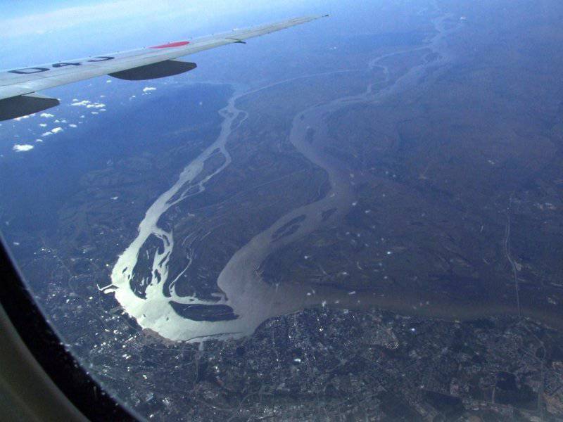
Having been in Khabarovsk, it is impossible not to discuss the issue that worries many Russian citizens, and Khabarovsk especially worries. Chinese territory is visible from the beautiful promenade of this city with the naked eye. Nearby flows the majestic Cupid. There are several islands in the middle of the river. In 2008, Russia transferred the island of Tarabarova and part of the Big Ussuriisky Island to China.
Why did this happen? The liberal public and a part of the most emotional patriots made and submit the incident as a “one-sided” and “unreasonable” concession on the part of our country towards China.
The best way to understand the situation is to look at the facts.
About this article Khabarovsk Artem Yakovlevich Krivosheev, who tried to make out the whole situation, as they say, "by the bones"
Why did Russia agree to transfer the island of Tarabarova and part of the Big Ussuri Island to China? Indeed, it is difficult to agree that the concession 337 square. km Russian territory is the success of our diplomacy. However, gentlemen journalists shouting about “selling the interests of Russia,” however, as always, act in short-term interests and greatly simplify the problem. Let's try to figure out what made the Russian President do that. BUT story The issue originates in 1858 year ...
Until 1858, the modern Amur Region, the Jewish Autonomous Region, the Southern part of the Khabarovsk Territory and the Primorsky Territory under the Nerchinsky Treaty of Russia and China 1689 of the year was, as it were, a “neutral territory”. Then it suited both states. However, with the beginning of the confrontation between Russia and England (after the Napoleonic wars), the situation with the significance of the modern territory of the Amur region begins to change. The danger of the occupation of these territories by the British and French increased, and then, having a kind of wedge penetrating the continent, the powers of the sea could successfully launch a struggle against both mainland China and continental Russia.
The consequences of such a development of events were well represented by the Governor-General of Eastern Siberia, N. N. Muravyov: “There was not an unfounded assumption that the British would occupy the mouth of the Amur,” N.N. reported on February 25, 1849. Muravyov to Emperor Nicholas I. - What then will the forces and resources of the government be required so that Eastern Siberia does not become English when an English fortress becomes at the mouth of the Amur and the English ships go along the Amur to Nerchinsk and even to Chita? ... If instead of an English fortress a Russian fortress had become at the mouth of the Amur, as well as at the port of Peter and Paul in Kamchatka, and between them flotilla“And for the sake of caution, so that in these fortresses and the flotilla the garrisons, crew and superiors would be delivered from inside Russia, then these small means would forever ensure the possession of Siberia and all its inexhaustible wealth for Russia forever.”
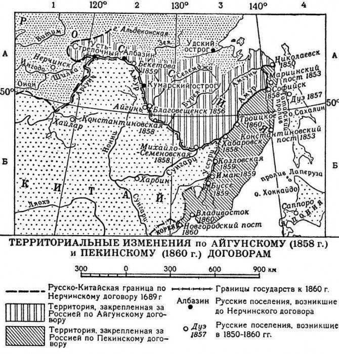
The Crimean War and the ongoing opium wars in China clearly demonstrated that if the Russians do not occupy the Amur region, the British will do it, or, in extreme cases, the French going to the wake of their policies. Being a talented politician and having authority from the emperor, Governor-General N. N. Muravyov initiated the conclusion of a new border treaty with China. According to the Aigun Treaty, the entire left bank of the Amur River to the mouth of the river departed from 16 in May of 1858 of Russia. A direct addition to the agreement was the Beijing Treaty concluded between Russia and China 2 (14) November 1860 of the year in the framework of a series of treaties between China and European countries in Beijing burned and plundered by the British and French. The border between the two countries was established along the Amur, Ussuri and Sungari through the lake. Khanka, to r. Tumyndzyan. Russia, thus, finally secured the Ussuri region. The western border between the two countries was also secured. The contract provided for the subsequent determination of the boundary on the ground, both on the east and on its western sections.
According to the agreement, the eastern border between Russia and China was established, starting from the confluence of the Shilka and Argun rivers, downstream. Cupid to the place of its confluence with r. Ussuri. The contract bypassed the question of the islands. However, within the framework of the demarcation works by the Russian side, a map of 25 versts in inches was drawn up and appended to the contract, attached to the text of the Beijing Treaty. An indication of the presence of such a card is in the 1 article of the text of the contract, which reads: “Above this, in fulfillment of the ninth article of the Tianjin Treaty, the mapped map is affirmed, on which boundary line, for greater clarity, is indicated by a red line and its direction is shown in letters of the Russian alphabet: A, B, C, D, D, E, F, 3, I, I, K, L, M, N, O, P, P, C, T, U. This map is signed by the representatives of both states and sealed with their seals ". It was on this map that Count N. P. Ignatiev drew a red pencil along the Chinese line along the Amur and Ussuri rivers, and in the Khabarovsk area along the Kazakevichev canal. However, at the conclusion of the Beijing Treaty, the Chinese representative, Prince Gong, refused to sign this card, and in 1861 - 1886. a description of the boundary line was drawn up only in its section from the mouth of the river. Ussuri to the mouth of the river. Foggy, which seriously confused the demarcation of the state border along the Amur. Thus, the Beijing Treaty provided for a gradual work on the demarcation of the border. This work was carried out in Primorye, Central Asia, on Argun, but on the Amur until the beginning of the 1990-s there was no work on the demarcation of the state border, only a general delimitation line was fixed.
Thus, although it is surprising, Russia and China did not define a clear border on Amur for various reasons for more than 100 years - from 1860 to 1990 a year.
All this has generated a lot of controversy and difficulties. The Beijing Treaty did not say anything about the ownership of the islands, the Chinese representative, according to the terms of the contract, did not sign the card. However, the emperor of China approved the decree along with the map. In addition, the contract stated that the border runs downstream. Cupid to the place of its confluence with r. Ussuri. The question was what to consider as the confluence of the Ussuri River in the Amur. Even among Russian scientists there was no unity about what is considered the mouth of the river. Ussuri: points located in the area of art. Kazakevichy or in the Khabarovsk region.
However, understanding the strategic importance of these islands for the then military post of Khabarovka, Russia immediately established control over the islands of Great Ussuriisky and Tarabarov. To avoid border conflicts, all activity on the islands was limited to mowing. To fix the line of the state border on the ground, the Russian-Chinese demarcation commission in 1861 on the Chinese coast opposite the village of Kazakevicheva established a wooden pole with the letter “E”, which had the coordinates 48º16'20 ″ n. and 152º37 'E In 1886, the wooden pole was replaced with a stone one installed in the same place. The archipelago was designated as the territory of Russia on the “Map of China and the Amur River banks” (1859) and the Map of Manchuria (1897) published in Russia. Despite this, the Chinese side has repeatedly made claims on the archipelago, accusing the other side of deception and unauthorized transfer of the demarcation pillar.
However, until the beginning of the First World War, the demarcation of the state border along the Amur was not carried out. Narimer, according to the instructions of the Ministry of Foreign Affairs of Russia, to the coastal population in 1911, it was proposed before the end of the disengagement "to use those islands that they recognize as belonging to them, not paying attention to the protests of the Chinese." In addition, the definition of the border on the main fairway (the maximum depth of the channel) on the Amur and Ussuri was very difficult. The point is in the features of their flow. These rivers carry a lot of silt, which constantly settles on the bottom - and, of course, exactly where the main stream flows, that is, along the fairway. As a result, the fairway of the rivers is constantly shifting. There are a lot of islands on the rivers. As a rule, the sludge settles on one side of the island, and on the other side at the same time the bottom sediments are eroded over. Therefore, the fairway now and then moves from one side of the island to the other. Thus, the island, which was recently considered to belong to one of the parties, according to the rule of the fairway, is owned by the other. Based on this principle, the ability to determine the ownership of the islands of the Great Ussuriysky and Tarabarov is generally not possible. Since there was no clear understanding of what should be considered the main fairway. This feature of the Amur and Ussuri rivers was used by the Chinese side in conducting “irrigation wars” in the region of the Bolshoi Ussuriysk and Tarabarov with a serious aggravation of relations with the USSR under Khrushchev, and later under Brezhnev. The meaning was simple: the Chinese were drowning sand barges in Kazakevicheva, intensifying its silting, which subsequently caused the departure of the fairway to the north and the automatic connection of the disputed islands to Chinese territory. Accordingly, we carried out dredging. It came to curiosities: at night the Chinese fell asleep to the canal, and during the day we deepened it.
It was with such a baggage of contradictions that the state border existed all the years of the First World War, the revolution and the civil war in Russia. In the 1929 year, taking advantage of the conflict on the CER as a pretext, our troops occupied Bolshoi Ussuriysky Island. Being in the immediate vicinity of Khabarovsk and previously not controlled by our troops, the island could be used to bombard the city, where industry began to be built. In 1931, Manchuria was occupied by the Japanese. In the light of these events, a military presence on the islands was absolutely necessary. In addition, the USSR took control of almost all the islands on the Amur and the Ussuri. Actually, the border remained in such a position until the creation of the People's Republic of China in 1949. The young state was obliged to the USSR by much, besides the general ideology, a competent policy in relation to China of the Stalinist USSR did not give a reason to flare up the border problem. The PRC and the USSR acted as a united front against the common enemy — the Anglo-Saxon powers. 14 February 1950. in Moscow, the Soviet-Chinese Treaty of Friendship, Union and Mutual Assistance was signed for 30 years, which, according to I.V. Stalin "to serve the cause of ensuring peace in the Far East against all and all aggressors and arsonists of war." In accordance with the treaty of friendship of the union, mutual assistance (1950), the Soviet-Chinese border, prior to the start of the audit of bilateral relations, was the border of good neighborliness, where active contacts were maintained between the people of the border areas, lively trade was conducted, cultural exchange was established. Cooperation agreements were concluded in a number of frontier areas, including the “Agreement on the order of navigation along the border rivers Amur, Ussuri, Argun, Sungach, and oz. Khanka and on the establishment of navigable conditions on these waterways ”(1951), on forestry, on joint fight against forest fires in border areas, etc. Under these agreements, the actual guarded border line has not been questioned [. Confirms the absence of claims from the Chinese comrades, the transfer to China of topographic maps with the designation of the entire border line. On the Chinese side, there were no comments on the border line.
The problems began with the death of Stalin and the coming to power of Khrushchev. By this example, one can clearly see the consequences of the misunderstanding of the canons of geopolitics by the country's leader. For several years, this “search designer” managed to surrender a number of positions to the Anglo-Saxon powers and severely spoil relations with the allied China. However, up to 1960, China’s territorial claims were not made. It is this year that the long-standing and unresolved territorial issue begins to rise, as a reflection of the general sharp deterioration in relations between the countries. In whose interests? In the interests of the United States, of course. In 1960, the USSR unexpectedly recalls Soviet specialists from China and almost simultaneously the first episode occurred at the border, which showed the existence of disagreements between the USSR and China on the issue of the border line and the ownership of certain sections. We are talking about the 1960 incident, when Chinese cattlemen grazed livestock in the territory under Soviet jurisdiction (in the area of the Buz-Aygyr Pass in Kyrgyzstan). When the Soviet border guards arrived, the shepherds said they were in the territory of the People’s Republic of China. Later it turned out that they acted according to the directive of the authorities of their province. On this occasion, the Ministries of Foreign Affairs of China and the USSR sent each other several notes and made oral statements in which, for the first time since the founding of the PRC, a different understanding of the border line with the Soviet Union was revealed at the official, diplomatic level.
From the autumn of 1960, the systematic exits of Chinese citizens to the islands on the border rivers of the Far East, which are under our control, began. They declared to the Soviet border guards that they were on Chinese territory. The reaction of Soviet border guards to incidents has changed. If earlier they simply ignored the Chinese peasant industries in a number of territories under Soviet jurisdiction, then, starting from 1960, we tried to stop them.
In this situation, the Presidium of the CPSU Central Committee decided to create an interdepartmental commission of specialists from the Foreign Ministry, the KGB and the Ministry of Defense, whose task was to select and study contractual acts on the border with the PRC. The commission identified 13 sites where there were discrepancies on the maps of the parties and 12 where no islands were distributed. The boundary line itself did not have a clear indication on the ground, since 141 was preserved from 40 in the original form; 77 was in a destroyed state, 24 was absent altogether. It was also noted that the description of the boundary in contractual acts is often of a general nature, and many contractual maps are drawn up on a small scale at a primitive level. In general, at the conclusion of the commission, it was noted that the entire border line with the PRC, except for the section on the Pamirs south of the Uz-Bel pass, is defined by treaties. In the case of border negotiations, the commission proposed to draw the border not along the banks of the rivers, but along the middle line of the main fairway on navigable rivers and along the middle of the river on non-navigable rivers, and not as it was marked by a red line on the map attached to the Beijing Treaty, according to which the border went along the Chinese coast. That is, the border was determined very roughly, it needed a new demarcation. The uncertainty of the border on the ground gave an excellent reason to create conflict situations.
And China has actively used the border problem as a cause for conflict. Violations statistics showed that from 1960 to 1964 the number grew rapidly, and in the second half of 60, incidents became more acute. In 1960, the number of violations was about 100, in 1962 already around 5 thousand. In 1963, more than 100 thousand Chinese civilian and military took part in the illegal crossing of the Soviet-Chinese border. Thus, Khrushchev’s quarrel with China marked the beginning of a very difficult and painful process of demarcating the entire state border. Under Khrushchev, in February 1964, consultations began with the PRC on cross-border issues. And the Chinese made obviously unrealistic demands. So China demanded to recognize the Treaty of Beijing and Aigun as "unequal". Here it is necessary to understand that the task of China at that time was not to resolve the territorial disputes, but to aggravate them and provoke a conflict, demonstrating to the United States its determination to resist the USSR.
In April, 1964, the parties exchanged topographic maps indicating their understanding of the boundary line and created a working group, after which they began to look directly at the boundary line. As a result of studying the Chinese maps and comparing them with the Soviet ones, it was found that there are discrepancies in the plotting of the border line on these 22 sites, of which 17 are located on the western part of the Soviet-Chinese border (now the Central Asian republics of the former USSR) and 5 sites - on eastern border. These plots roughly coincided with the plots that the 1960 Interdepartmental Commission indicated in their note. On the Chinese maps, 3 plots were also indicated which did not appear in the commission’s materials, including a rather large plot in the area of the Bedel Pass (Kyrgyzstan) and islands in Khabarovsk.
Following the consideration of maps in Moscow, it was concluded that negotiations could be held not on individual sections, as previously assumed, but on the entire border, as the Chinese delegation insisted. Such an approach became possible, since for the most part of the extension of the boundary line there were no vital differences. According to the longest line that required clarification - the river border in the Far East, the parties had the same understanding that the border should have passed along the main channel. In this regard, the delegation was given additional instructions - to confirm the border line in areas where the parties understand it in the same way.
So, let us remember - Khrushchev initiated the border problem, who doused Stalin, who had been an indisputable authority for Mao Dzedun, and carried out a number of unfriendly actions against China. The result of Khrushchev's short-sighted policy was the fighting on Damanski Island, as well as in Kazakhstan and, most importantly, the reversal of China from friendship and cooperation with the USSR to the United States. That in many respects, determined our geopolitical defeat at the beginning of the 1990s. The border issue was the result of this policy.
Further events developed as follows. During Gorbachev’s time when negotiations were held in 1987 - 1991, which culminated in the signing of the Agreement on the Soviet-Chinese border 1991, it was established that the border on the Amur should pass along the main fairway of the river. According to this agreement, many islands that were previously controlled by the USSR, in Among them, Damansky Island turned out to be Chinese territory.
Now the question. Does anyone remember the wrathful articles of the liberals that Gorbachev was trading in his homeland and gave several dozens of "originally Russian islands" to China at once? Nevertheless, here Mikhail Sergeyevich, with his passion for unilateral concessions, nevertheless helped to resolve the long-term border problem, largely initiated by the policies of Khrushchev.
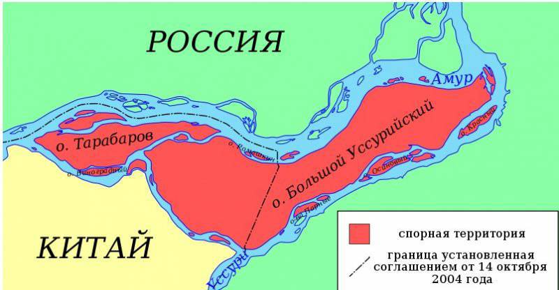
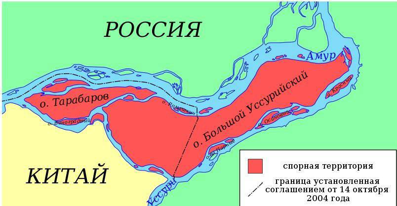
However, this agreement bypassed the solution of the border problem near the islands in the Khabarovsk region. And the reason you can see on the map below. The southernmost channel between China and the Tarabarov and Bolshoy Ussuriysky islands is the Kazakevich channel. If we consider it the confluence of the Ussuri and Amur, then all the islands are Russian territory. And if we consider the location of the Ussuri and Amur to be a place to the north of the Big Ussuri Island, then the islands are completely Chinese territory. And this option is unacceptable for Russia, since then the border will be held right in the immediate vicinity of Khabarovsk (the left bank will be the Chinese, and on the right there will be Khabarovsk
In fact, this was the last unresolved territorial dispute with China (together with the Abagaytuy island on Argun) at the time President Putin took office. Now you need to understand the geopolitical context in which Putin acted in the early 2000-s. From 2003 to 2004, Vladimir Putin initiates a vivid lesson for those who want to give Russian bowels under the control of US monopolies and, by order of Americans, to buy up the State Duma (the YUKOS case and Khodorkovsky’s landing), abolishes the law of the PSA (Section Agreement products), will introduce the mineral extraction tax (“Mineral Tax”) that fills the current state budget. Following Putin takes the next step. In October, Russian-Chinese negotiations open in Beijing, in which, together with a number of unpublished agreements, additional agreements are signed that settle all the existing territorial disputes between Russia and China.
Since in the case of the Khabarovsk Islands it was impossible to apply the principle of delimitation along the fairway, the parties agreed to divide the Big Ussuriisky Island into southern China and Northern (most developed) Russian parts. In addition, in exchange for the northern part of the Bolshoy Ussuriysk, we lost half of the island of Abagaytuy to Argun. A new principle was applied - territories were divided according to landmarks.
Through the cries of the liberals “on trade in the motherland,” the fact was missed that for the first time in the history of Russia and China, all claims and controversial points were removed from all over the 4300 km of the Russian-Chinese border. Of course, the transfer of part of the islands cannot be definitely called a success, and I’m far from thinking of justifying our President, but non-persistent journalists for some reason do not say that the situation with the state border at the beginning of 2000 went to Putin from Khrushchev and Gorbachev. Where the first quarreled with our main geopolitical ally, as a result of which the territorial issue was initiated, and the second successfully solved this problem, finally having ditched the country that he was in charge of. As a result, the Russian Federation in terms of strength and influence in the world, and most importantly, the presence of trumps at the negotiations in 2004, was a far from Stalinist USSR of the model 1952 of the year. In 1952, a border treaty could be concluded on terms that were favorable to us, since the space for diplomatic bargaining was incomparably wider.
Was it possible to resolve the territorial issue in the conditions of our time in some other way? This is a big question. The transfer of part of the island near Khabarovsk was the result of almost 150 years of history of our victories and defeats, strengthening and weakening Russia, and was not a “one-time concession from Russia”. So why are liberal journalists criticizing Putin like this and overly emotional patriots? Let's look at the facts. In October 2004, border agreements are signed in Beijing, the border issue is finally settled. Immediately thereafter, 31 of December 2004 of the year issued an order of the Government of the Russian Federation No. 1737-p on the design and construction of the Eastern Siberia-Pacific Ocean oil pipeline (ESPO) with branches to China. (Legal border clearance was completed only in July 2008, when Russian Foreign Minister Sergey Lavrov and Foreign Minister Yang Jiechi signed an additional protocol describing the line of the Russian-Chinese border in its eastern part.
The leadership of Russia and China has taken a course on cooperation and good neighborly relations with each other, eliminating the last territorial disputes that could seriously spoil relations between the two countries and lead to the Russian-Chinese war, which the US needs so much. This is not like the liberal bloggers and journalists, or rather their overseas sponsors.
They need confrontation, and better war between the two most powerful continental countries.
And the more reasons for conflicts there are, the better.
In short, the whole story about the ownership of the islands on the Amur.
Why did this happen? The liberal public and a part of the most emotional patriots made and submit the incident as a “one-sided” and “unreasonable” concession on the part of our country towards China.
The best way to understand the situation is to look at the facts.
About this article Khabarovsk Artem Yakovlevich Krivosheev, who tried to make out the whole situation, as they say, "by the bones"

Why did Russia agree to transfer the island of Tarabarova and part of the Big Ussuri Island to China? Indeed, it is difficult to agree that the concession 337 square. km Russian territory is the success of our diplomacy. However, gentlemen journalists shouting about “selling the interests of Russia,” however, as always, act in short-term interests and greatly simplify the problem. Let's try to figure out what made the Russian President do that. BUT story The issue originates in 1858 year ...
Until 1858, the modern Amur Region, the Jewish Autonomous Region, the Southern part of the Khabarovsk Territory and the Primorsky Territory under the Nerchinsky Treaty of Russia and China 1689 of the year was, as it were, a “neutral territory”. Then it suited both states. However, with the beginning of the confrontation between Russia and England (after the Napoleonic wars), the situation with the significance of the modern territory of the Amur region begins to change. The danger of the occupation of these territories by the British and French increased, and then, having a kind of wedge penetrating the continent, the powers of the sea could successfully launch a struggle against both mainland China and continental Russia.
The consequences of such a development of events were well represented by the Governor-General of Eastern Siberia, N. N. Muravyov: “There was not an unfounded assumption that the British would occupy the mouth of the Amur,” N.N. reported on February 25, 1849. Muravyov to Emperor Nicholas I. - What then will the forces and resources of the government be required so that Eastern Siberia does not become English when an English fortress becomes at the mouth of the Amur and the English ships go along the Amur to Nerchinsk and even to Chita? ... If instead of an English fortress a Russian fortress had become at the mouth of the Amur, as well as at the port of Peter and Paul in Kamchatka, and between them flotilla“And for the sake of caution, so that in these fortresses and the flotilla the garrisons, crew and superiors would be delivered from inside Russia, then these small means would forever ensure the possession of Siberia and all its inexhaustible wealth for Russia forever.”
The Crimean War and the ongoing opium wars in China clearly demonstrated that if the Russians do not occupy the Amur region, the British will do it, or, in extreme cases, the French going to the wake of their policies. Being a talented politician and having authority from the emperor, Governor-General N. N. Muravyov initiated the conclusion of a new border treaty with China. According to the Aigun Treaty, the entire left bank of the Amur River to the mouth of the river departed from 16 in May of 1858 of Russia. A direct addition to the agreement was the Beijing Treaty concluded between Russia and China 2 (14) November 1860 of the year in the framework of a series of treaties between China and European countries in Beijing burned and plundered by the British and French. The border between the two countries was established along the Amur, Ussuri and Sungari through the lake. Khanka, to r. Tumyndzyan. Russia, thus, finally secured the Ussuri region. The western border between the two countries was also secured. The contract provided for the subsequent determination of the boundary on the ground, both on the east and on its western sections.
According to the agreement, the eastern border between Russia and China was established, starting from the confluence of the Shilka and Argun rivers, downstream. Cupid to the place of its confluence with r. Ussuri. The contract bypassed the question of the islands. However, within the framework of the demarcation works by the Russian side, a map of 25 versts in inches was drawn up and appended to the contract, attached to the text of the Beijing Treaty. An indication of the presence of such a card is in the 1 article of the text of the contract, which reads: “Above this, in fulfillment of the ninth article of the Tianjin Treaty, the mapped map is affirmed, on which boundary line, for greater clarity, is indicated by a red line and its direction is shown in letters of the Russian alphabet: A, B, C, D, D, E, F, 3, I, I, K, L, M, N, O, P, P, C, T, U. This map is signed by the representatives of both states and sealed with their seals ". It was on this map that Count N. P. Ignatiev drew a red pencil along the Chinese line along the Amur and Ussuri rivers, and in the Khabarovsk area along the Kazakevichev canal. However, at the conclusion of the Beijing Treaty, the Chinese representative, Prince Gong, refused to sign this card, and in 1861 - 1886. a description of the boundary line was drawn up only in its section from the mouth of the river. Ussuri to the mouth of the river. Foggy, which seriously confused the demarcation of the state border along the Amur. Thus, the Beijing Treaty provided for a gradual work on the demarcation of the border. This work was carried out in Primorye, Central Asia, on Argun, but on the Amur until the beginning of the 1990-s there was no work on the demarcation of the state border, only a general delimitation line was fixed.
Thus, although it is surprising, Russia and China did not define a clear border on Amur for various reasons for more than 100 years - from 1860 to 1990 a year.
All this has generated a lot of controversy and difficulties. The Beijing Treaty did not say anything about the ownership of the islands, the Chinese representative, according to the terms of the contract, did not sign the card. However, the emperor of China approved the decree along with the map. In addition, the contract stated that the border runs downstream. Cupid to the place of its confluence with r. Ussuri. The question was what to consider as the confluence of the Ussuri River in the Amur. Even among Russian scientists there was no unity about what is considered the mouth of the river. Ussuri: points located in the area of art. Kazakevichy or in the Khabarovsk region.
However, understanding the strategic importance of these islands for the then military post of Khabarovka, Russia immediately established control over the islands of Great Ussuriisky and Tarabarov. To avoid border conflicts, all activity on the islands was limited to mowing. To fix the line of the state border on the ground, the Russian-Chinese demarcation commission in 1861 on the Chinese coast opposite the village of Kazakevicheva established a wooden pole with the letter “E”, which had the coordinates 48º16'20 ″ n. and 152º37 'E In 1886, the wooden pole was replaced with a stone one installed in the same place. The archipelago was designated as the territory of Russia on the “Map of China and the Amur River banks” (1859) and the Map of Manchuria (1897) published in Russia. Despite this, the Chinese side has repeatedly made claims on the archipelago, accusing the other side of deception and unauthorized transfer of the demarcation pillar.
However, until the beginning of the First World War, the demarcation of the state border along the Amur was not carried out. Narimer, according to the instructions of the Ministry of Foreign Affairs of Russia, to the coastal population in 1911, it was proposed before the end of the disengagement "to use those islands that they recognize as belonging to them, not paying attention to the protests of the Chinese." In addition, the definition of the border on the main fairway (the maximum depth of the channel) on the Amur and Ussuri was very difficult. The point is in the features of their flow. These rivers carry a lot of silt, which constantly settles on the bottom - and, of course, exactly where the main stream flows, that is, along the fairway. As a result, the fairway of the rivers is constantly shifting. There are a lot of islands on the rivers. As a rule, the sludge settles on one side of the island, and on the other side at the same time the bottom sediments are eroded over. Therefore, the fairway now and then moves from one side of the island to the other. Thus, the island, which was recently considered to belong to one of the parties, according to the rule of the fairway, is owned by the other. Based on this principle, the ability to determine the ownership of the islands of the Great Ussuriysky and Tarabarov is generally not possible. Since there was no clear understanding of what should be considered the main fairway. This feature of the Amur and Ussuri rivers was used by the Chinese side in conducting “irrigation wars” in the region of the Bolshoi Ussuriysk and Tarabarov with a serious aggravation of relations with the USSR under Khrushchev, and later under Brezhnev. The meaning was simple: the Chinese were drowning sand barges in Kazakevicheva, intensifying its silting, which subsequently caused the departure of the fairway to the north and the automatic connection of the disputed islands to Chinese territory. Accordingly, we carried out dredging. It came to curiosities: at night the Chinese fell asleep to the canal, and during the day we deepened it.
It was with such a baggage of contradictions that the state border existed all the years of the First World War, the revolution and the civil war in Russia. In the 1929 year, taking advantage of the conflict on the CER as a pretext, our troops occupied Bolshoi Ussuriysky Island. Being in the immediate vicinity of Khabarovsk and previously not controlled by our troops, the island could be used to bombard the city, where industry began to be built. In 1931, Manchuria was occupied by the Japanese. In the light of these events, a military presence on the islands was absolutely necessary. In addition, the USSR took control of almost all the islands on the Amur and the Ussuri. Actually, the border remained in such a position until the creation of the People's Republic of China in 1949. The young state was obliged to the USSR by much, besides the general ideology, a competent policy in relation to China of the Stalinist USSR did not give a reason to flare up the border problem. The PRC and the USSR acted as a united front against the common enemy — the Anglo-Saxon powers. 14 February 1950. in Moscow, the Soviet-Chinese Treaty of Friendship, Union and Mutual Assistance was signed for 30 years, which, according to I.V. Stalin "to serve the cause of ensuring peace in the Far East against all and all aggressors and arsonists of war." In accordance with the treaty of friendship of the union, mutual assistance (1950), the Soviet-Chinese border, prior to the start of the audit of bilateral relations, was the border of good neighborliness, where active contacts were maintained between the people of the border areas, lively trade was conducted, cultural exchange was established. Cooperation agreements were concluded in a number of frontier areas, including the “Agreement on the order of navigation along the border rivers Amur, Ussuri, Argun, Sungach, and oz. Khanka and on the establishment of navigable conditions on these waterways ”(1951), on forestry, on joint fight against forest fires in border areas, etc. Under these agreements, the actual guarded border line has not been questioned [. Confirms the absence of claims from the Chinese comrades, the transfer to China of topographic maps with the designation of the entire border line. On the Chinese side, there were no comments on the border line.
The problems began with the death of Stalin and the coming to power of Khrushchev. By this example, one can clearly see the consequences of the misunderstanding of the canons of geopolitics by the country's leader. For several years, this “search designer” managed to surrender a number of positions to the Anglo-Saxon powers and severely spoil relations with the allied China. However, up to 1960, China’s territorial claims were not made. It is this year that the long-standing and unresolved territorial issue begins to rise, as a reflection of the general sharp deterioration in relations between the countries. In whose interests? In the interests of the United States, of course. In 1960, the USSR unexpectedly recalls Soviet specialists from China and almost simultaneously the first episode occurred at the border, which showed the existence of disagreements between the USSR and China on the issue of the border line and the ownership of certain sections. We are talking about the 1960 incident, when Chinese cattlemen grazed livestock in the territory under Soviet jurisdiction (in the area of the Buz-Aygyr Pass in Kyrgyzstan). When the Soviet border guards arrived, the shepherds said they were in the territory of the People’s Republic of China. Later it turned out that they acted according to the directive of the authorities of their province. On this occasion, the Ministries of Foreign Affairs of China and the USSR sent each other several notes and made oral statements in which, for the first time since the founding of the PRC, a different understanding of the border line with the Soviet Union was revealed at the official, diplomatic level.
From the autumn of 1960, the systematic exits of Chinese citizens to the islands on the border rivers of the Far East, which are under our control, began. They declared to the Soviet border guards that they were on Chinese territory. The reaction of Soviet border guards to incidents has changed. If earlier they simply ignored the Chinese peasant industries in a number of territories under Soviet jurisdiction, then, starting from 1960, we tried to stop them.
In this situation, the Presidium of the CPSU Central Committee decided to create an interdepartmental commission of specialists from the Foreign Ministry, the KGB and the Ministry of Defense, whose task was to select and study contractual acts on the border with the PRC. The commission identified 13 sites where there were discrepancies on the maps of the parties and 12 where no islands were distributed. The boundary line itself did not have a clear indication on the ground, since 141 was preserved from 40 in the original form; 77 was in a destroyed state, 24 was absent altogether. It was also noted that the description of the boundary in contractual acts is often of a general nature, and many contractual maps are drawn up on a small scale at a primitive level. In general, at the conclusion of the commission, it was noted that the entire border line with the PRC, except for the section on the Pamirs south of the Uz-Bel pass, is defined by treaties. In the case of border negotiations, the commission proposed to draw the border not along the banks of the rivers, but along the middle line of the main fairway on navigable rivers and along the middle of the river on non-navigable rivers, and not as it was marked by a red line on the map attached to the Beijing Treaty, according to which the border went along the Chinese coast. That is, the border was determined very roughly, it needed a new demarcation. The uncertainty of the border on the ground gave an excellent reason to create conflict situations.
And China has actively used the border problem as a cause for conflict. Violations statistics showed that from 1960 to 1964 the number grew rapidly, and in the second half of 60, incidents became more acute. In 1960, the number of violations was about 100, in 1962 already around 5 thousand. In 1963, more than 100 thousand Chinese civilian and military took part in the illegal crossing of the Soviet-Chinese border. Thus, Khrushchev’s quarrel with China marked the beginning of a very difficult and painful process of demarcating the entire state border. Under Khrushchev, in February 1964, consultations began with the PRC on cross-border issues. And the Chinese made obviously unrealistic demands. So China demanded to recognize the Treaty of Beijing and Aigun as "unequal". Here it is necessary to understand that the task of China at that time was not to resolve the territorial disputes, but to aggravate them and provoke a conflict, demonstrating to the United States its determination to resist the USSR.
In April, 1964, the parties exchanged topographic maps indicating their understanding of the boundary line and created a working group, after which they began to look directly at the boundary line. As a result of studying the Chinese maps and comparing them with the Soviet ones, it was found that there are discrepancies in the plotting of the border line on these 22 sites, of which 17 are located on the western part of the Soviet-Chinese border (now the Central Asian republics of the former USSR) and 5 sites - on eastern border. These plots roughly coincided with the plots that the 1960 Interdepartmental Commission indicated in their note. On the Chinese maps, 3 plots were also indicated which did not appear in the commission’s materials, including a rather large plot in the area of the Bedel Pass (Kyrgyzstan) and islands in Khabarovsk.
Following the consideration of maps in Moscow, it was concluded that negotiations could be held not on individual sections, as previously assumed, but on the entire border, as the Chinese delegation insisted. Such an approach became possible, since for the most part of the extension of the boundary line there were no vital differences. According to the longest line that required clarification - the river border in the Far East, the parties had the same understanding that the border should have passed along the main channel. In this regard, the delegation was given additional instructions - to confirm the border line in areas where the parties understand it in the same way.
So, let us remember - Khrushchev initiated the border problem, who doused Stalin, who had been an indisputable authority for Mao Dzedun, and carried out a number of unfriendly actions against China. The result of Khrushchev's short-sighted policy was the fighting on Damanski Island, as well as in Kazakhstan and, most importantly, the reversal of China from friendship and cooperation with the USSR to the United States. That in many respects, determined our geopolitical defeat at the beginning of the 1990s. The border issue was the result of this policy.
Further events developed as follows. During Gorbachev’s time when negotiations were held in 1987 - 1991, which culminated in the signing of the Agreement on the Soviet-Chinese border 1991, it was established that the border on the Amur should pass along the main fairway of the river. According to this agreement, many islands that were previously controlled by the USSR, in Among them, Damansky Island turned out to be Chinese territory.
Now the question. Does anyone remember the wrathful articles of the liberals that Gorbachev was trading in his homeland and gave several dozens of "originally Russian islands" to China at once? Nevertheless, here Mikhail Sergeyevich, with his passion for unilateral concessions, nevertheless helped to resolve the long-term border problem, largely initiated by the policies of Khrushchev.
However, this agreement bypassed the solution of the border problem near the islands in the Khabarovsk region. And the reason you can see on the map below. The southernmost channel between China and the Tarabarov and Bolshoy Ussuriysky islands is the Kazakevich channel. If we consider it the confluence of the Ussuri and Amur, then all the islands are Russian territory. And if we consider the location of the Ussuri and Amur to be a place to the north of the Big Ussuri Island, then the islands are completely Chinese territory. And this option is unacceptable for Russia, since then the border will be held right in the immediate vicinity of Khabarovsk (the left bank will be the Chinese, and on the right there will be Khabarovsk
In fact, this was the last unresolved territorial dispute with China (together with the Abagaytuy island on Argun) at the time President Putin took office. Now you need to understand the geopolitical context in which Putin acted in the early 2000-s. From 2003 to 2004, Vladimir Putin initiates a vivid lesson for those who want to give Russian bowels under the control of US monopolies and, by order of Americans, to buy up the State Duma (the YUKOS case and Khodorkovsky’s landing), abolishes the law of the PSA (Section Agreement products), will introduce the mineral extraction tax (“Mineral Tax”) that fills the current state budget. Following Putin takes the next step. In October, Russian-Chinese negotiations open in Beijing, in which, together with a number of unpublished agreements, additional agreements are signed that settle all the existing territorial disputes between Russia and China.
Since in the case of the Khabarovsk Islands it was impossible to apply the principle of delimitation along the fairway, the parties agreed to divide the Big Ussuriisky Island into southern China and Northern (most developed) Russian parts. In addition, in exchange for the northern part of the Bolshoy Ussuriysk, we lost half of the island of Abagaytuy to Argun. A new principle was applied - territories were divided according to landmarks.
Through the cries of the liberals “on trade in the motherland,” the fact was missed that for the first time in the history of Russia and China, all claims and controversial points were removed from all over the 4300 km of the Russian-Chinese border. Of course, the transfer of part of the islands cannot be definitely called a success, and I’m far from thinking of justifying our President, but non-persistent journalists for some reason do not say that the situation with the state border at the beginning of 2000 went to Putin from Khrushchev and Gorbachev. Where the first quarreled with our main geopolitical ally, as a result of which the territorial issue was initiated, and the second successfully solved this problem, finally having ditched the country that he was in charge of. As a result, the Russian Federation in terms of strength and influence in the world, and most importantly, the presence of trumps at the negotiations in 2004, was a far from Stalinist USSR of the model 1952 of the year. In 1952, a border treaty could be concluded on terms that were favorable to us, since the space for diplomatic bargaining was incomparably wider.
Was it possible to resolve the territorial issue in the conditions of our time in some other way? This is a big question. The transfer of part of the island near Khabarovsk was the result of almost 150 years of history of our victories and defeats, strengthening and weakening Russia, and was not a “one-time concession from Russia”. So why are liberal journalists criticizing Putin like this and overly emotional patriots? Let's look at the facts. In October 2004, border agreements are signed in Beijing, the border issue is finally settled. Immediately thereafter, 31 of December 2004 of the year issued an order of the Government of the Russian Federation No. 1737-p on the design and construction of the Eastern Siberia-Pacific Ocean oil pipeline (ESPO) with branches to China. (Legal border clearance was completed only in July 2008, when Russian Foreign Minister Sergey Lavrov and Foreign Minister Yang Jiechi signed an additional protocol describing the line of the Russian-Chinese border in its eastern part.
The leadership of Russia and China has taken a course on cooperation and good neighborly relations with each other, eliminating the last territorial disputes that could seriously spoil relations between the two countries and lead to the Russian-Chinese war, which the US needs so much. This is not like the liberal bloggers and journalists, or rather their overseas sponsors.
They need confrontation, and better war between the two most powerful continental countries.
And the more reasons for conflicts there are, the better.
In short, the whole story about the ownership of the islands on the Amur.
Information