Traces of the war on satellite imagery Google Earth
All over the world, species space information is widely used as an objective source of operational and reliable information about the situation in crisis regions and to substantiate decision-making.
Space visual control tools have become a tool for informing not only the special services, but also the general public.
As baseline data, for images provided in free access, WorldView-1 images of US satellites with spatial resolution are better than 0,5 (the most detailed images in the world, distributed without secrecy) and Formosat-2 (resolution 2). These satellites are also used as part of the NEXTVIEW program, which is designed to deliver highly detailed photographs of special services and the Pentagon received from US commercial satellites.
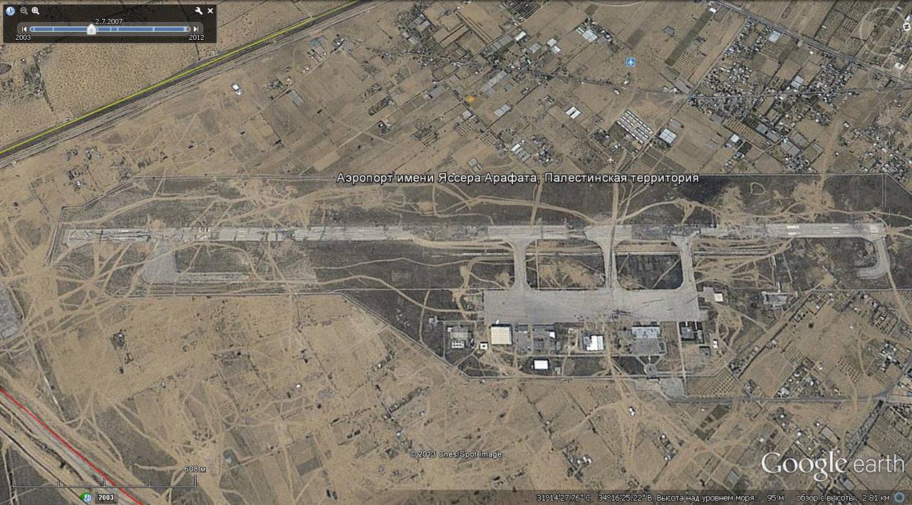
After launching the Google Earth project, everyone who wants to has the opportunity to view any parts of the earth's surface. However, not all areas of the earth's surface are available for viewing at the same resolution; the frequency of updating images is often different by times.
For example, images of a significant part of the US territory are updated 2-3 once a year, at the same time images of the territory of the State of Israel correspond to a decade ago, with extremely low resolution.
The same applies to combat zones. The pictures of the territory of Iraq during the period of the military company’s holding there are of low detail and often of low quality. But oil wells burning in the desert are well distinguishable.
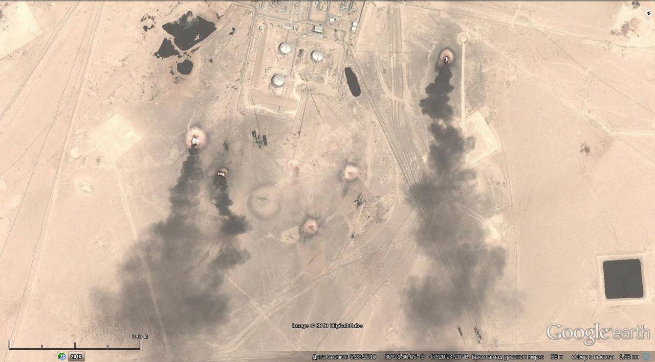
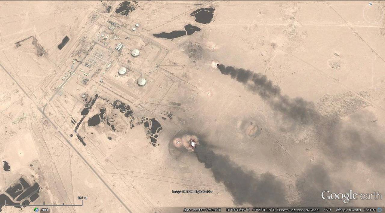
Burning oil wells near Basra
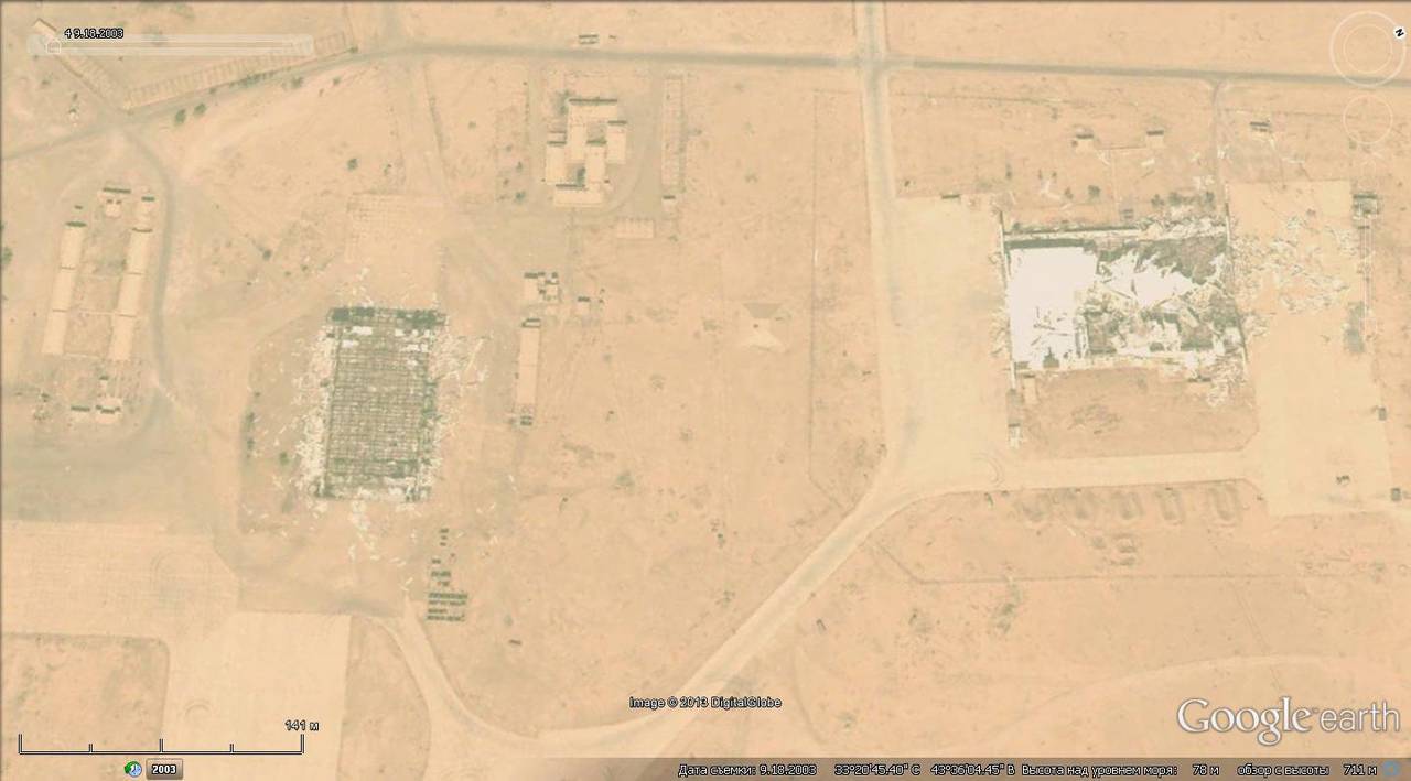
Destroyed industrial buildings in the vicinity of Baghdad
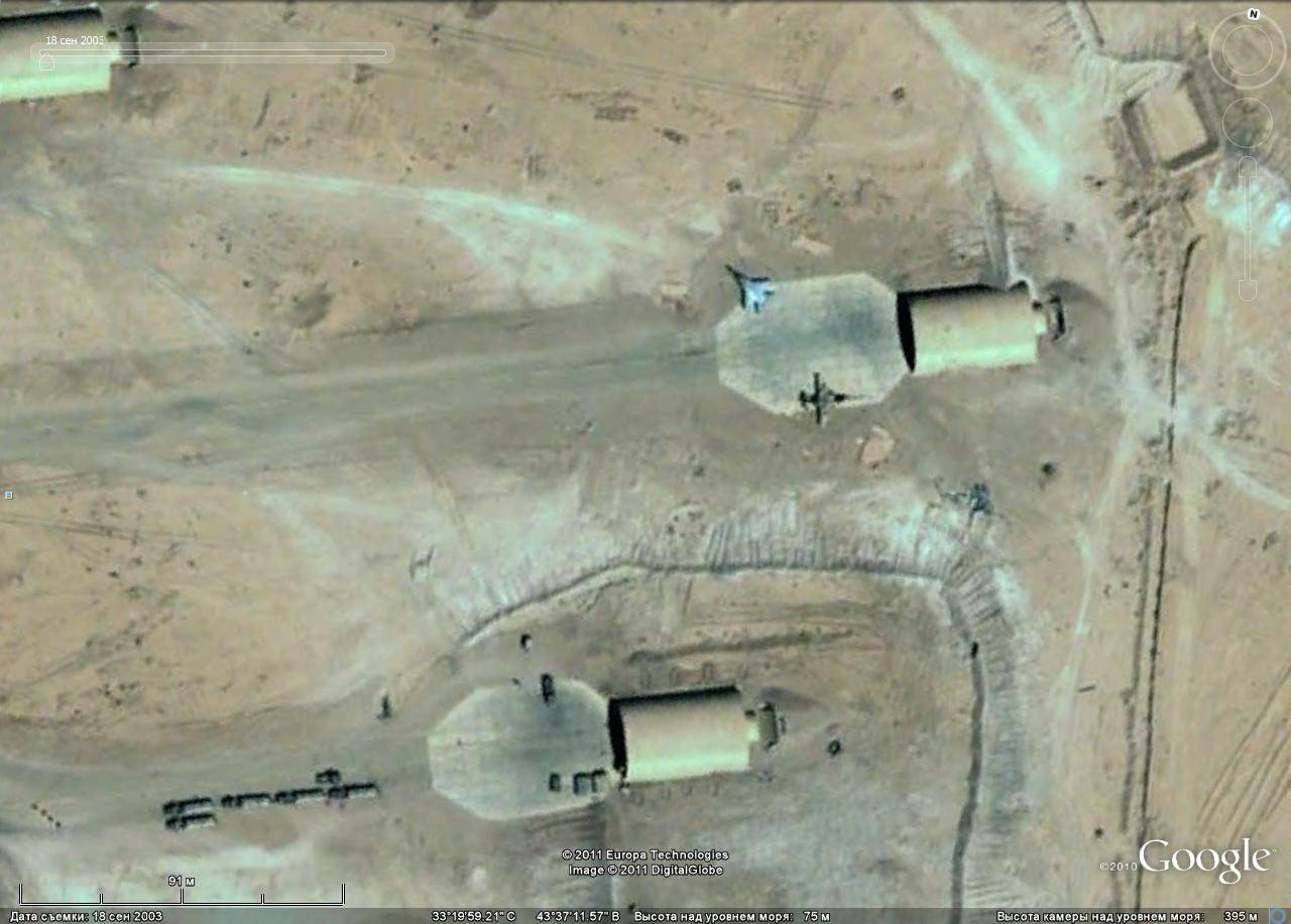
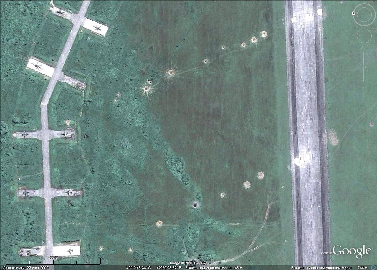
In the course of the US aggression against Iraq, control centers, communication centers, air defense systems and airfields were the first to be hit.
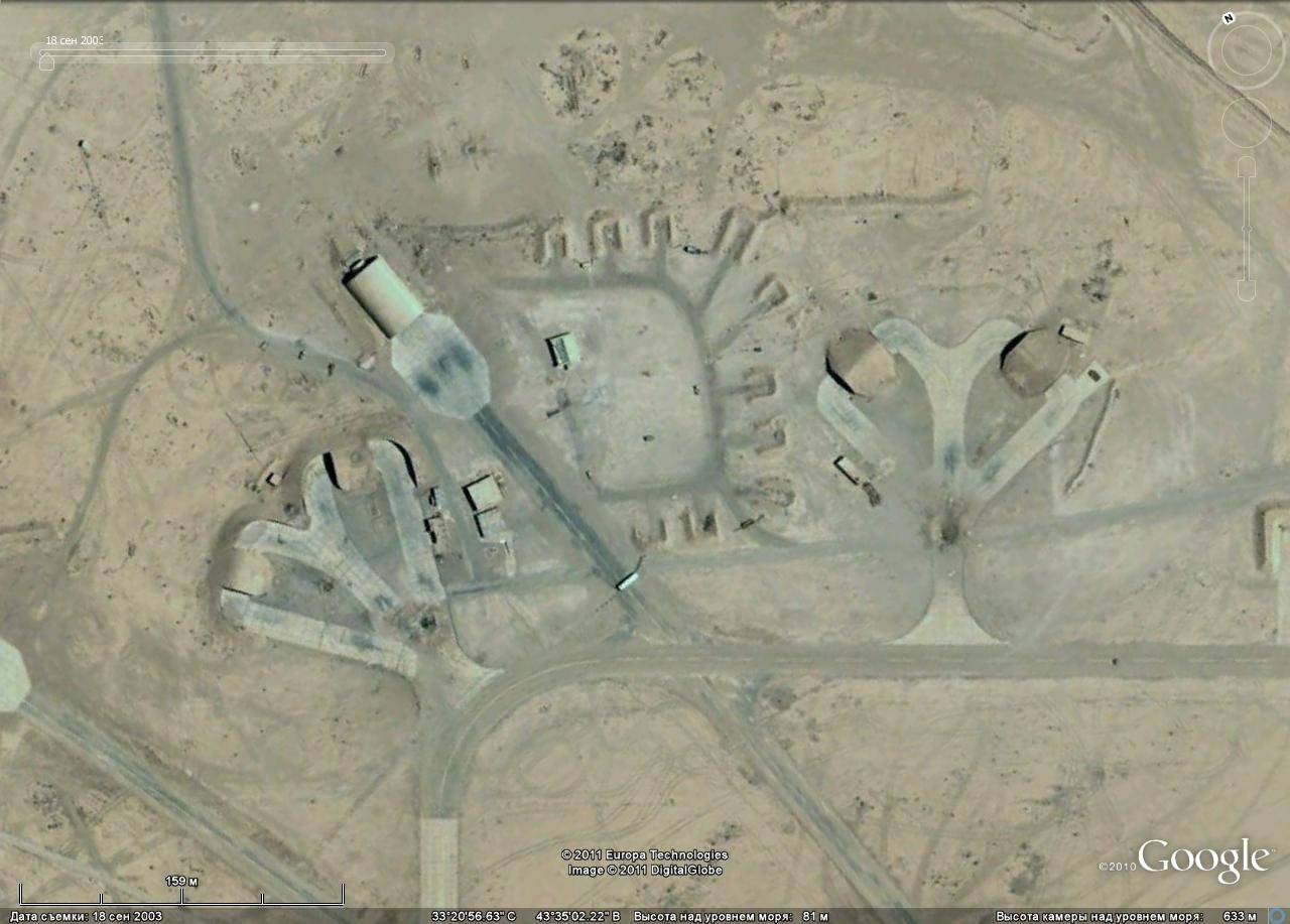
Nasiriyah airfield
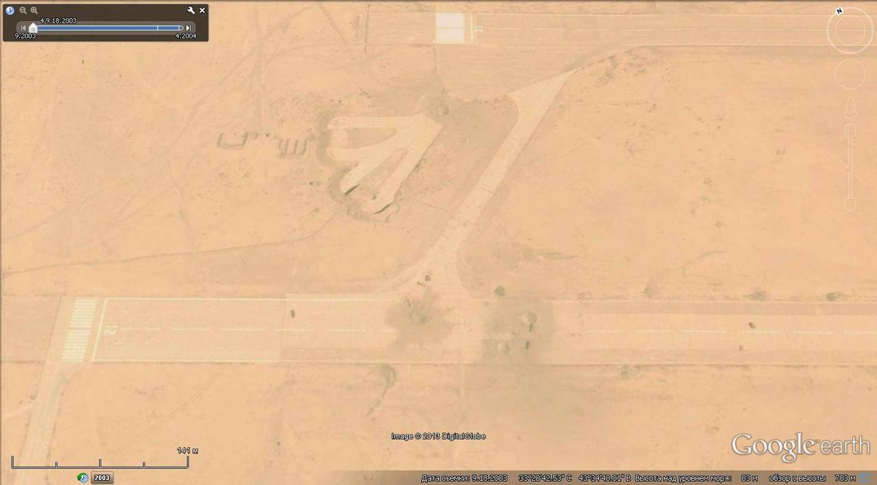
Kut airfield
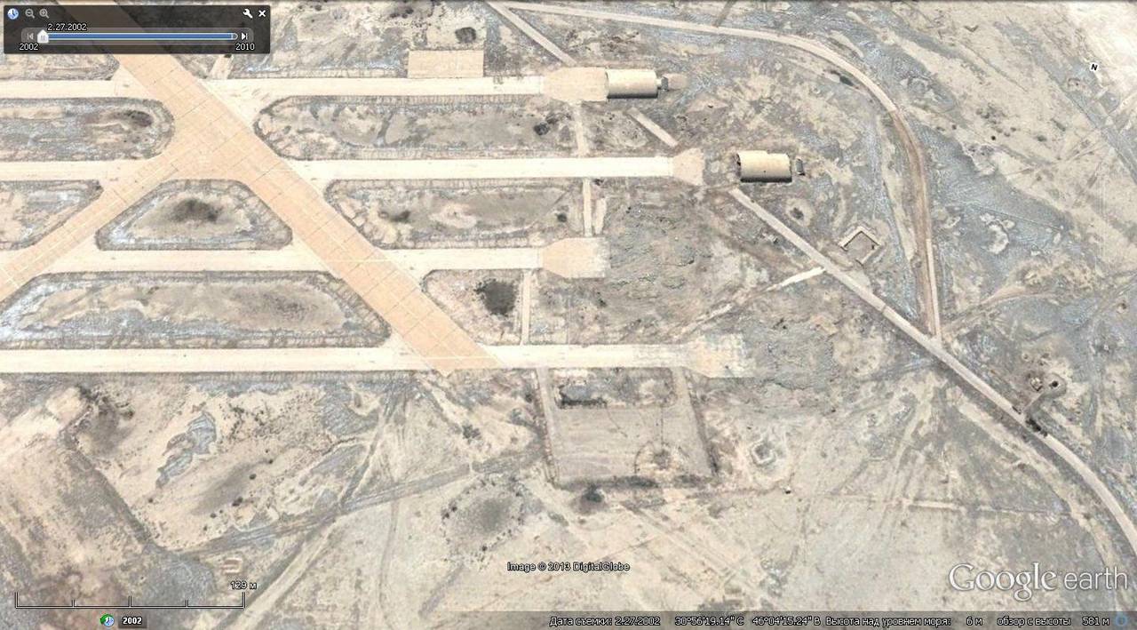
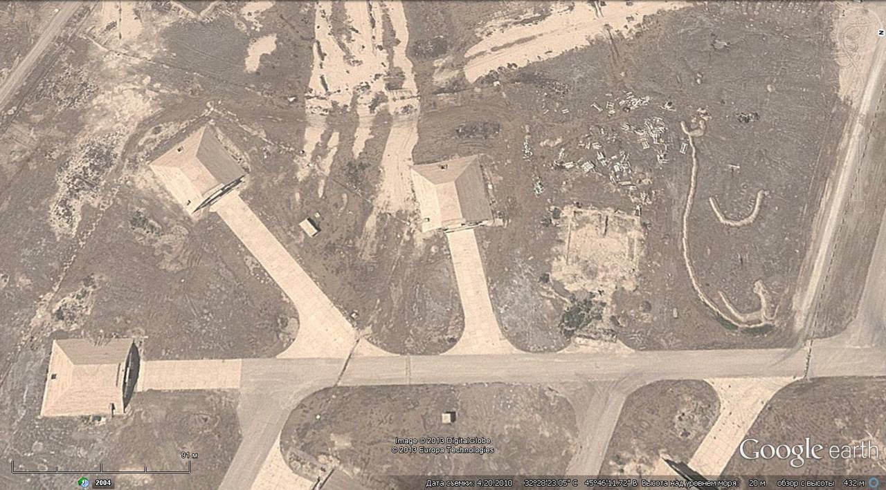
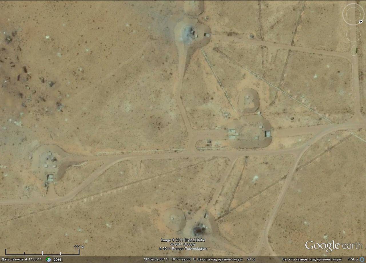
WFP airfield Al Habbania
Funnels at the exit of the hangar, the airfield of Al-Habbania
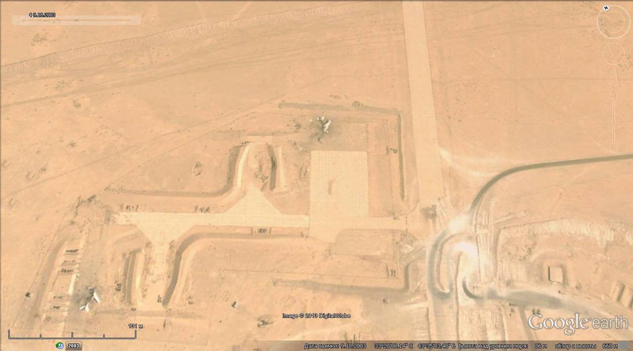
Wreckage of aircraft, the airfield of Al-Habbania
Americans captured Iraqi MiG-29 and Su-25
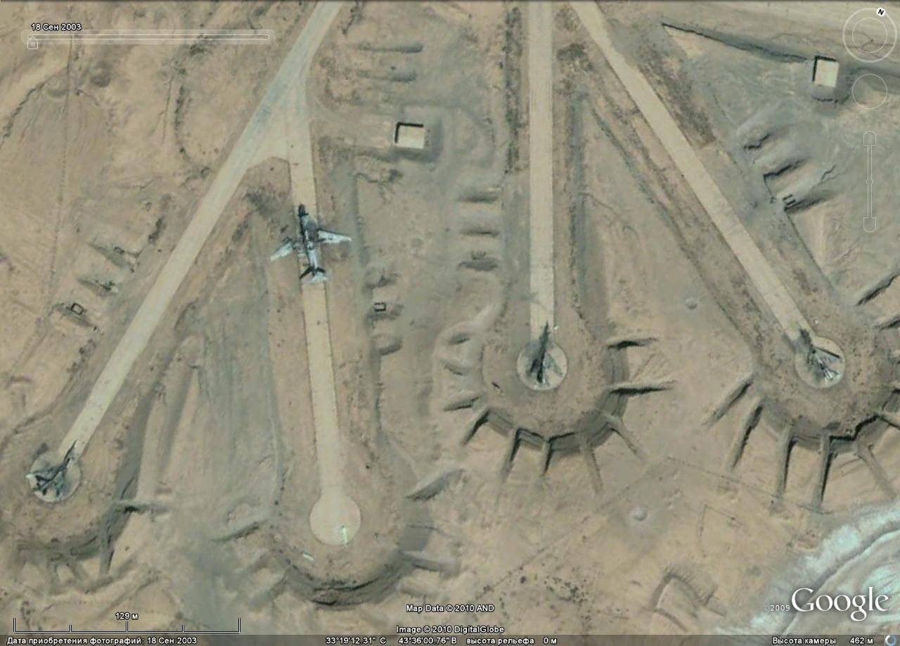
Destroyed at parking as a result of the Tu-16 and Tu-22 airstrike
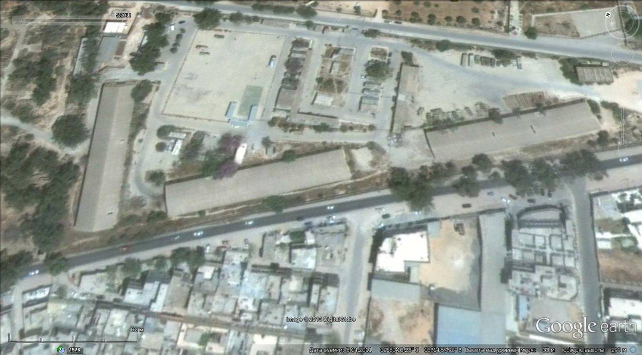
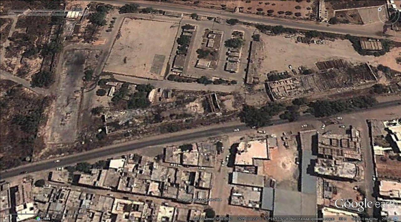
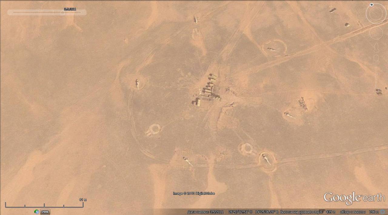
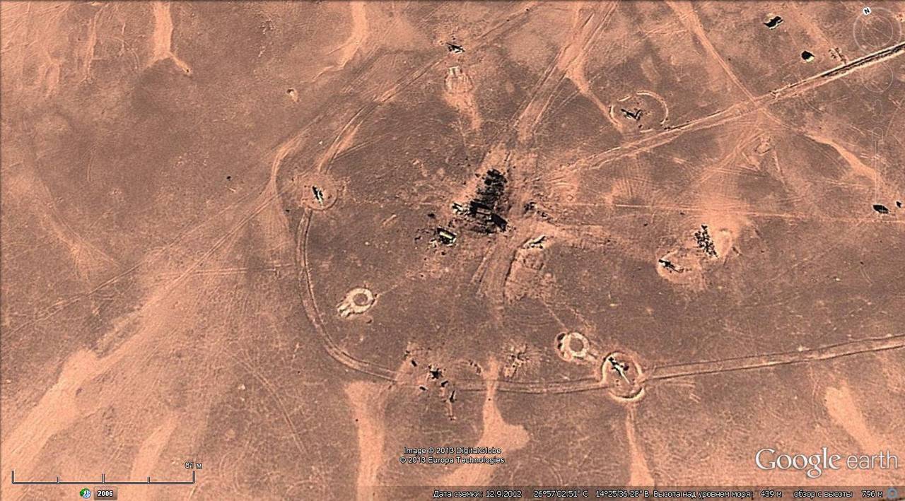
Pictures of the territory of Libya quite allow us to estimate the extent of destruction.
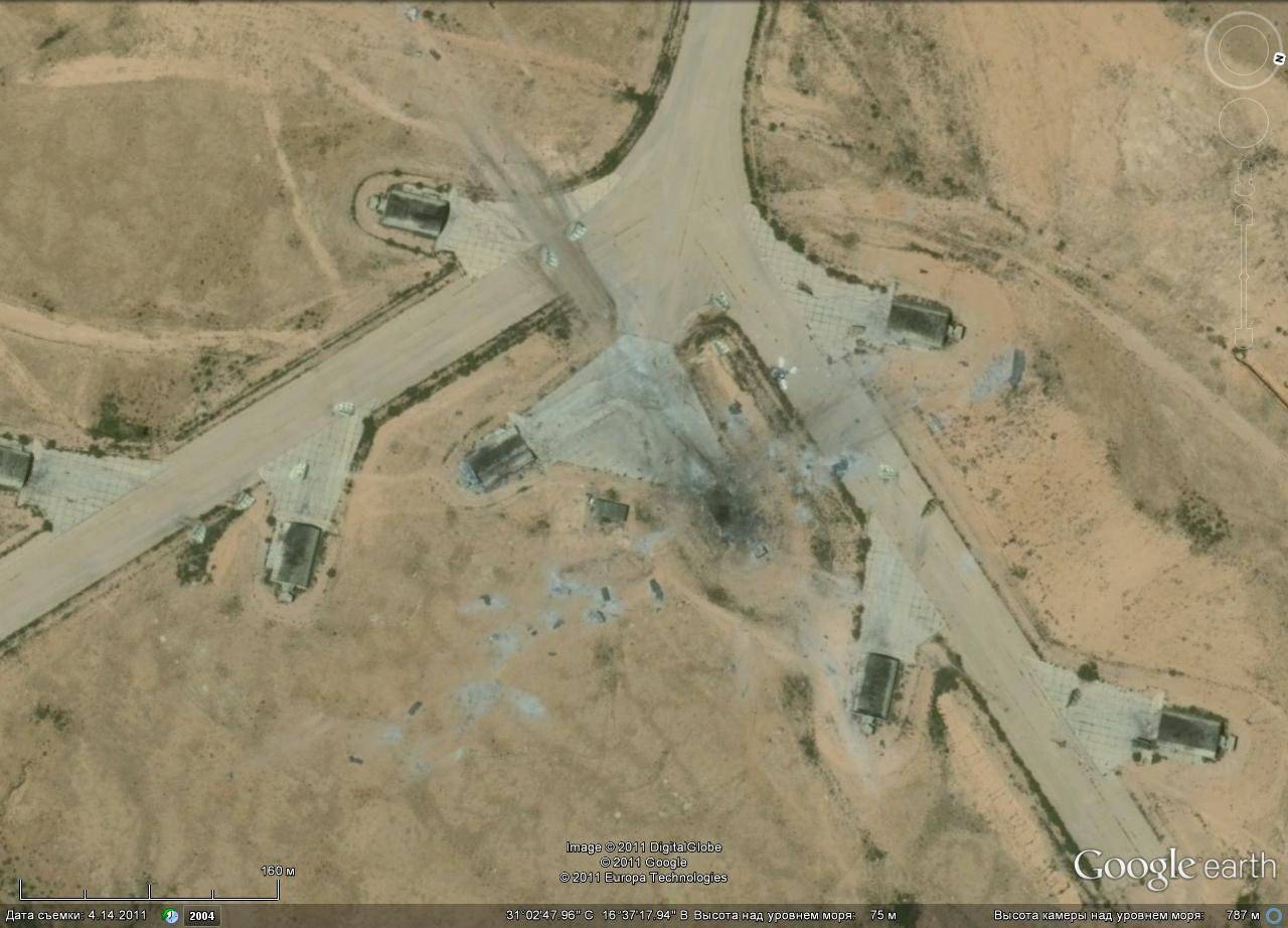
Concrete shelter destroyed by direct contact for aviation equipment
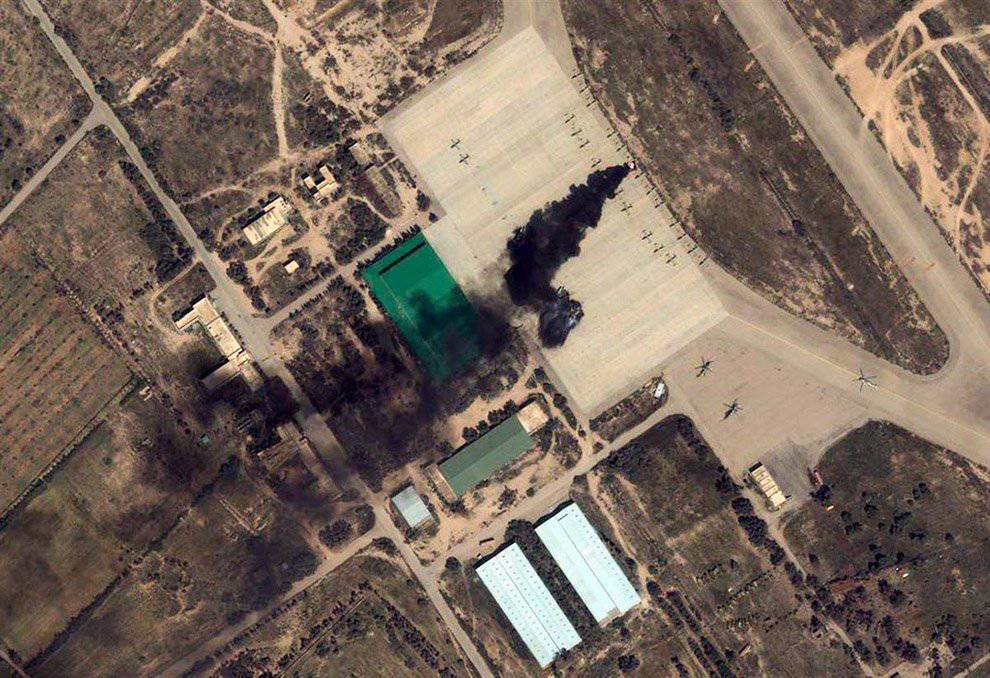
Burning aircraft in the parking lot of Misrata
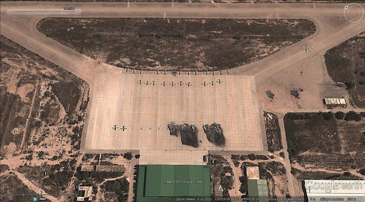
Burnt MiG-23, Misrata airfield
Building in Tripoli before the air strike
The same place after the air strike
Park technology before the bombing
The same fleet of equipment after the bombing
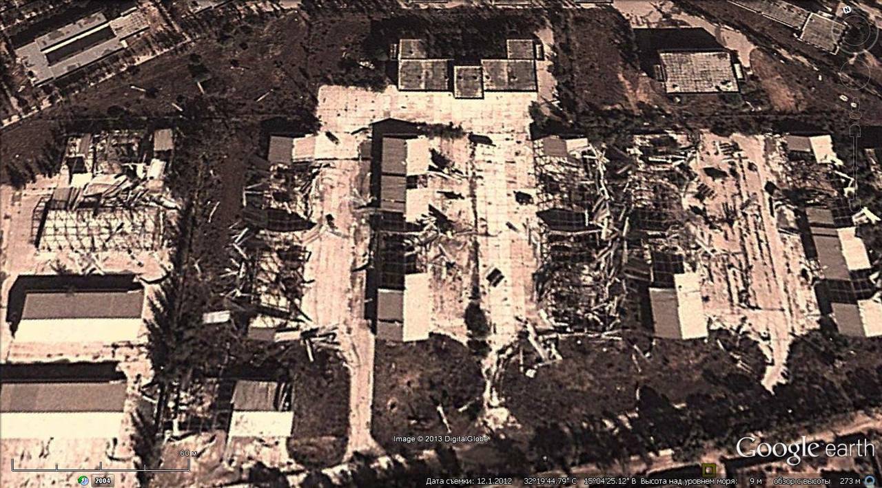
Destroyed buildings in the town of Misurata
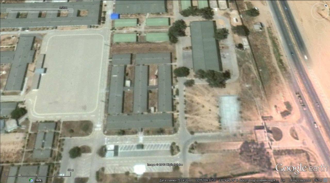
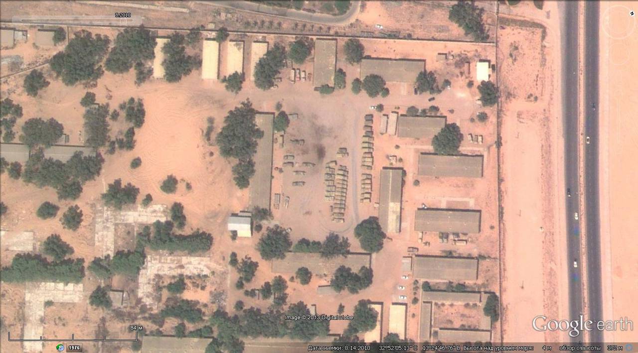
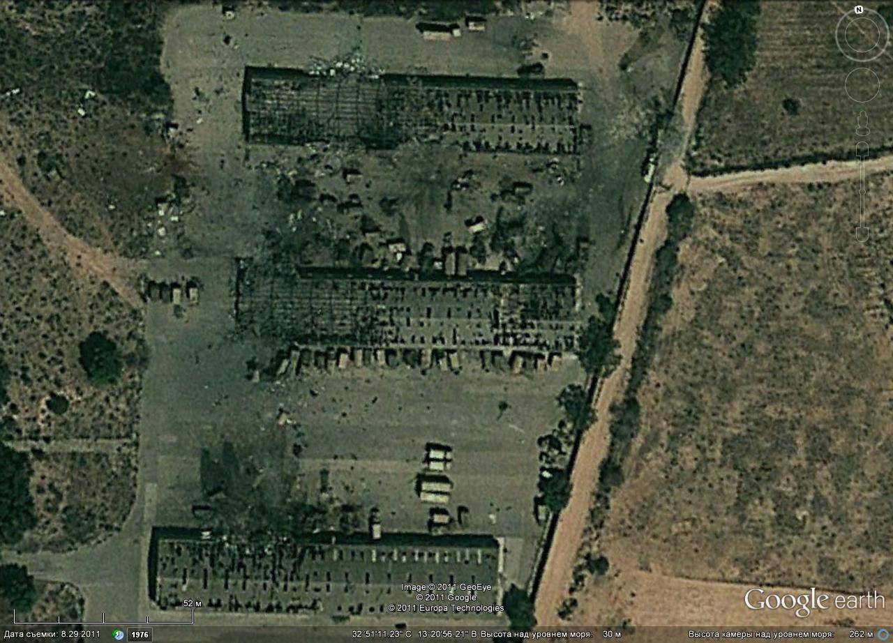
Military warehouses in Tripoli before the air strike
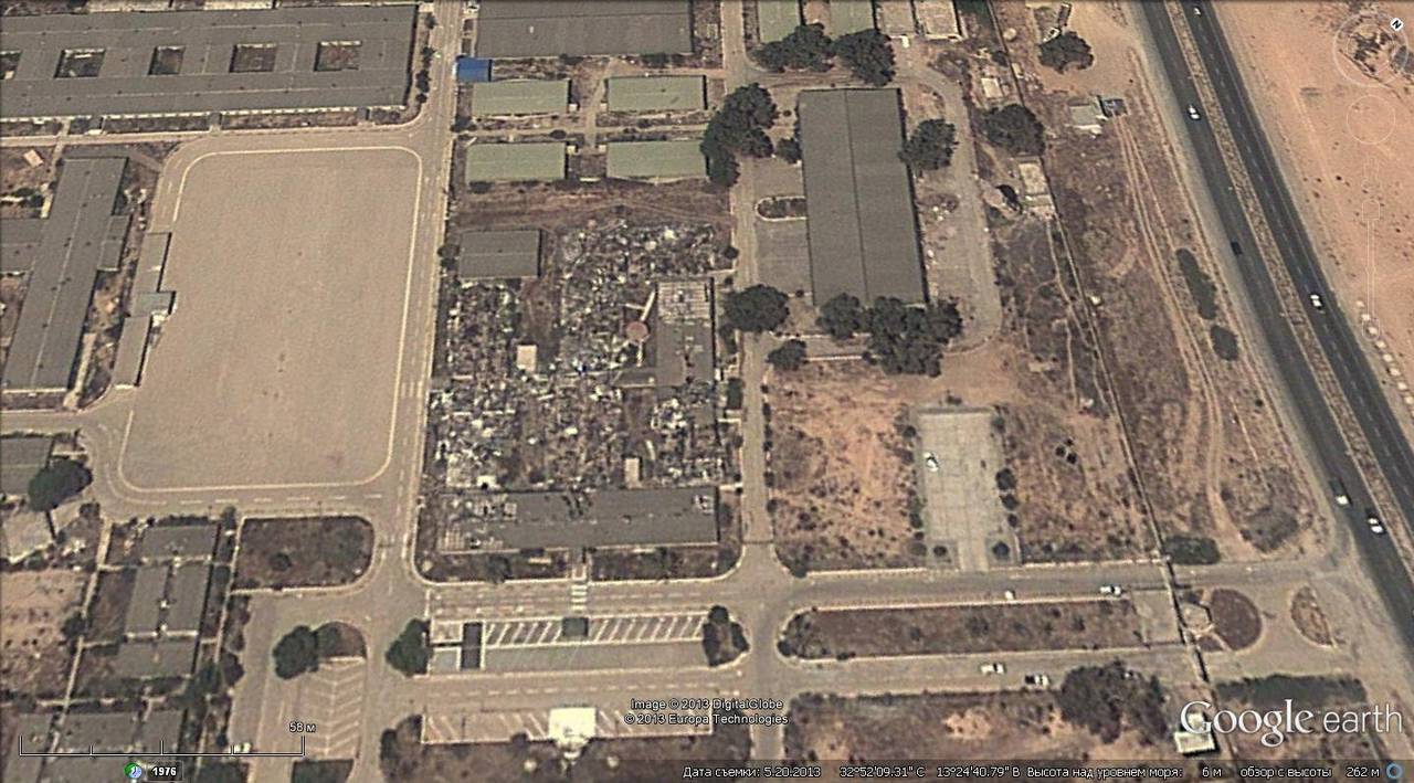
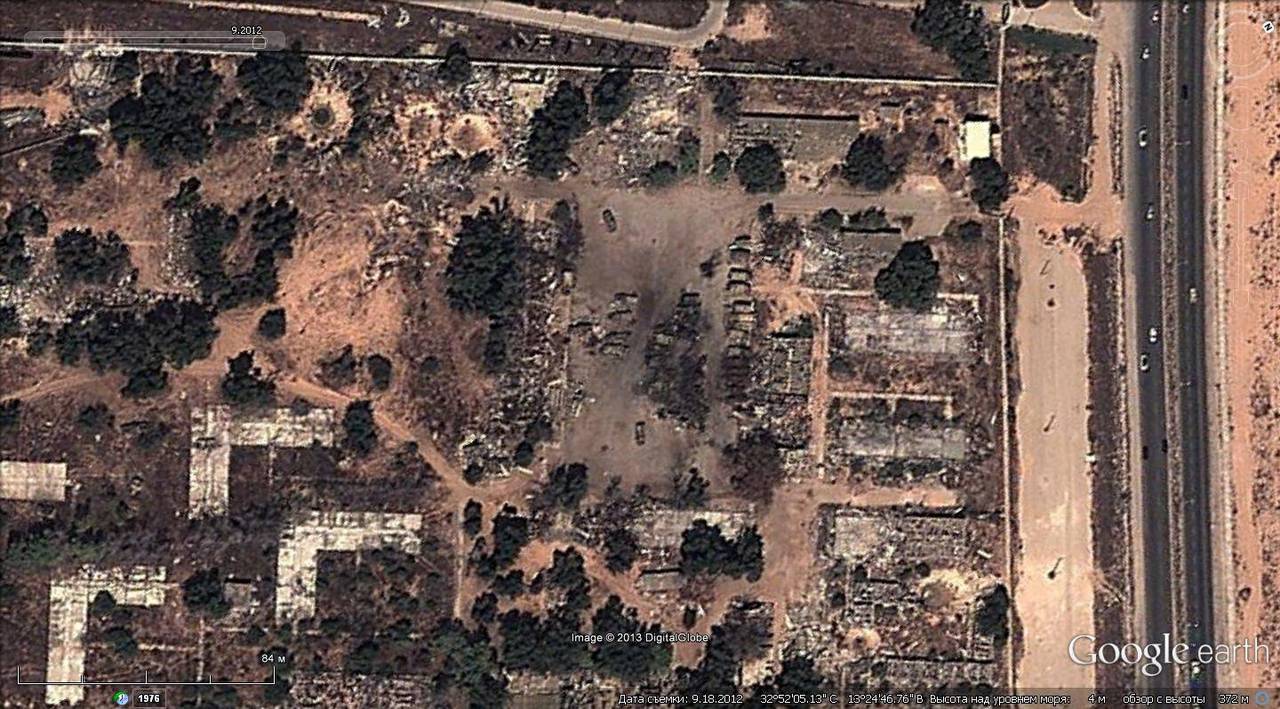
What remains of the warehouses after the air strike
Destroyed park of equipment in Tripoli
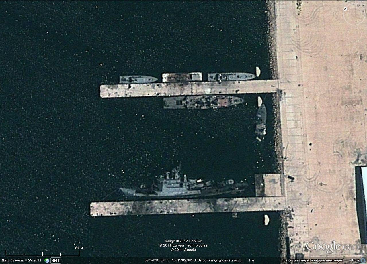
Libyan patrol ship sunk at the port of Tripoli
Destroyed PU ZRK C-200

Libyan radio equipment SAM C-200 to air strikes
Libyan radio equipment SAM C-200 after an air strike
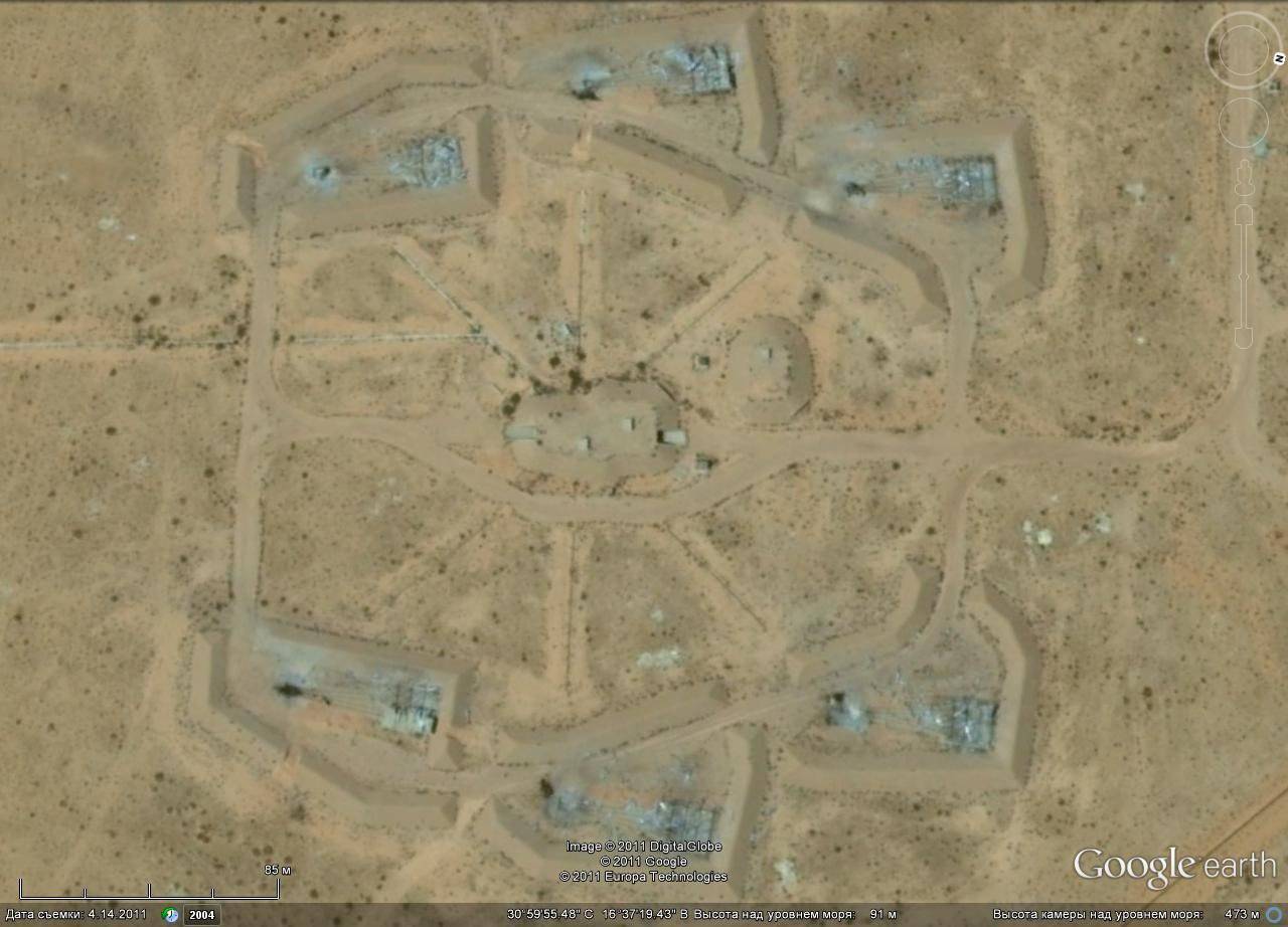
Positions of the C-75 air defense system before the air strike in the Sabha area
The same position after the air strike

Destroyed Libyan low-altitude air defense system С-125
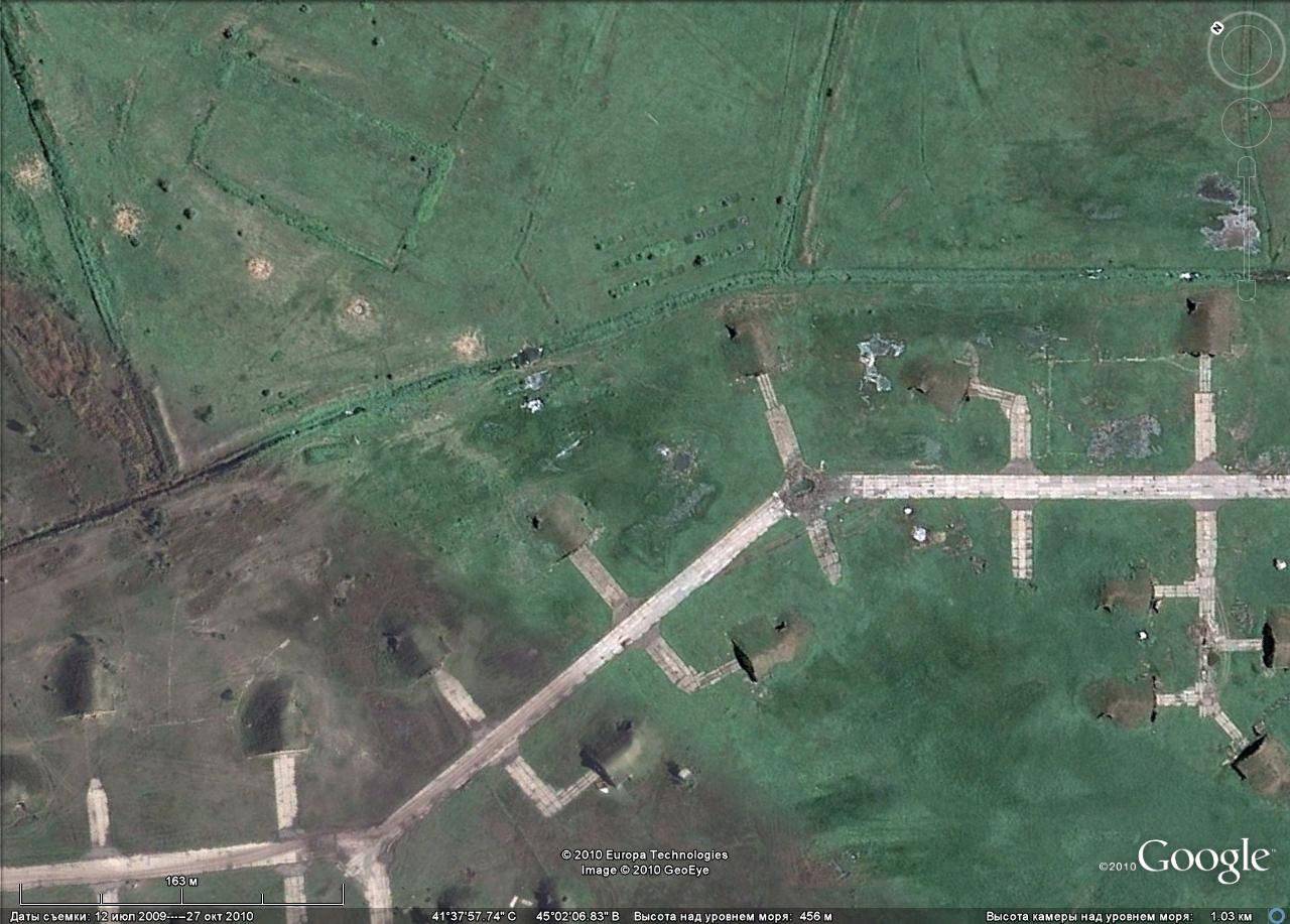
The area of the South Ossetian conflict, which was under close observation from space by civilian and commercial satellites of highly detailed imagery, not to mention the military satellites that are armed with at least 10 from various countries, was no exception.

Tskhinval, destroyed peacekeepers base
Tskhinval, what is left of the parliament building
During the confrontation of 2008, Russian aviation exposed Georgian troops in the conflict zone and various military and strategic objects deep in the territory of Georgia. The proportion of high-precision munitions in these strikes was relatively small. Used mainly by the NAR and free-fall bombs.
Georgia, Vaziani airfield
Georgia, Scamredia airfield
Space and aerial photographs integrated into “digital globes” are becoming a powerful means of obtaining geospatial information, an alternative to classical geographical maps. Already, the cost of new geoproducts is many orders of magnitude lower than the cost of "classic" maps. Unfortunately, our country lags far behind in this direction. Domestic grouping of satellites engaged in shooting in high resolution is not very numerous. It is unlikely that satellite images obtained with the help of the domestic Resurs-DK satellite can be freely available. The situation with satellite navigation systems is repeated in many ways, when the provision of GPS navigation services in the civilian market made it possible to quickly recoup the costs of creating a system. Being late for almost 20 years, the authorities are forced to take protectionist measures, almost forcibly introducing the GLONASS system inside the country.
The capabilities of the new systems are already fully realized throughout the world. Without prompt consideration of the latest trends and the creation of satellite systems, designed not just for an abstract survey of the Earth from space, but for quickly obtaining high-quality, metrically reliable and publicly available geodata, the backlog in this area will become critical.
Information