Google Earth - a military secrets debater
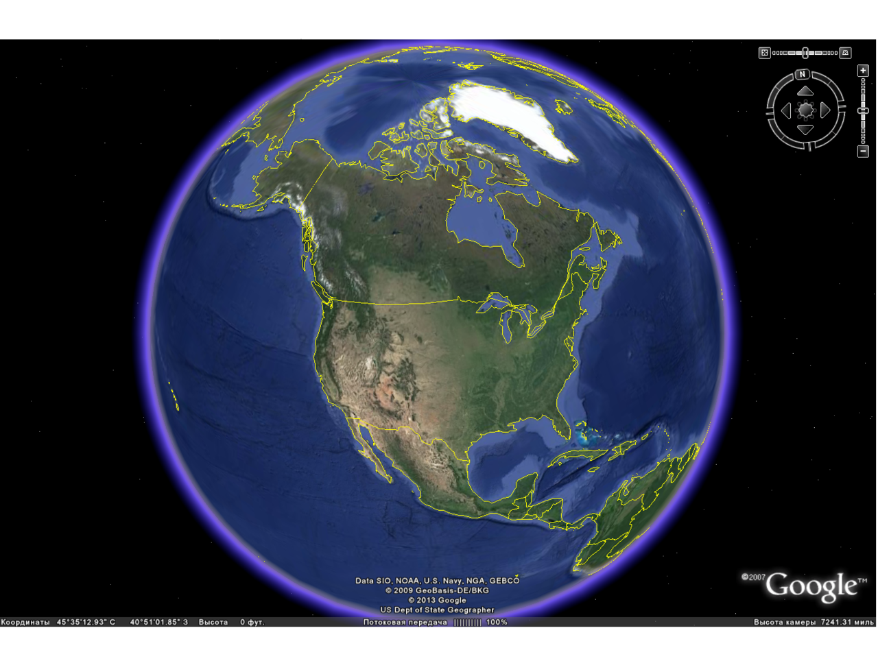
About ten years ago, the Google search engine launched a unique Google Earth project. Many areas of the earth's surface were available for viewing in high resolution using images taken from space.
With the advent of information technology, we have at our disposal high-quality maps that have high resolution, can show relief and perform many other useful functions. All these features are completely free. The Google Earth program is one of the best, perhaps the best application that is free and available for everyone.
For the full work of the program requires an Internet connection, since the size of 16 megabytes has only the program, and the maps themselves are loaded during online viewing.
The image and program layers are saved in the cache, which significantly saves time and traffic. System requirements in Google Earth are very small: 1-2 GHz processor and 1 GB of RAM. But if necessary, the program can work on weaker computers, including mobile phones. In many ways, the download speed depends on the Internet, but the 20-50 Kb / s is quite enough not to wait for a long time when the next section loads.
You can use several types of search in Google Earth. For example, enter the name of a city or a specific street in English or Russian, and the program will indicate the exact location. Also the program can count the way. To do this, you must enter the "names" of the starting and ending points and the program will show the desired path, which will be highlighted in blue and accompanied by inscriptions that help not to get lost.
Google Earth has special layers that show panoramas, galleries, weather, and more. If any layer interferes with normal viewing or there is no need for it, then it can be turned off at any time. In the program, the image quality makes a good impression. In some areas of the survey, objects can be observed from a height of several tens of meters, which made it possible to see the smallest details.
It is possible to view 3d objects, this is especially useful when “traveling” through the streets of cities or viewing large objects.
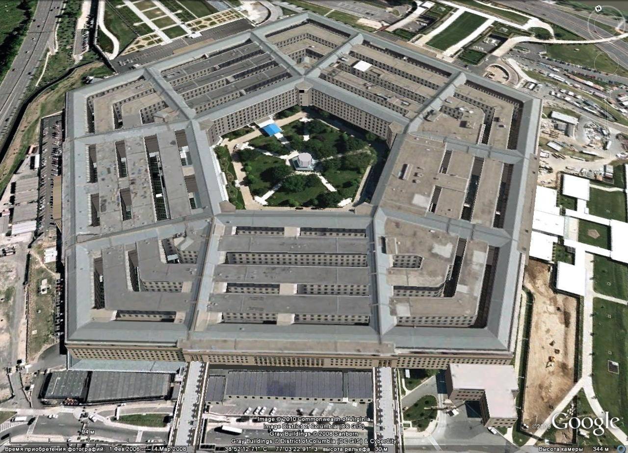
Pentagon

The Statue of Liberty
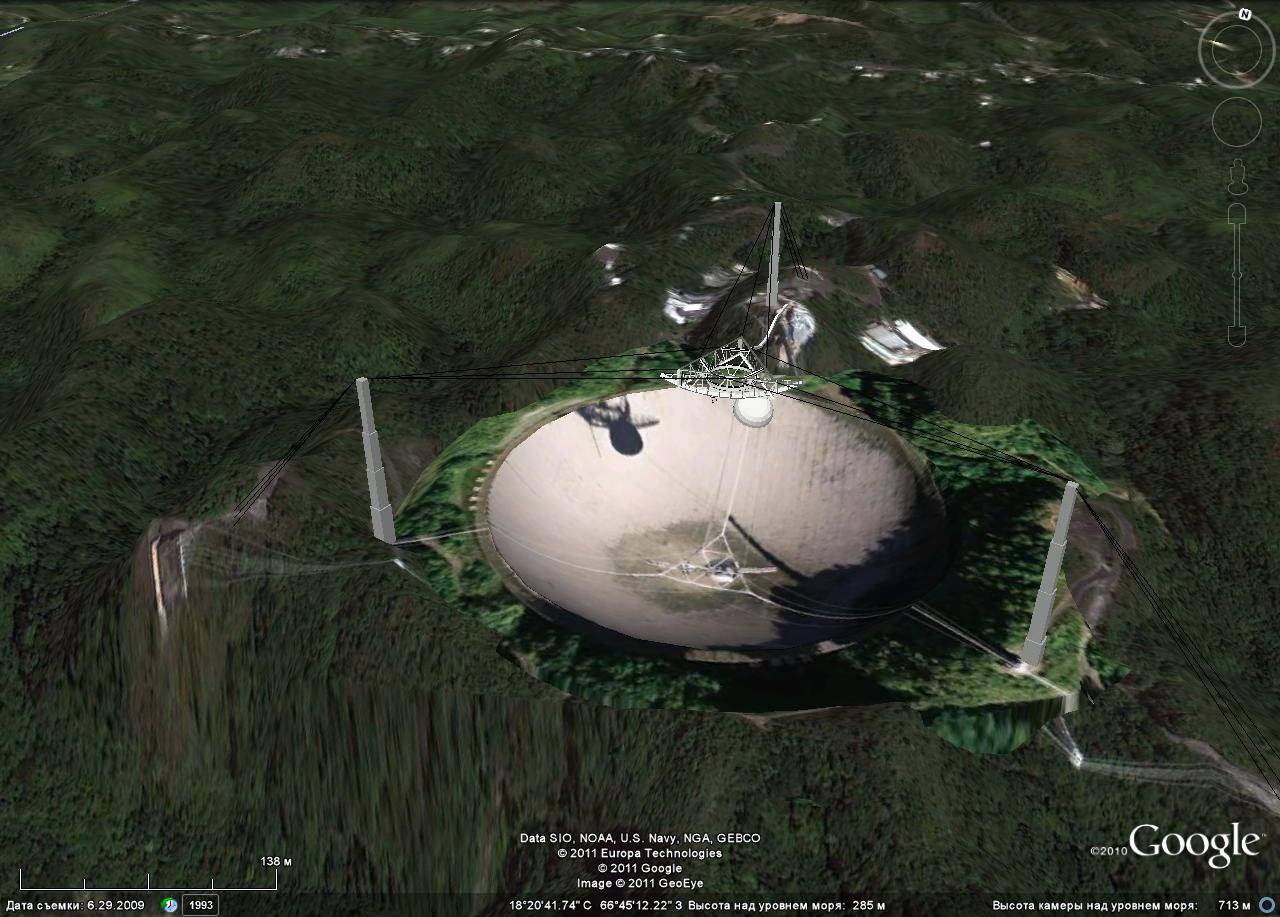
Arecibo Radio Telescope
In addition, satellite images of military facilities around the world are published. Despite the presence of "closed" to view areas, such as the Aberdeen Proving Ground in the United States, most of the military facilities are readily available for viewing. Thus, the images that were previously at the disposal of only the special services and were marched, were possible for anyone to see.
From now on, everyone can, as they say, individually count the number of aircraft, missiles, ships. The fact that recently was the prerogative of the military intelligence of the world, today has become the object of entertainment lovers. Of particular interest are strategic nuclear forces (SNF). The photographs indicating the latitude and longitude, you can consider the details of interest.
As is known, the basis of American strategic forces is ballistic missiles placed on submarines (SLBMs). Each SSBN is equipped with a 24 class Trident 2 SLBM. Currently, the naval component of the US strategic nuclear forces consists of 14 nuclear submarines (SSBNs) with 336 SLBMs.
Due to the ability to conduct long-term patrols while underwater, SSBNs are complex for satellite visual reconnaissance objects.
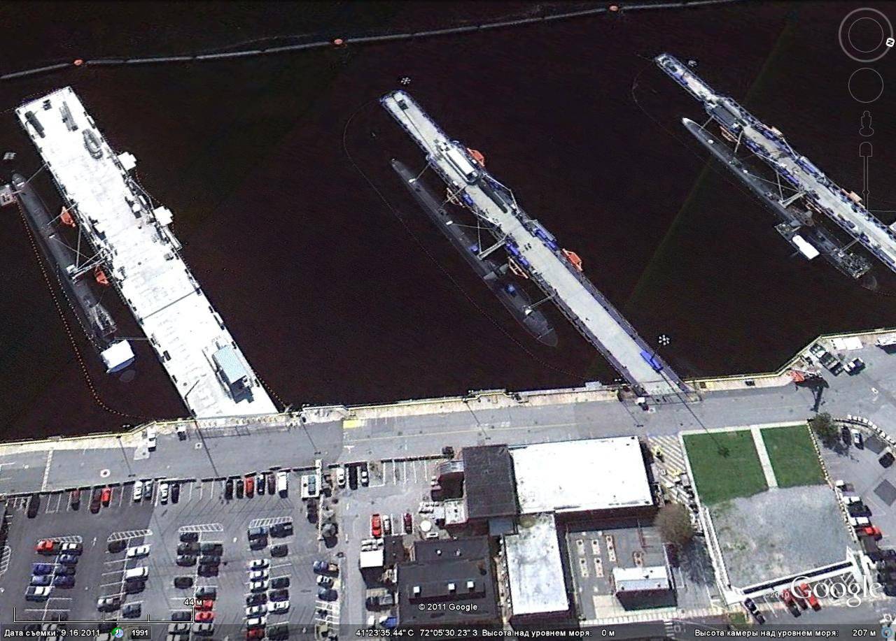
Naval base at Groton
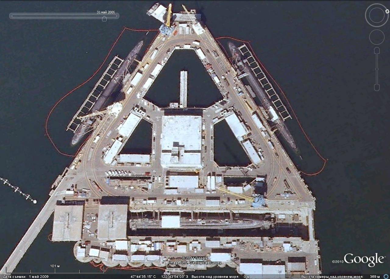
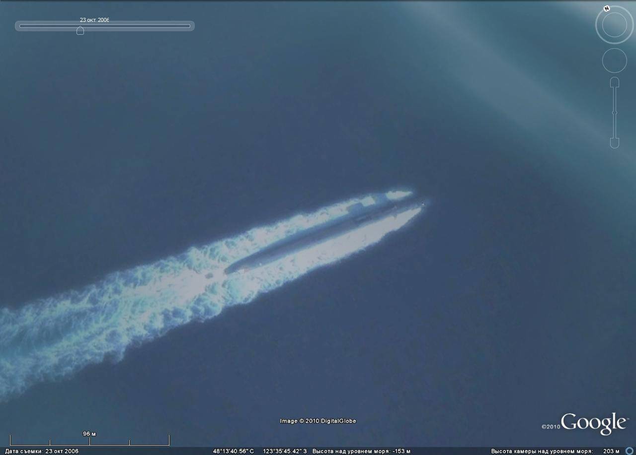
SSBN at berth in Bangor
It is much easier to observe the submarines at berths, docks and disposal points.
The ground component of the US Strategic Nuclear Forces is comprised of strategic missile systems equipped with intercontinental ballistic missiles (ICBMs). Currently deployed to 450 "Minuteman" in the mine launchers (silos).

Baza Malstrom, silo "Minetman"
Aviation the strategic nuclear forces are strategic, or heavy, bombers capable of solving nuclear missions. All strategic bombers have dual-use status: they can strike using both nuclear and conventional weapons.
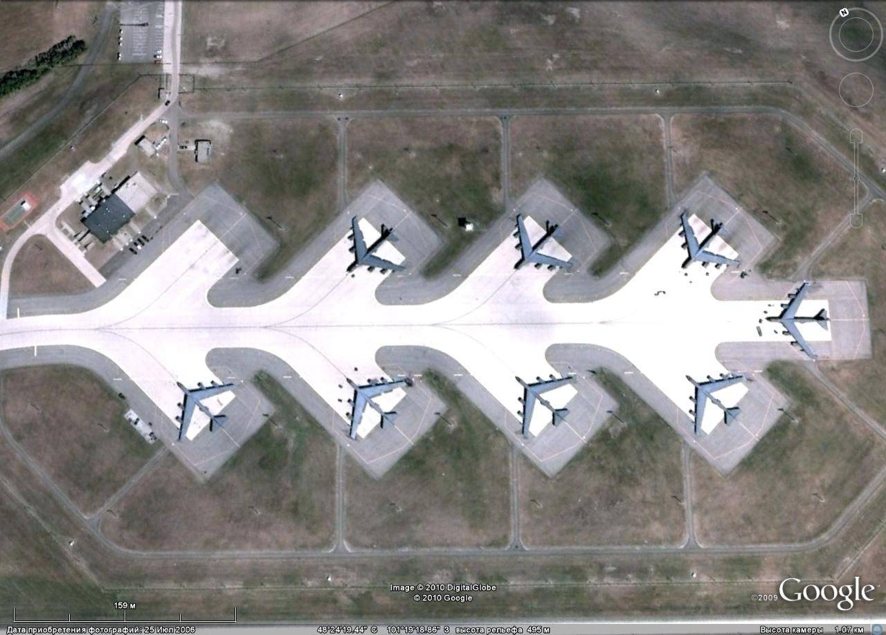
B-52H carrying combat duty at the Mino airbase
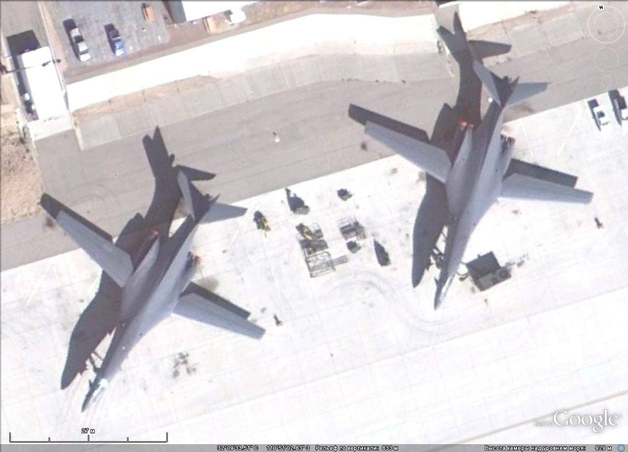
B-1B at Texon Air Base
B-2A at Anderson airbase
The aviation component of the United States SNA at the five aviation bases in the continental United States contained about 230 bombers of three types - B-52H, B-1В and B-2А.
The strategic objects include radar missile defense and space centers.

Radar missile defense, Bale airbase
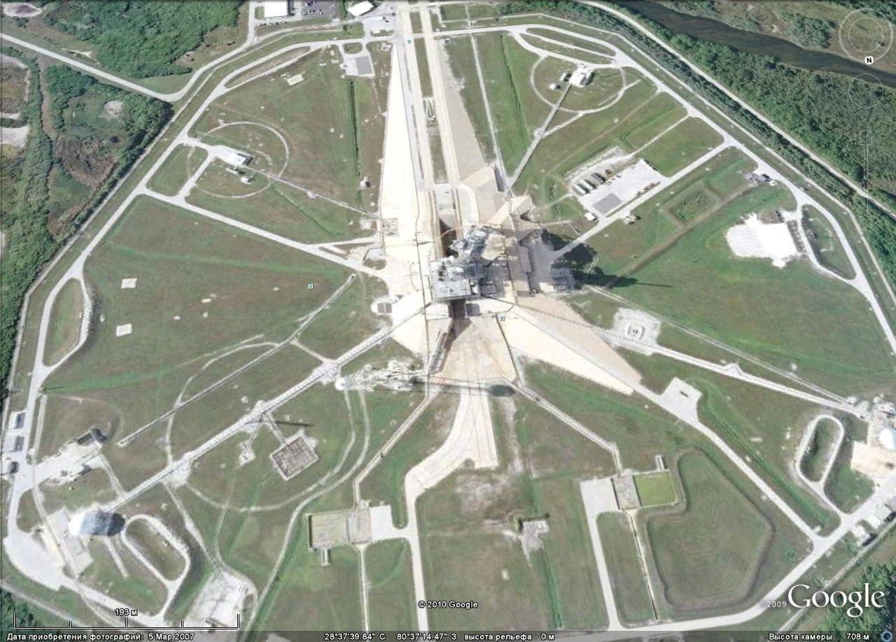
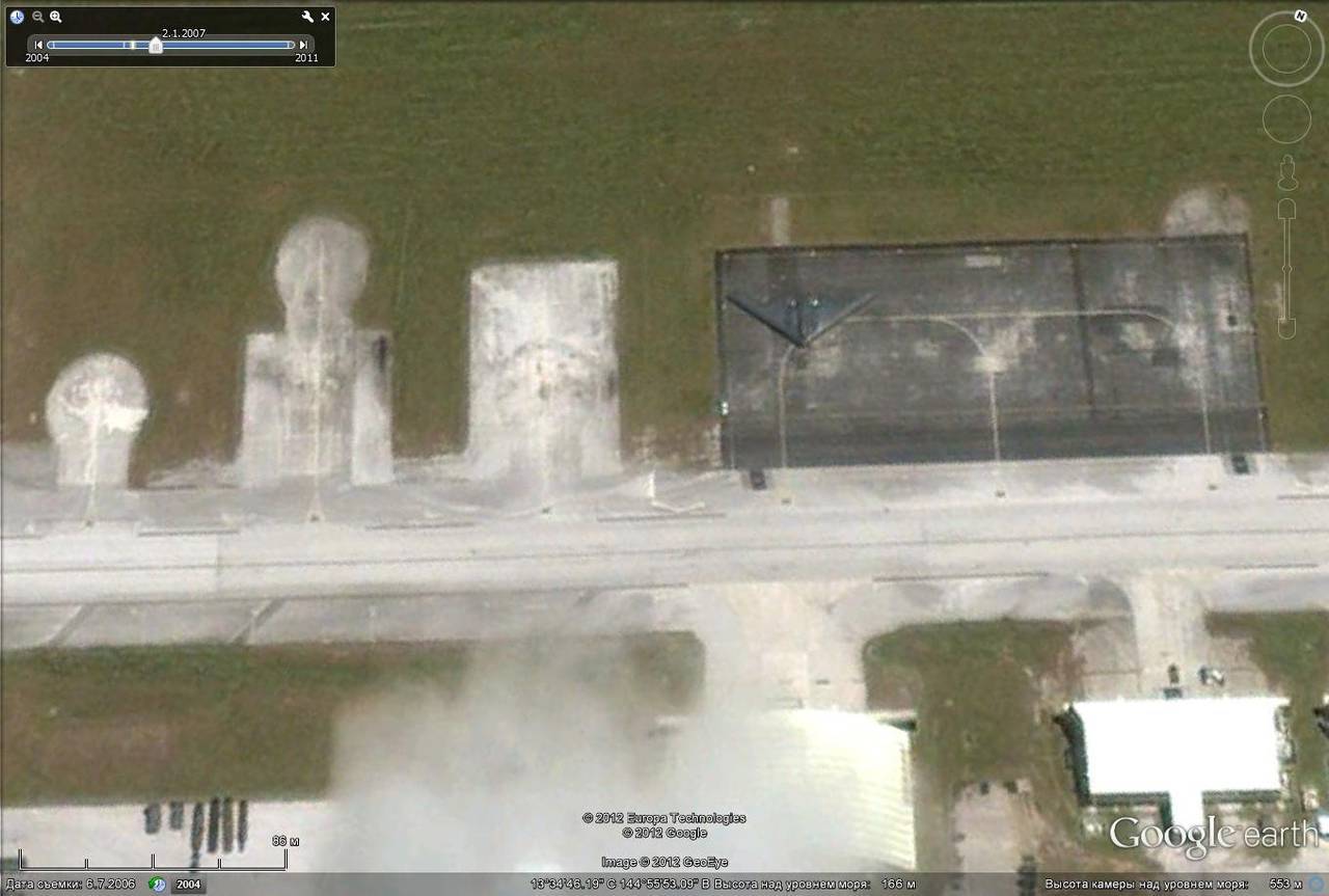
Kennedy Spaceport
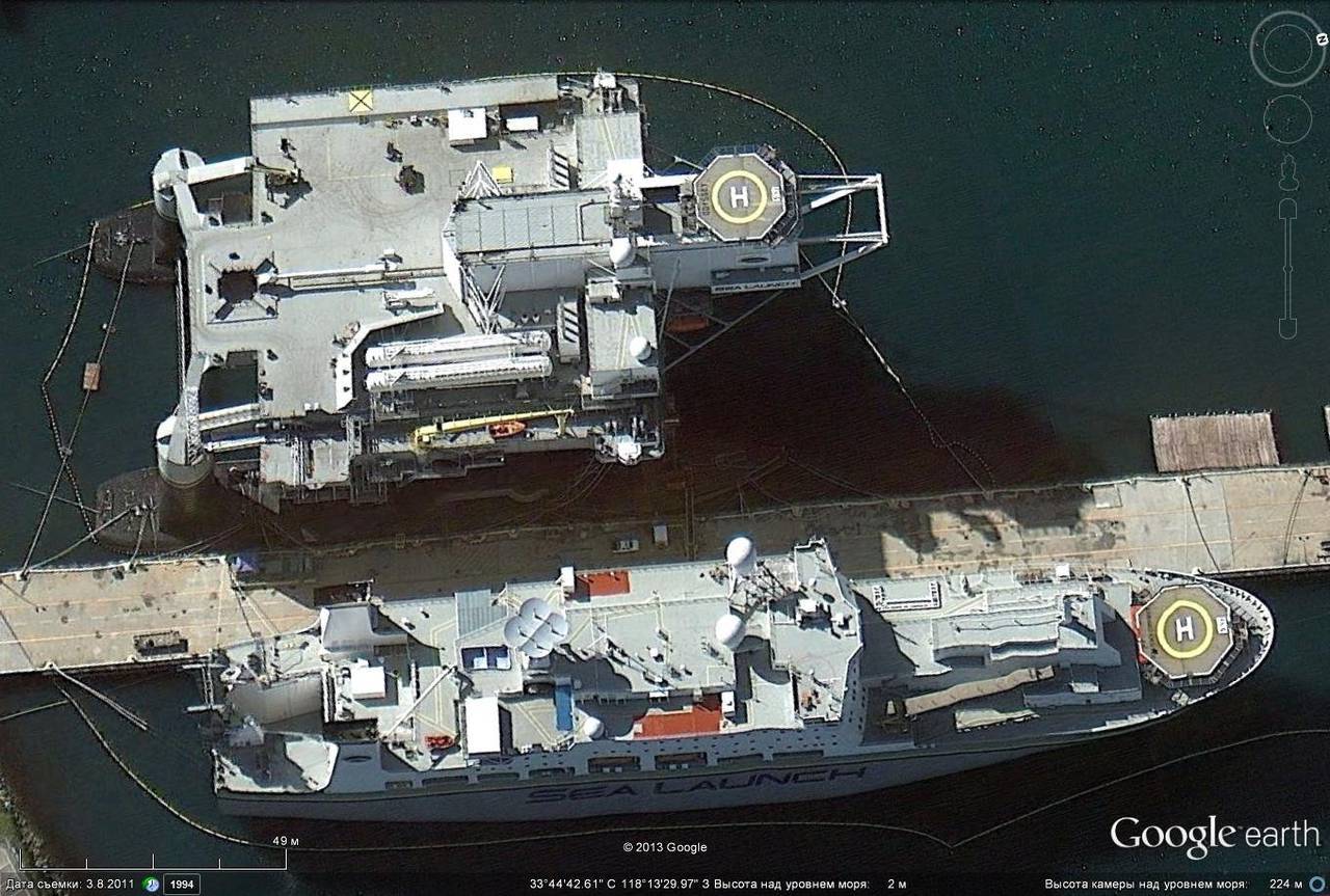
Complex "Sea Launch", Long Beach
As part of the US Navy on 19 March 2013, there were 284 ships and vessels of various types.
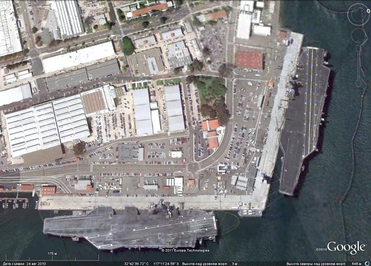
Atomic multipurpose aircraft carriers such as "Nimitz" parked in San Diego
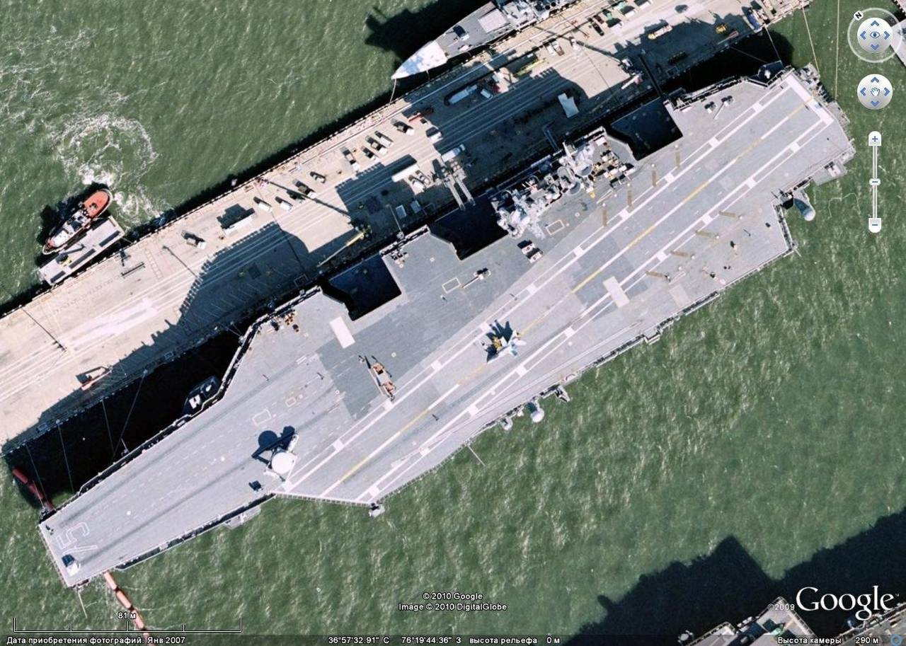
The atomic multi-purpose aircraft carrier "Harry S. Truman" in Norfolk
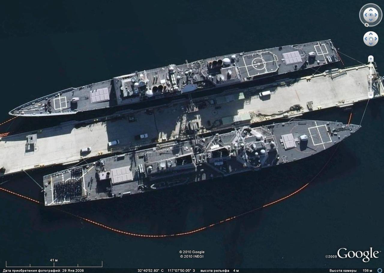
Ticondeur-class missile cruiser and Arleigh Burk destroyer
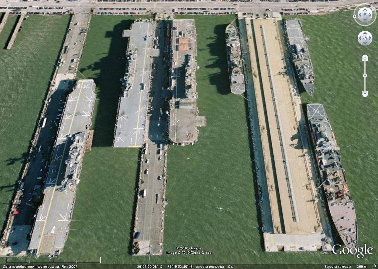
Universal amphibious ships
With the help of Google Earth on the airfields can observe a variety of aircraft.
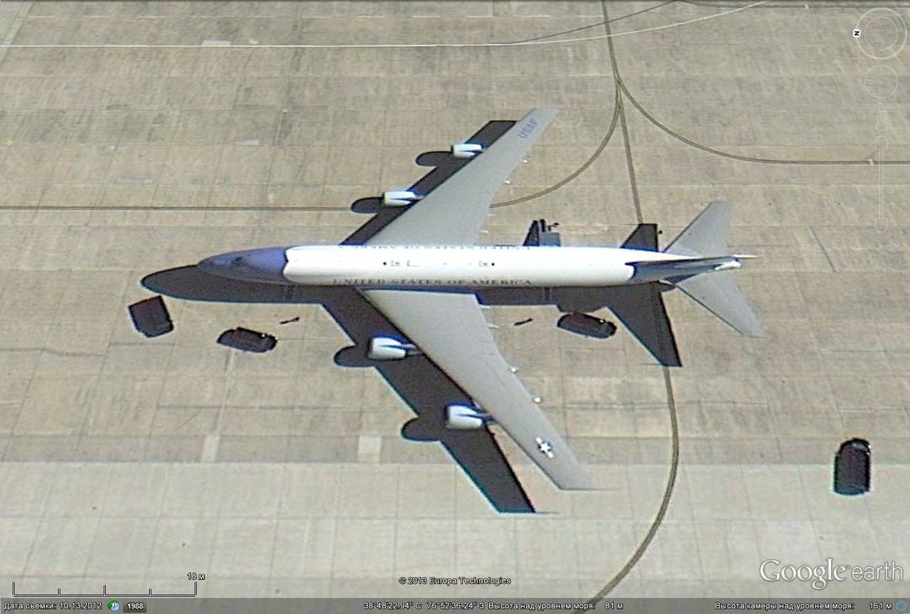
E-4B President's aircraft, at Andrews Avabase
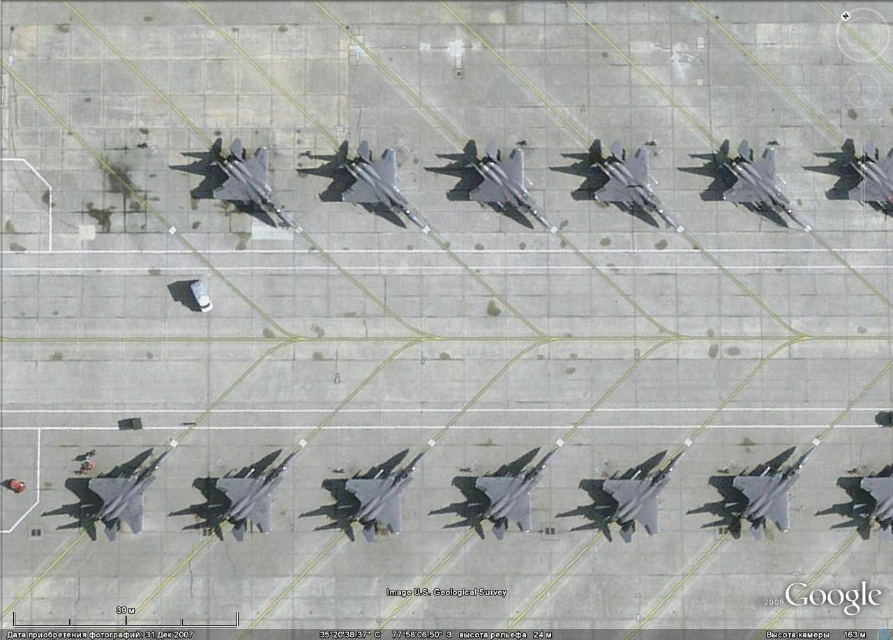
F-15E at Seymour Johnson Air Base
F-5N squadron "Aggressor" in Key West
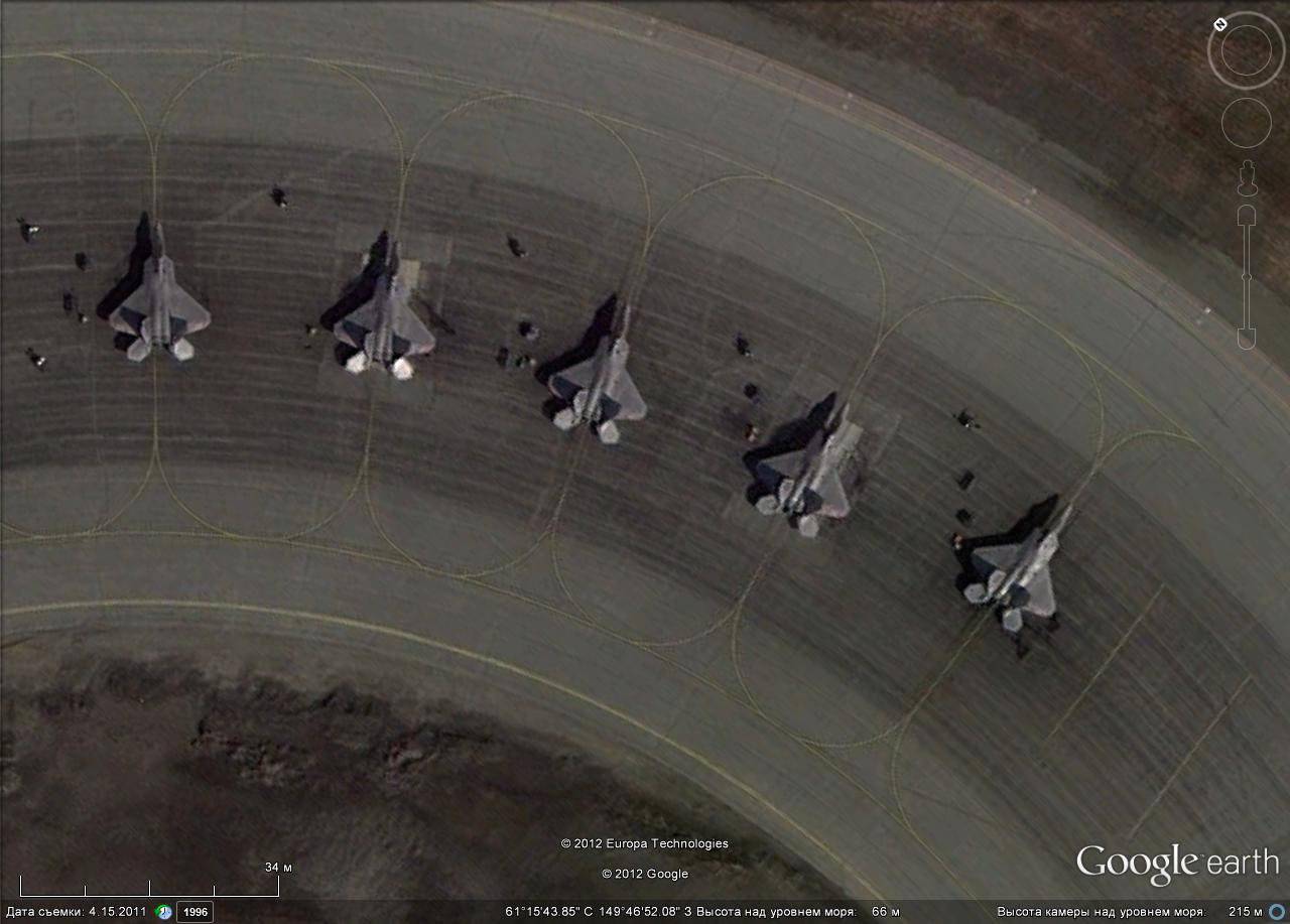
F-22A at Elmendorf-Richadson Air Base
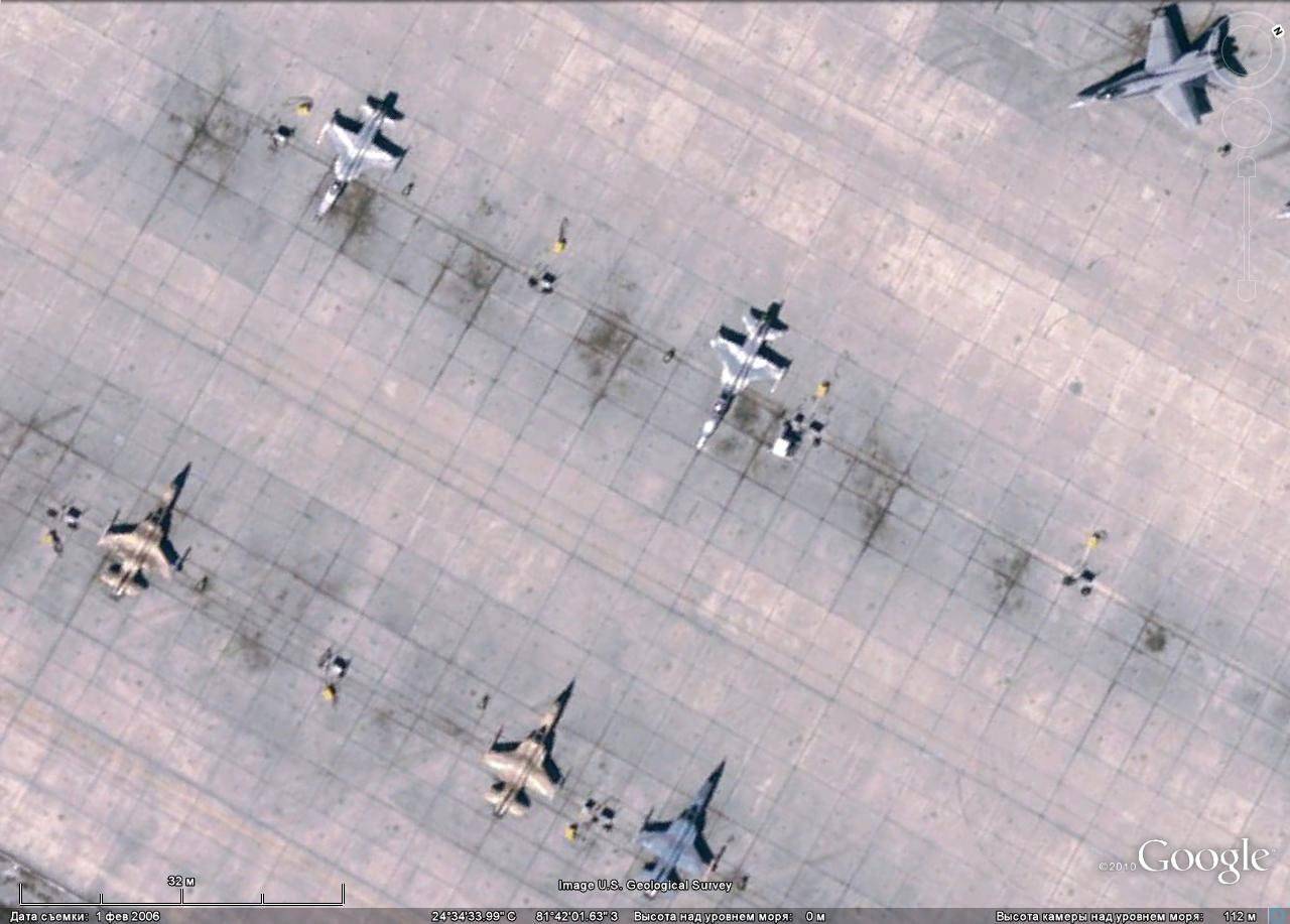
F-16 at Luke airbase
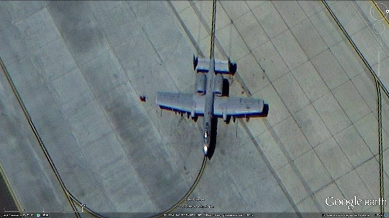
A-10 attack aircraft, Nellis airbase
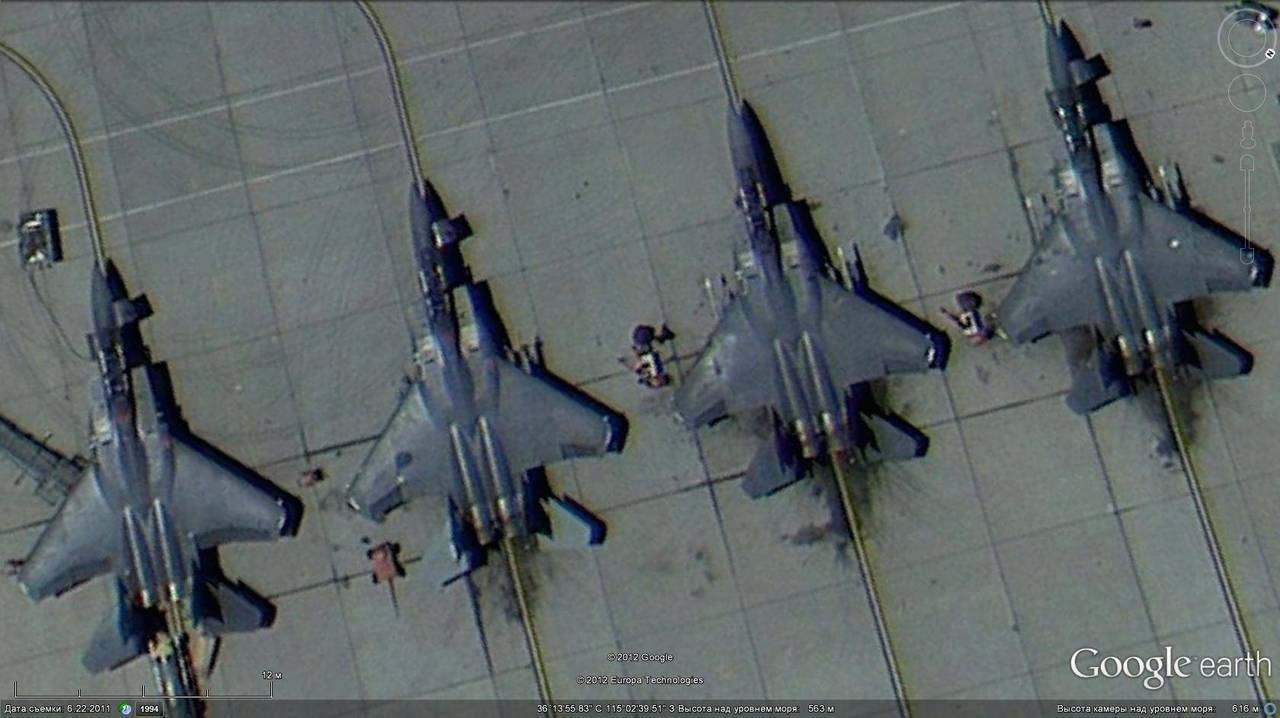
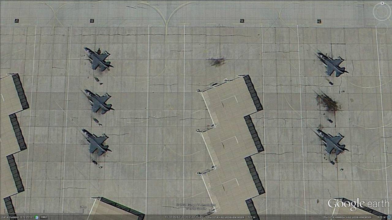
F-15C at Nellis airbase
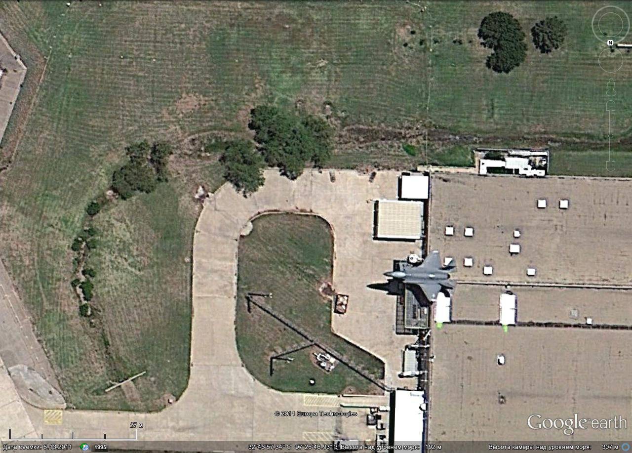
F-35 at Fort Worth factory airfield

OV-10 at Albuquerque airport
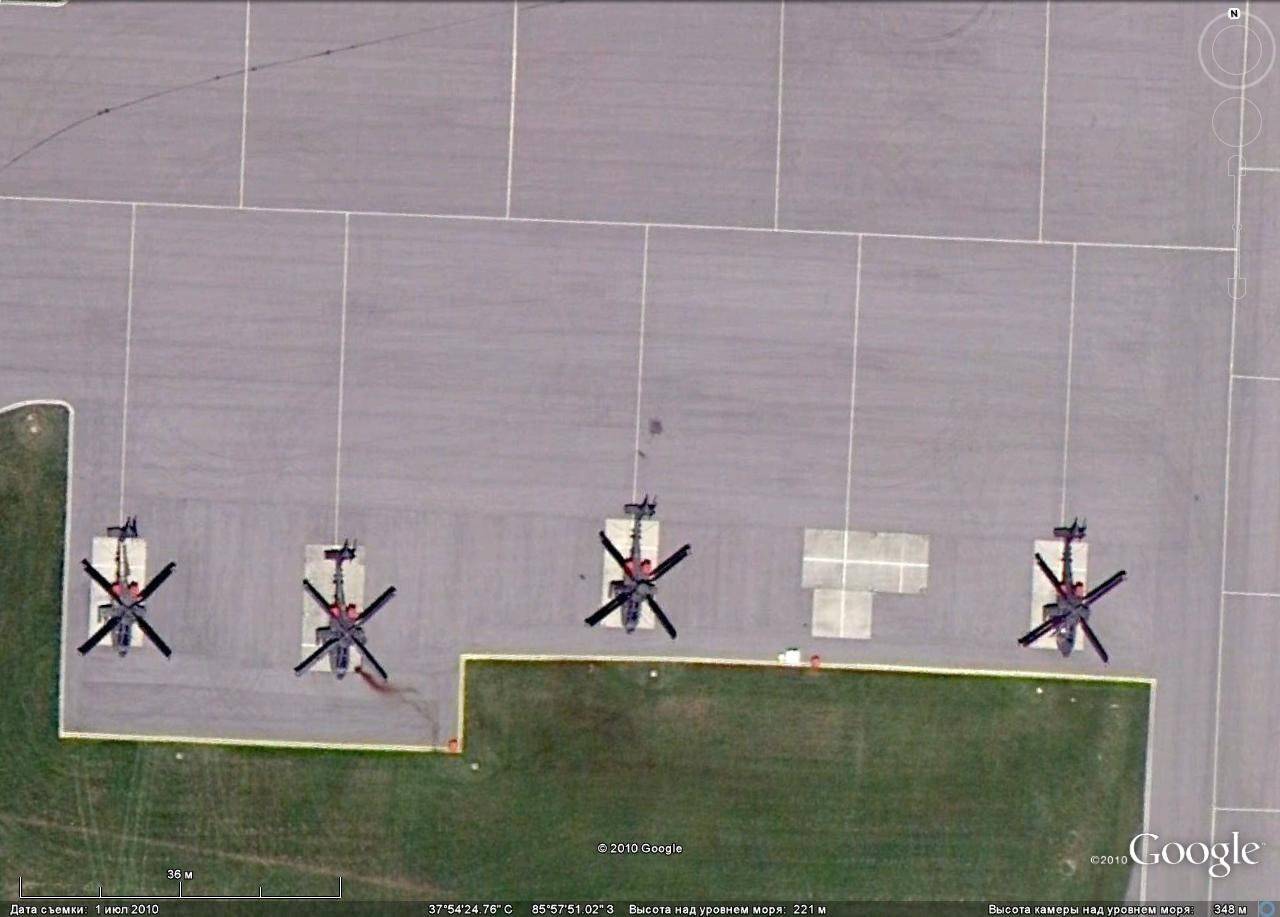
Combat helicopters AN-64, to Fort Knox
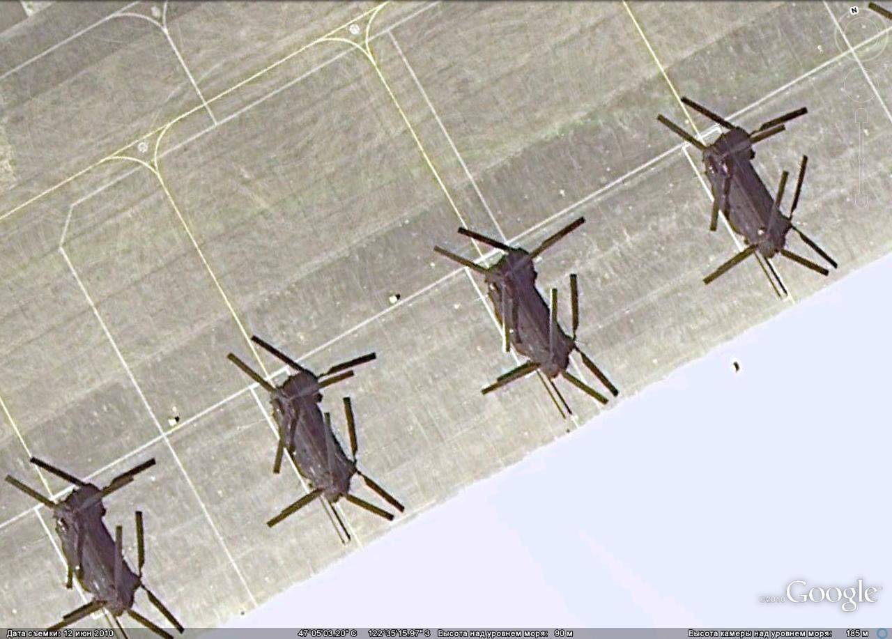
CH-47 transport helicopters at Fort Lewis
Global Hawk UAV at Edwards Air Base
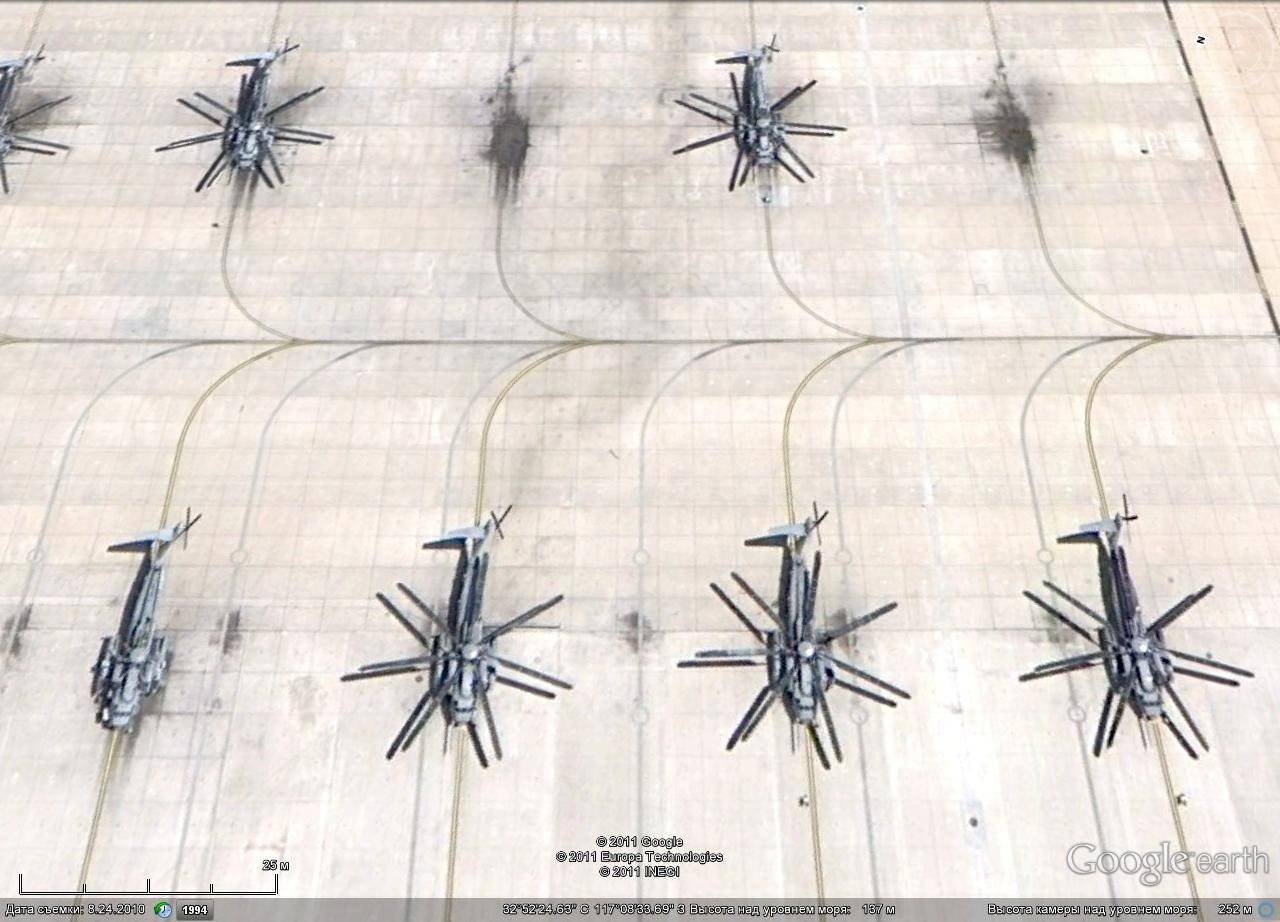
Helicopters of the Marine Corps CH-53 at Miramar Air Base
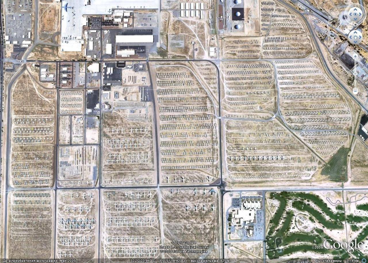
Aviation equipment storage center
Some aircraft can be observed on take-off, in this case, the contours of the aircraft in the picture are not much blurry.
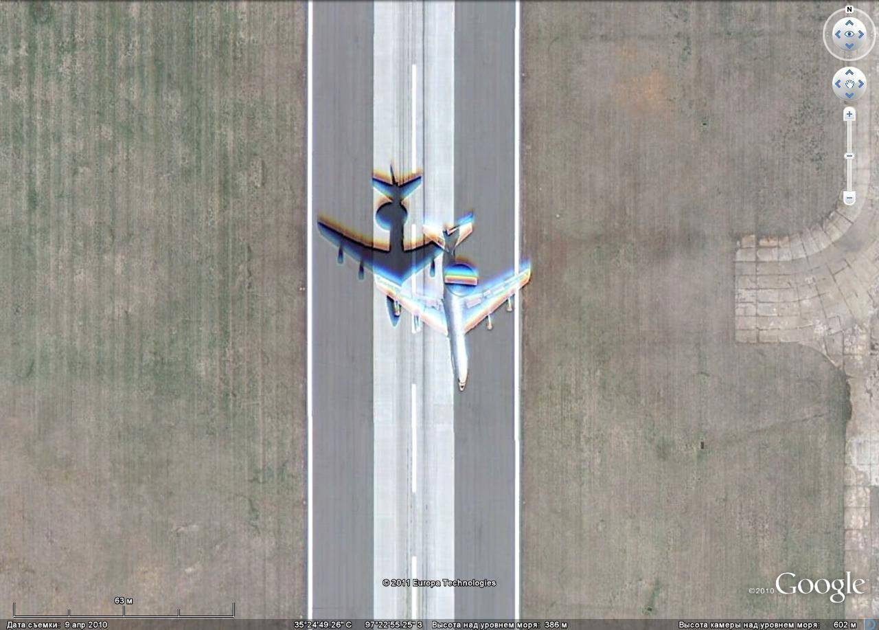
E-3 takes off Avaks
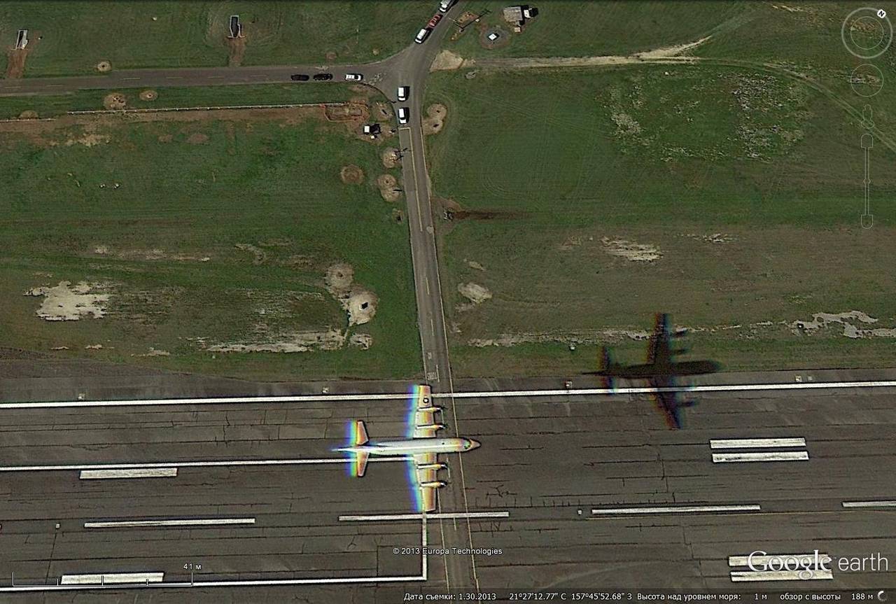
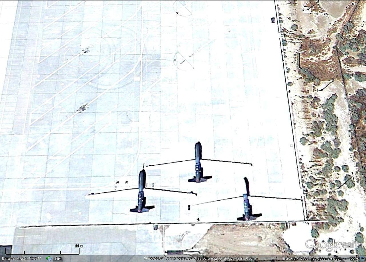
In the air patrol R-3 "Orion"
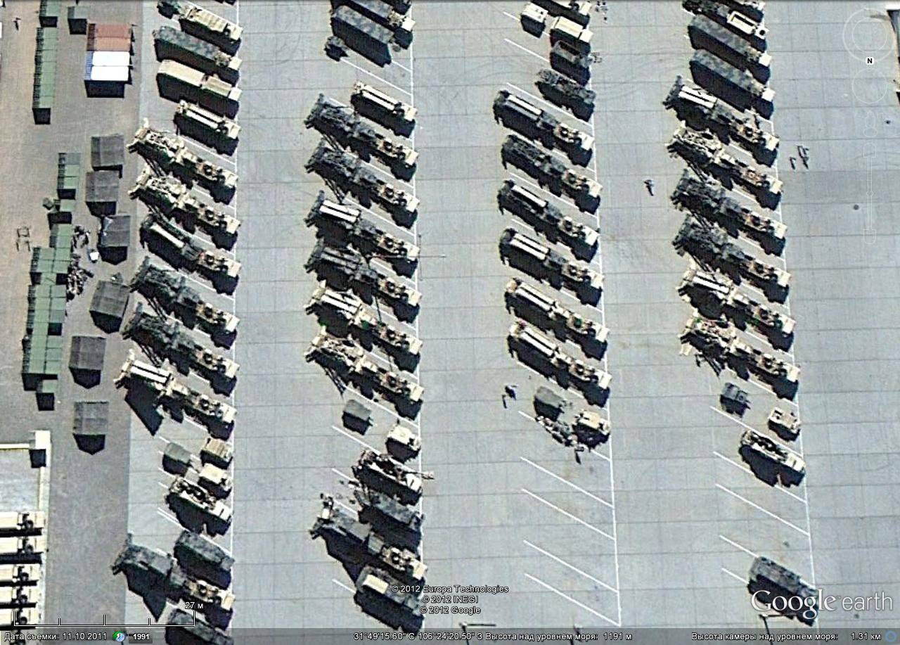
It is easiest to study the techniques of ground forces in places of permanent deployment and storage. Or in the factories of manufacturers.
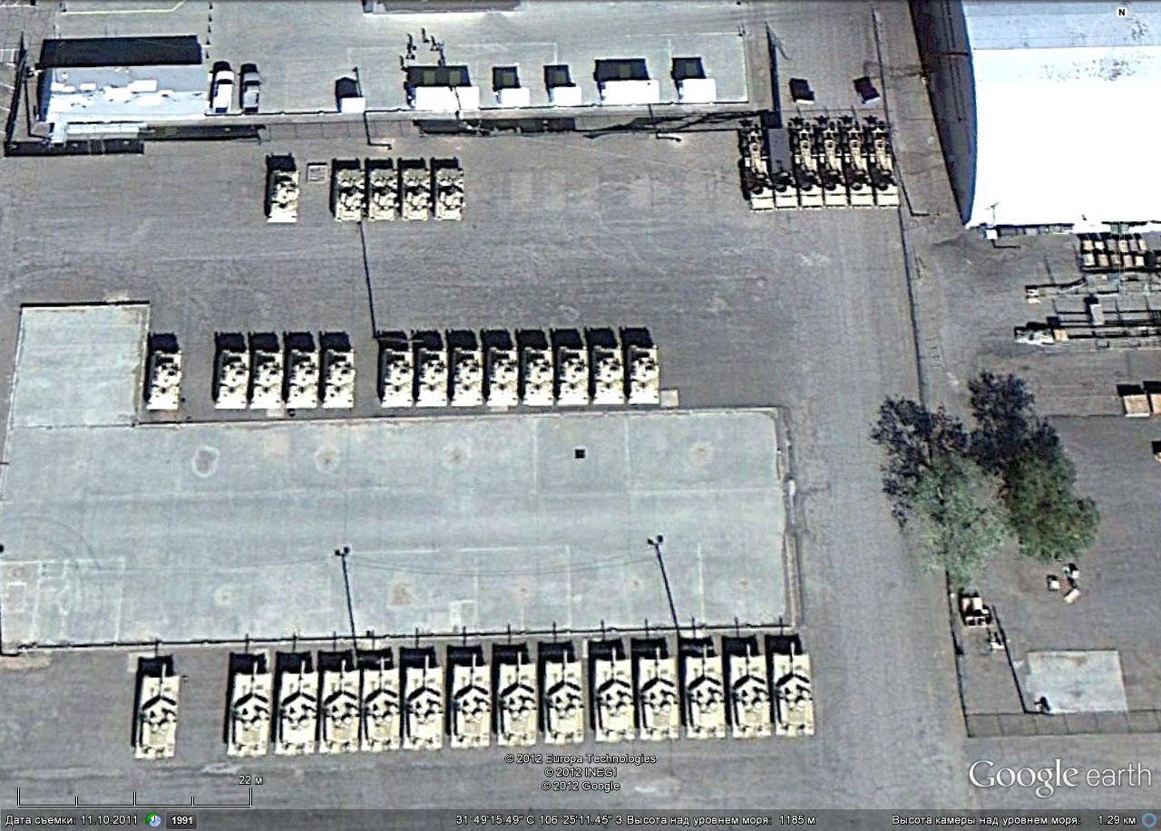
Armored vehicles in Fort Bliss
PU ZRK Patriot in Fort Bliss
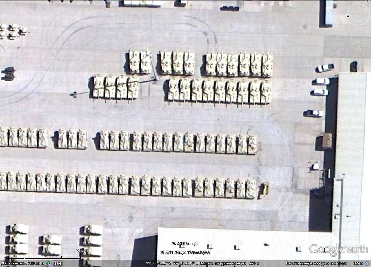
Abrams to Fort Hood
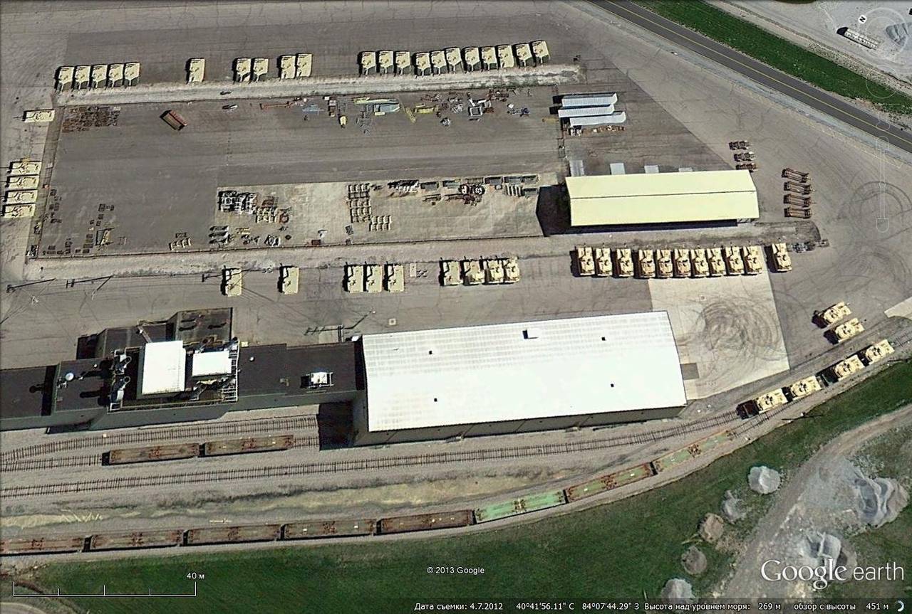
Tank Abrams manufacturing and modernization plant in Lima, Ohio
A very interesting object to study is the nuclear test site covered with numerous craters in the Nevada desert.
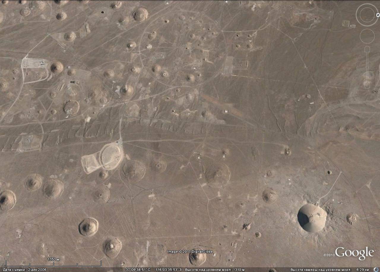
At the site of the Air Force, so everything is covered with funnels.

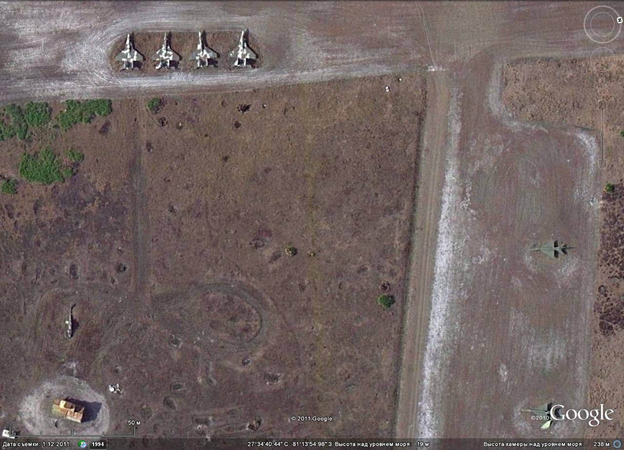
Soviet vehicles were set as targets.
And this is just a fraction of what can be learned with the help of Google Earth about military facilities located in different parts of the world.
Information