Transcaucasian knots of discord
The hallways are still crowded
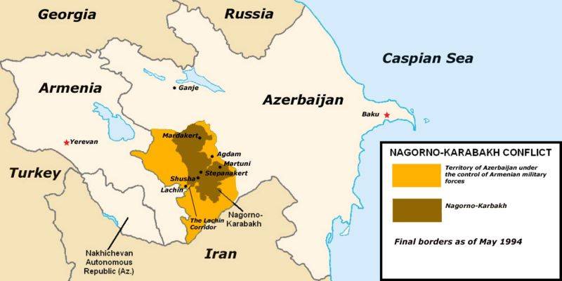
Literally the other day, and right before the eyes of Russian peacekeepers, the conflict region in the southern sector of the border between Armenia and Azerbaijan - Zangezur was supplemented by the Lachin corridor. Baku "activists" blocked this artery, which provides transport and economic ties between Nagorno-Karabakh and Armenia.
This was done not for the first time, but for the first time so seriously and with a clear attitude for a long time. The US State Department and the French Foreign Ministry have already officially called for an end to the blockade. In a word, the conflict situation now covers about half of the length of the border between Armenia and Azerbaijan...
The focus of Azerbaijan, as already reported by "Military Review" (Zangezur corridor. Forty kilometers of geopolitics), on Zangezur is due to Baku's desire to completely control the South Transcaucasus. This region, which almost no one knows as Syunik, is located in the south of Armenia between the Nakhichevan autonomy of Azerbaijan and the rest of its territory.
One of its features is that Syunik includes almost the entire border of Transcaucasia with Iran. And this, accordingly, in the event of occupation, allows to “eliminate” southern Armenia as a transit territory.
Demanded resources
An attempt to occupy, and so far quite successful, only 30 square meters. km in Syunik is probably also due to the fact that very large centers of non-ferrous metallurgy of Armenia are located near this expropriated zone - the Kapan and Kadazaran metallurgical plants. It is no coincidence that Armenian Prime Minister Nikol Pashinyan mentioned this at the recent CSTO summit.
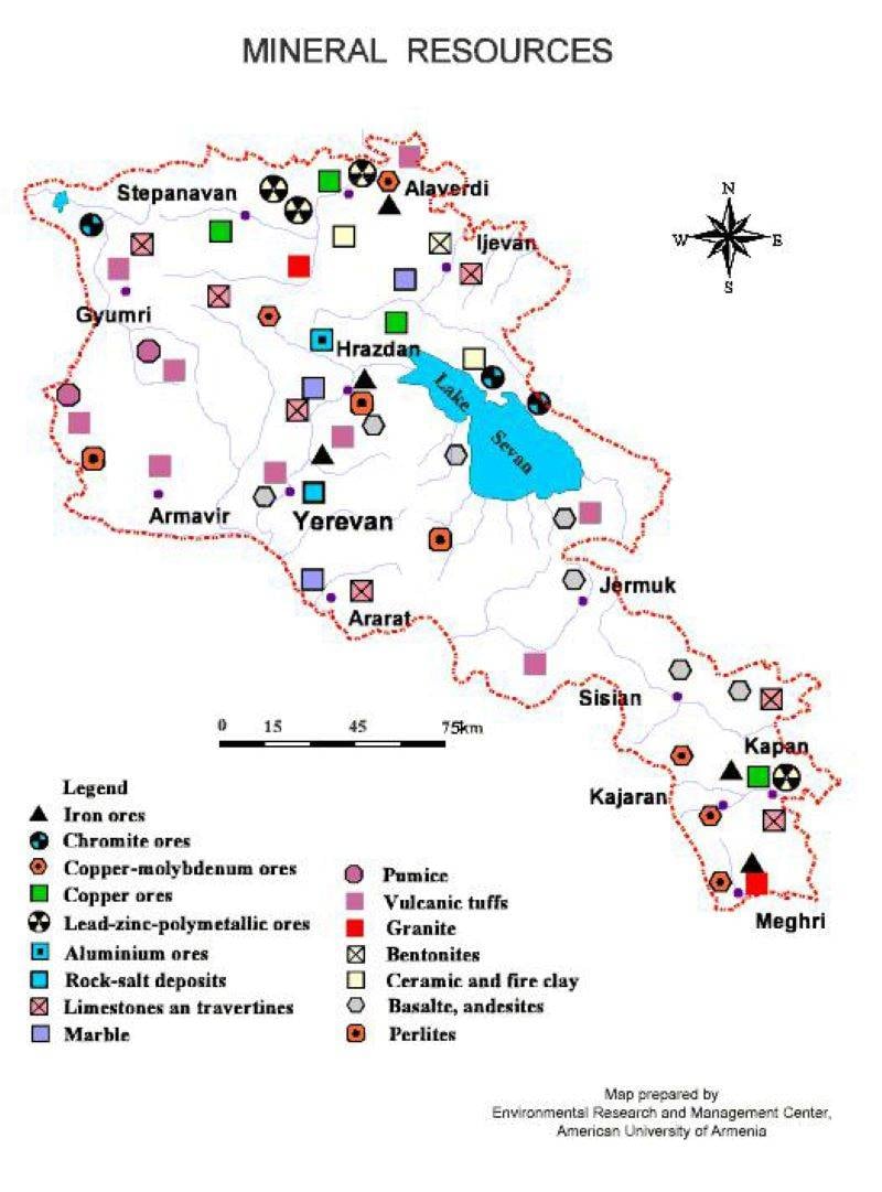
Recall that the total share of these enterprises in the all-Union production of non-ferrous metallurgy by the mid-80s. reached 15%. And near these plants are concentrated significant reserves of high-quality ores of cobalt, vanadium, molybdenum, bismuth, copper, rare earth metals.
The total volume fraction of these reserves in the south of Armenia reached in the 30-80s. 20% in the all-union register of the same resources. But now the level of their actual development in the south of Armenia barely reaches 35%. Moreover, most of these South Armenian deposits are concentrated just near the southern sector of the Armenian-Azerbaijani border.
And including in a new point of discord - near the same 30 square meters. km in Syunik, now controlled by Azerbaijan.
There is no way back
Combines in Kapan and Kajaran have been working since the mid-90s, as they say, neither shaky nor roll. But it is noteworthy that the 40 km railway connecting Kapan with the USSR railway network was built in the early 50s not to the southern Armenian station of Meghri, bordering Iran, but to Azerbaijan.
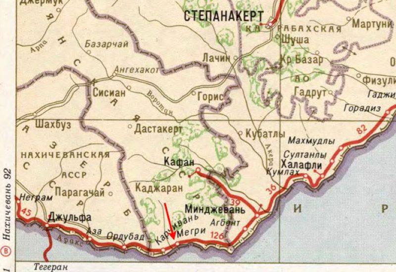
To clarify, the path led to the Azerbaijani station Minjevan on the Transcaucasian Trans-Siberian Railway (Tbilisi - Rustavi - Yerevan - Norashen - Nakhichevan - Julfa - Meghri - Minjevan - Horadiz - Imishli - Baku), passing along the borders of Transcaucasia with Turkey and Iran. Moreover, the line Kapan - Minjevan was managed by the administration of the railways of the Azerbaijan SSR, although about a third of the length of this line is located in Armenia ...
The leadership of the Armenian SSR has repeatedly offered Moscow to reassign this line to Yerevan, but in vain. So, the significant metallurgical capacities of Armenia and the large resources of non-ferrous metal ores in the south of the country were "tied" to the railway network of Azerbaijan.
This line has been inactive since the mid-1990s, just as almost the entire "Transcaucasian Trans-Siberian" has been inactive since the same period. But if a further escalation of the conflict takes place in the same southern Armenian region, it is possible that the Kapan and Kajaran plants, together with the mentioned highways, may simply come under the control of the Azerbaijani side.
Zangezur as an alternative
As for the Azerbaijani corridor to Nakhichevan through the Armenian Zangezur, this is an old story. More precisely, the project of the railway through this region of Armenia between Nakhichevan and central Azerbaijan was developed back in the mid-60s.
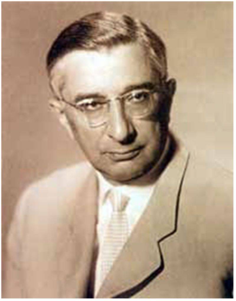
Academician Tigran Sergeevich Khachaturov, head of the Economics Department of the USSR Academy of Sciences, supervised the work (pictured in 1967). A group of Soviet experts led by T.S. Khachaturov proposed the same thing in 1988. That line would become the shortest route between Nakhichevan and central Azerbaijan. The project was tentatively approved by the State Planning Commission and the Ministry of Railways of the USSR.
But, since the route passed through Nagorno-Karabakh, Baku decided that the highway would increase the “gravitation” of this region towards Armenia. And in Yerevan, they feared, as they say, on the contrary: the excessive presence of Azerbaijan in Armenia, thanks to the same steel line.
Therefore, in Yerevan and Baku, in the end, they decided to limit themselves to the aforementioned "Trans-Siberian Railway of Transcaucasia" and the operating highway from Baku, passing through Nagorno-Karabakh and further - Zangezur, to Nakhichevan.
A new aggravation of the situation in the southern Armenian-Azerbaijani border area is capable of forever "redrawing" the resource-economic, and indeed the political map of this region. And hardly in favor of Armenia, one of the few proven allies, at least supporters of Russia...
- Alexey Chichkin, Alexey Podymov
- mavink.com, massispost.com, vpoanalytics.com, en.wikipedia.org
Information