A new automated system for working with topographic maps went to the troops

25
A new automated system for working with topographic maps went to the troops

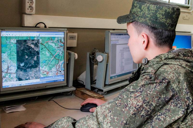
A new automated system for working with topographic maps, 3D models and satellite images of the terrain has begun to arrive in air defense units and formations. Reported by "News" with reference to the Ministry of Defense.

The military department decided to start equipping with a new system, called the "Unified automated system for providing geospatial information" (EASO GPI), from air defense units and formations. The first EASO GPI received the air defense divisions of the Western Military District - the 2nd Red Banner, which protects St. Petersburg and the 32nd named after A.I. Pokryshkina stationed in Kaliningrad.


The system provides "real-time" access to the most accurate geospatial information: electronic maps, satellite imagery and 3D terrain models via a secure "military Internet". Thanks to this, commanders can more accurately select positions or calculate the direction of a possible strike.

The EASO GUI database is centralized and has several levels of databanks intended for commanders of various levels. Only the General Staff has access to the central base, there are bases at the level of districts and armies, divisions and brigades.

The Ministry of Defense emphasizes that current three-dimensional maps will significantly increase the combat effectiveness of air defense units, especially mobile ones. At the same time, it is specified that new digital technologies will not displace traditional paper maps from the practice of troops for a long time, which, in conditions of suppression of electronic means, may remain the only source of information.
  • Ministry of Defense of the Russian Federation
Our news channels

Subscribe and stay up to date with the latest news and the most important events of the day.

25 comments
Information
Dear reader, to leave comments on the publication, you must sign in.
  1. +7
    9 February 2021 09: 46
    At the same time, it is specified that new digital technologies will not displace traditional paper maps from the practice of troops for a long time, which, in conditions of suppression of electronic means, may remain the only source of information.

    Very reasonable. hi
    1. +6
      9 February 2021 09: 49
      Oh, and I wanted this for a long time ...
      The main thing is to a pack of Belomor paper maps have not forgotten how to navigate.
  2. +4
    9 February 2021 09: 47
    Good. And overland people also want it very much. And then just over these open spaces and crawl. For this, tablets with the protection of nun, hotsa, and very nana.
    1. 0
      9 February 2021 10: 19
      And overland people also want it very much.
      And at least the smallest one, even at the level of a company, we put our guys in the navigator.
    2. 0
      9 February 2021 20: 50
      ESU TK - your EVERYTHING! Use it!
  3. -1
    9 February 2021 10: 21
    Cool thing for ours. And we also need one with distorted coordinates for Poles, Tribals, Ukrainians and other Geyropeans.
  4. +2
    9 February 2021 10: 21
    The system provides "real-time" access to the most accurate geospatial information: electronic maps, satellite imagery and 3D terrain models via a secure "military Internet". 

    ...
    What does real time mean in relation to maps?
    1. +3
      9 February 2021 10: 25
      On military maps, in addition to static relief, a lot more is indicated)
      1. 0
        9 February 2021 10: 48
        Semyon Semyonich .. we are talking about objects on the maps. Thanks.
    2. +1
      9 February 2021 10: 28
      What does real time mean in relation to maps?

      really, it's funny to read this in relation to Sasplanet or OfflineMaps
      and the program of "General Staff maps" OzyExplore she changes the landscape,
      1. 0
        9 February 2021 12: 54
        Quote: Dimka75
        What does real time mean in relation to maps?

        really, it's funny to read this in relation to Sasplanet or OfflineMaps
        and the program of "General Staff maps" OzyExplore she changes the landscape,

        SAS gives access to the old archive of the General Staff "five hundred meters" in the raster, which is more than 20 years old. Ozi Exploreer works with a raster of the General Staff, which also needs to be converted and "glued", it does not change any landscape when working with a raster. GIS for the military makes new vector maps like "Garminovsky" or OSM, where it can quickly make changes. This is "real time". hi
        1. +1
          9 February 2021 13: 56
          Everything is clear, I myself do this for personal use. Sas, ozick, osm.
          The question is, what's innovative and automated here?
          1. 0
            9 February 2021 14: 17
            Quote: Dimka75
            Everything is clear, I myself do this for personal use. Sas, ozick, osm.
            The question is, what's innovative and automated here?

            As far as I understand, firstly - the vector "General Staff" maps themselves, and secondly, a program for use with updating the changes on the maps. By the way, I would not mind trying.
    3. 0
      9 February 2021 10: 28
      Quote: Svetlana
      What does real time mean in relation to maps?

      Even in chess you have to be able to think quickly, but here in general there are cards! laughing
    4. +2
      9 February 2021 10: 29
      Quote: Svetlana
      The system provides "real-time" access to the most accurate geospatial information: electronic maps, satellite imagery and 3D terrain models via a secure "military Internet". 

      ...
      What does real time mean in relation to maps?

      Well, for example, three packs of bricks were delivered to me a year ago, in March 2020. I removed the bricks in September 2020. But on the satellite map, these 3 packs are still at home ... laughing
      1. +1
        9 February 2021 10: 35
        But on the satellite map, these 3 packs are still at home ...
        I have already built a house, but I still have one toilet. wassat
        1. HAM
          +5
          9 February 2021 10: 47
          So it is necessary, let the enemies think that you are still there ... laughing
    5. +1
      9 February 2021 11: 22
      I suppose that military satellites and reconnaissance UAVs periodically produce images of certain areas and it is automatically loaded into the EASO GPI. Thus, the system receives fresh data.
      1. +1
        9 February 2021 14: 28
        And also topographers.
    6. +1
      9 February 2021 14: 44
      This means obtaining an operational tactical situation in the combat area! bully
  5. 0
    9 February 2021 11: 17
    This makes me happy.
  6. +7
    9 February 2021 11: 46
    At the same time, it is specified that new digital technologies will not displace traditional paper maps from the practice of troops for a long time, which, in conditions of suppression of electronic means, may remain the only source of information.
    And this, in my opinion, is the most important thing. sad
  7. +8
    9 February 2021 11: 48
    Quote: evgen1221
    Good. And overland people also want it very much. And then just over these open spaces and crawl. For this, tablets with the protection of nun, hotsa, and very nana.

    And when the battery runs out, and there is nothing to charge and there will be nowhere - what shall we do? laughing wink bully hi
    1. +2
      9 February 2021 14: 45
      We will print on a printer! 3D! hi Yes
  8. 0
    9 February 2021 18: 27
    Understood nothing. Will it interfere or not interfere with collecting dead wood?

"Right Sector" (banned in Russia), "Ukrainian Insurgent Army" (UPA) (banned in Russia), ISIS (banned in Russia), "Jabhat Fatah al-Sham" formerly "Jabhat al-Nusra" (banned in Russia) , Taliban (banned in Russia), Al-Qaeda (banned in Russia), Anti-Corruption Foundation (banned in Russia), Navalny Headquarters (banned in Russia), Facebook (banned in Russia), Instagram (banned in Russia), Meta (banned in Russia), Misanthropic Division (banned in Russia), Azov (banned in Russia), Muslim Brotherhood (banned in Russia), Aum Shinrikyo (banned in Russia), AUE (banned in Russia), UNA-UNSO (banned in Russia), Mejlis of the Crimean Tatar people (banned in Russia), Legion “Freedom of Russia” (armed formation, recognized as terrorist in the Russian Federation and banned), Kirill Budanov (included to the Rosfinmonitoring list of terrorists and extremists)

“Non-profit organizations, unregistered public associations or individuals performing the functions of a foreign agent,” as well as media outlets performing the functions of a foreign agent: “Medusa”; "Voice of America"; "Realities"; "Present time"; "Radio Freedom"; Ponomarev Lev; Ponomarev Ilya; Savitskaya; Markelov; Kamalyagin; Apakhonchich; Makarevich; Dud; Gordon; Zhdanov; Medvedev; Fedorov; Mikhail Kasyanov; "Owl"; "Alliance of Doctors"; "RKK" "Levada Center"; "Memorial"; "Voice"; "Person and law"; "Rain"; "Mediazone"; "Deutsche Welle"; QMS "Caucasian Knot"; "Insider"; "New Newspaper"