Cruise missile navigation methods
Given the experience of combat use of cruise missiles, covering six and a half decades, they can be considered as a mature and well-proven technology. During their existence, there has been a significant development of technologies used in the creation of cruise missiles, covering the airframe, engines, means of overcoming air defense and navigation systems.
Thanks to the creation technology, the airframe of the rocket became more and more compact. Now they can be placed in the internal compartments and on the external hangers of the aircraft, shipboard launchers of pipe type or torpedo tubes of submarines. Engines changed from simple Pulsejet through turbojet and liquid-fuel rocket engines or ramjet engines (ramjet) to the current combination turbojet engines for subsonic tactical cruise missiles turbofan subsonic strategic cruise missiles and ramjet engines or mixed turbojet / rocket designs for supersonic tactical cruise missiles.
Means of overcoming air defense arose in the 1960-ies when the air defense system gained greater efficiency. These include low altitude with rounding of the terrain or rocket flight at extremely low altitude above the sea surface in order to hide from the radar and more and more often a form that increases stealth and radio absorbing materials designed to reduce radar visibility. Some Soviet cruise missiles were also equipped with defensive jamming transmitters designed to disrupt the interception of anti-aircraft missile systems.
Finally, during this period, the cruise missile navigation system developed and diversified considerably.
Cruise missile navigation problems
The main idea of all cruise missiles is that weapon can be launched into a target out of the range of the enemy's air defense systems, in order not to subject the launch platform to a counter attack. This creates serious design problems, the first of which is to force the cruise missile to move safely up to a thousand kilometers into close proximity to the intended target - and as soon as it is in the immediate vicinity of the target, provide the warhead with accurate targeting to produce the planned military effect.
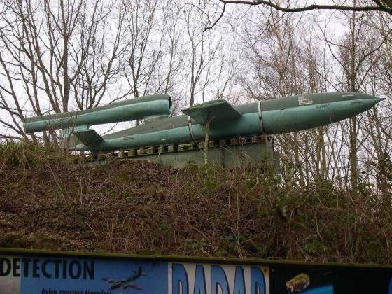
The first combat cruise missile FZG-76 / V-1
The first combat cruise missile was the German FZG-76 / V-1, more than 8000 of which was used, mostly on targets in the UK. Judging by modern standards, its navigation system was quite primitive: the autopilot based on the gyroscope kept the course, and the anemometer distance to the target. The rocket was set at the intended course before launching and the estimated distance to the target was set on it and as soon as the odometer indicated that the rocket was above the target, the autopilot took it to a steep dive. The rocket had an accuracy of about a mile and that was enough to bomb large urban targets such as London. The main purpose of the bombing was to terrorize the civilian population and distract British forces from offensive operations and send them to perform air defense tasks.
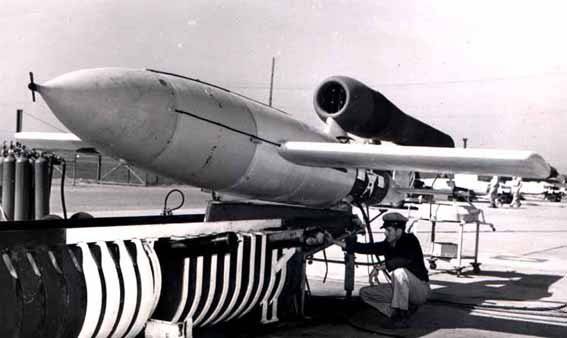
The first American cruise missile JB-2 is a copy of the German V-1
In the immediate post-war period, the United States and the USSR recreated the V-1 and began developing their own cruise missile programs. The first generation of the theater of operations and tactical nuclear weapons led to the creation of the Regulus cruise missiles of the US Navy, the Mace / Matador series of US air forces and the Soviet series Comet 1 and Comet 20 and the further development of navigation technology. All of these missiles initially use autopilots based on accurate gyroscopes, but also the possibility of adjusting the rocket’s trajectory via radio links so that the nuclear warhead could be delivered as accurately as possible. A slip of hundreds of meters may be enough to reduce the overpressure produced by a nuclear warhead was below the lethal threshold of fortified targets. In the 1950-ies, the first conventional post-war tactical cruise missiles entered service, primarily as an anti-ship weapon. While on the marching section of the trajectory, guidance was continued on the basis of a gyroscope, and sometimes corrected by radio communications, guidance accuracy on the final portion of the trajectory was provided by a seeker with short-range radar, semi-active in the earliest versions, but soon displaced by active radars. Rockets of this generation usually fly at medium and high altitudes, diving during an attack on a target.

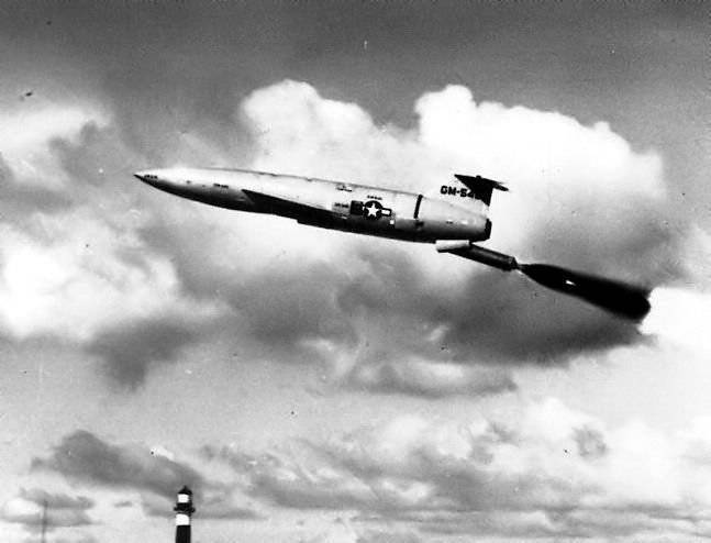
Intercontinental cruise missile Northrop SM-62 Snark
The next important stage in cruise missile navigation technology followed the adoption of Northrop SM-62 Snark ground-based intercontinental cruise missiles, designed for autonomous flight over the polar regions to attack large nuclear warheads of targets in the Soviet Union. Intercontinental distances presented to the designers a new challenge - to create a rocket capable of hitting targets at a distance of ten times more than earlier cruise missiles could do. A proper inertial navigation system using a gyro-stabilized platform and accurate accelerometers to measure the movement of a rocket in space, as well as an analog computer used to accumulate measurements and determine the position of the rocket in space, was installed on Snark. However, a problem soon emerged, the drift in the inertial system was too great for operational use of the rocket, and the errors of the inertial positioning system turned out to be cumulative - thus, the positioning error accumulated with each hour of flight.
The solution to this problem was another device designed to perform precision measurements of the geographic position of the rocket on the flight path of its flight and capable of correcting or “tying” errors generated in the inertial system. This is a fundamental idea and today remains central to the design of modern guided weapons. Thus, the accumulated errors of the inertial system are periodically reduced to the error of the positional measuring device.
Martin Matador cruise missile
To solve this problem, an astronavigation system or star orientation, an automated optical device that performs angular measurements of the known position of the stars and uses them to calculate the position of the rocket in space, was used. The astronavigation system proved to be very accurate, but also quite expensive to manufacture and difficult to maintain. It was also required that rockets equipped with this system flew at high altitude to avoid the effect of cloudiness on the line of sight to the stars.
It is less well known that the success of astronavigational systems has generally triggered the development of satellite navigation systems such as GPS and GLONASS. Satellite navigation is based on a similar concept of astronavigation, but artificial Earth satellites in polar orbits are used instead of stars, and artificial microwave signals are used instead of natural light, and pseudo-range measurements are used rather than angular measurements. As a result, this system significantly reduced costs and allowed to determine the location at all altitudes in all weather conditions. Despite the fact that satellite navigation technologies were invented at the beginning of the 1960-s, they became operational only in the 1980-s.
In 1960-ies there have been significant improvements in the accuracy of inertial systems, as well as the cost of such equipment has increased. As a result, this led to conflicting accuracy and cost requirements. As a result, a new technology appeared in the field of cruise missile navigation based on a rocket positioning system by comparing the radar display of the terrain with a reference mapping program. This technology entered service with US cruise missiles in the 1970s and Soviet missiles in the 1980s. The TERCOM technology (digital correlation system with the terrain relief of a cruise missile guidance unit) was used, like the astronavigation system, to reset the total inertial system errors.
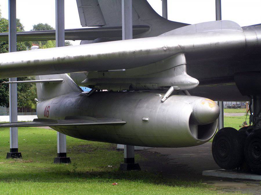
Cruise missile Comet
TERCOM technology is relatively simple in design, although it is complex in details. A cruise missile continuously measures the height of the terrain under the trajectory of its flight using a radar altimeter for this, and compares the results of these measurements with the barometric altimeter readings. The TERCOM navigation system also stores digital elevation maps of the terrain over which it will fly. Then, using a computer program, the profile of the terrain over which the rocket flies is compared with the stored digital elevation map in order to determine their best fit. Once the profile is matched with the database, the position of the rocket on the digital map can be accurately determined, which is used to correct the cumulative errors of the inertial system.
TERCOM had a huge advantage over astronavigational systems: it allowed cruise missiles to fly at the extremely low altitude necessary to overcome enemy air defenses, it turned out to be relatively cheap in production and very accurate (up to ten meters). This is more than enough for a kiloton nuclear warhead 220 and enough for a 500 conventional kilogram warhead used against many types of targets. Yet TERCOM was not without flaws. The rocket that was supposed to fly over a unique rolling area, easily comparable to the height profile of digital maps, had excellent accuracy. However TERCOM proved ineffective over the water surface, above the seasonally variable terrain, such as sand dunes and terrain with various seasonal radar reflectivity such as Siberian Tundra and boreal forest where snow may change the height of the terrain or hide its features. The limited memory capacity of rockets has often made it difficult to store enough map data.
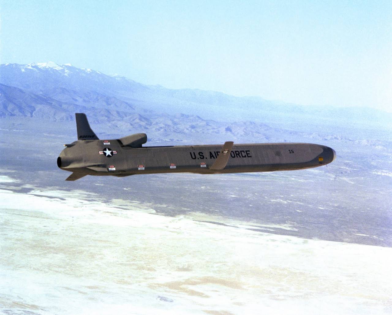
Boeing AGM-86 CALCM cruise missile
Being sufficient for the Tomahawk RGM-109A Navy and the AGM-86 ALCM Air Force equipped with nuclear warheads of the KR, TERCOM was clearly not sufficient to destroy individual buildings or structures with a conventional warhead. In this regard, the US Navy equipped TERCOM Tomahawk RGM-109C / D cruise missiles with an additional system based on the so-called display object correlation technology with its reference digital image. This technology has been used in 1980-ies on ballistic missiles Pershing II of, Soviet KAB-500 / 1500Kr and American high-precision bombs DAMASK / JDAM, as well as the recent Chinese anti controlled missile system designed to counter aircraft carriers.
When correlating the display of an object, a camera is used to fix the terrain in front of a rocket, and then the information from the camera is compared with a digital image obtained using satellites or aerial reconnaissance and stored in the rocket’s memory. Measuring the angle of rotation and displacement required for the exact coincidence of two images, the device is able to very accurately determine the missile position error and use it for error correction of inertial and TERCOM navigation systems. The digital correlation unit of the DSMAC cruise missile guidance system used on several KR units Tomahawk were really accurate, but had side operational effects similar to TERCOM, which needed to be programmed to fly the rocket over easily recognizable terrain, especially in the immediate vicinity of the target. In the 1991-th year, during Operation Desert Storm, this has led to a number of road junctions in Baghdad have been used as such bindings, which in turn allowed the Defense Forces Saddam located there, and anti-aircraft batteries to shoot down a few Tomahawks. Like the TERCOM, the digital correlation unit of the cruise missile guidance system is sensitive to seasonal variations in the contrast of the terrain. Tomahawks equipped with DSMAC also carried flashlights to illuminate the terrain at night.
In 1980, the first GPS receivers were integrated into American cruise missiles. GPS technology was attractive because it allowed the rocket to constantly correct its inertial errors regardless of the terrain and weather conditions, and it also acted the same way both above water and above ground.
These advantages were negated by the problem of poor GPS noise immunity, since the GPS signal is inherently very weak, susceptible to the “re-image” effect (when the GPS signal is reflected from the terrain or buildings) and changes in accuracy depending on the number of received satellites and as they are distributed across the sky. All American cruise missiles today are equipped with GPS receivers and inertial guidance system package, and at the end of 1980-1990's and early-ies technology mechanical inertial system replaced by a cheaper and more accurate inertial navigation system to ring laser gyroscopes.
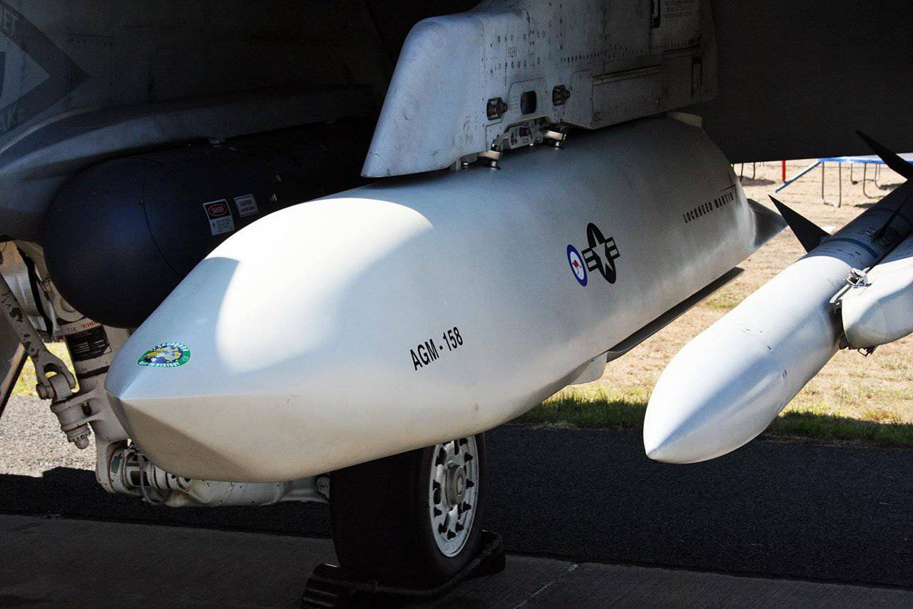
Cruise missile AGM-158 JASSM
The problems associated with basic GPS accuracy are gradually solved by introducing wide-band GPS (Wide Area Differential GPS) methods in which correction signals valid for a given geographical location are broadcast to a GPS receiver over the air (in the case of American missiles, the WAGE -Wide Area GPS Enhancement is used). The main sources of signals of this system are radio navigation beacons and satellites in geostationary orbit. The most accurate technologies of this kind, developed in the USA in the 1990s, can correct GPS errors up to several inches in three dimensions and are accurate enough to get a rocket into the open hatch of an armored vehicle.
The problems with noise immunity and “repeated image” turned out to be the most difficult to solve. They led to the introduction of the technology of so-called “smart” antennas, usually based on “digital beam forming” in software. The idea behind this technology is simple, but as usual difficult in detail. A conventional GPS antenna receives signals from the entire upper hemisphere above the rocket, thus including GPS satellites, as well as enemy interference. A so-called controlled-pattern antenna (Controlled Reception Pattern Antenna, CRPA) using software synthesizes narrow beams aimed at the intended location of GPS satellites, resulting in an antenna that is blind in all other directions. The most advanced designs of antennas of this type produce so-called "zeros" in the antenna pattern aimed at sources of interference to further suppress their influence.

Cruise missileTomagavk
Most of the problems that were widely publicized at the beginning of the production of AGM-158 JASSM cruise missiles were the result of problems with the GPS receiver software, which resulted in the missile losing GPS satellites and falling off its trajectory.
Advanced GPS receivers provide a high level of accuracy and robust noise immunity to GPS sources located on the ground. They are less effective against complex sources of GPS interference deployed on satellites, unmanned aerial vehicles or aerostats.
The latest generation of the American cruise missile uses GPS-inertial guidance system complements its installed in the nose of the missile digital thermal imaging camera, aims to provide opportunities like DSMAC against stationary targets with appropriate software and the possibility of automatic recognition of images and against moving targets, such as antiaircraft rocket systems or rocket launchers. Data lines, as a rule, originate from JTIDS / Link-16 technology, which is being implemented to enable the weapon to be retargeted in the event that a mobile target has changed its location while the rocket is on the march. The use of this function mainly depends on users with intelligence and the ability to detect such movements of the target.
Long-term trends in the development of cruise missile navigation will lead to their greater intelligence, greater autonomy, greater diversity in sensors, increased reliability and lower cost.
Information