Russian Defense Ministry publishes map of new alignment of forces in Syria
The Russian Ministry of Defense at its Online posted an interactive map of the alignment of forces in northern Syria in the area of the Turkish military operation "Source of Peace" with all the changes to date.
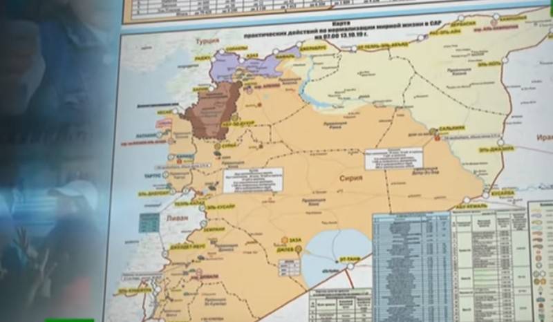
The map posted on the website of the Russian military department reflects the latest information on 17 hours Moscow time. time 15 October 2019 year. The Russian military noted areas formerly controlled by units of the Syrian Democratic Forces and Kurdish military units that had already come under the control of the Syrian government army. According to new data, the city of Manbij, the surroundings of Tabka, an airfield, three bridges and two hydroelectric power stations came under the control of Damascus.
As previously reported, the Syrian government forces and the advancing Turkish army, with the support of the Syrian Free Army of the SSA, are shared by patrols of the Russian military police who had previously arrived in the area.
As previously reported, today the key settlement of Manbij, controlled by the Kurds, came under the control of government forces amid the onset of a pro-Turkish group from the FSA with the support of the Turkish army. In addition, the US military contingent left its bases in areas of the Dadat settlement, located northwest of the cities of Manbij and Umm-Mial, descending towards the Syrian border with Iraq. Currently, Dadat and Umm Mial are also occupied by Syrian government forces.
Meanwhile, it became known that US troops who left their bases in northeastern Syria will be deployed in neighboring Arab states, such as Iraq, Kuwait and, possibly, in Jordan. We are talking about about one thousand US military.
You can see the map by going to link
Information